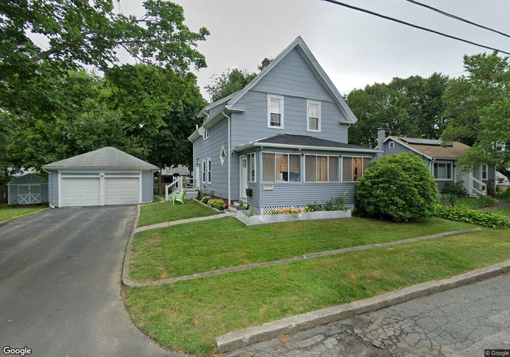
133 Stetson St Whitman, MA 02382
Estimated Value: $501,664 - $545,000
3
Beds
2
Baths
1,386
Sq Ft
$377/Sq Ft
Est. Value
About This Home
This home is located at 133 Stetson St, Whitman, MA 02382 and is currently estimated at $521,916, approximately $376 per square foot. 133 Stetson St is a home located in Plymouth County with nearby schools including St Bridget School.
Ownership History
Date
Name
Owned For
Owner Type
Purchase Details
Closed on
Jul 31, 2008
Sold by
Johnson Susan M
Bought by
Tavares Iolanda S and Tavares Claudino E
Current Estimated Value
Home Financials for this Owner
Home Financials are based on the most recent Mortgage that was taken out on this home.
Original Mortgage
$177,600
Interest Rate
6.47%
Mortgage Type
Purchase Money Mortgage
Purchase Details
Closed on
Aug 29, 2007
Sold by
Wheaton Dorothy
Bought by
Johnson Susan M
Create a Home Valuation Report for This Property
The Home Valuation Report is an in-depth analysis detailing your home's value as well as a comparison with similar homes in the area
Home Values in the Area
Average Home Value in this Area
Purchase History
| Date | Buyer | Sale Price | Title Company |
|---|---|---|---|
| Tavares Iolanda S | $222,000 | -- | |
| Johnson Susan M | -- | -- |
Source: Public Records
Mortgage History
| Date | Status | Borrower | Loan Amount |
|---|---|---|---|
| Open | Johnson Susan M | $175,000 | |
| Closed | Johnson Susan M | $177,600 |
Source: Public Records
Tax History
| Year | Tax Paid | Tax Assessment Tax Assessment Total Assessment is a certain percentage of the fair market value that is determined by local assessors to be the total taxable value of land and additions on the property. | Land | Improvement |
|---|---|---|---|---|
| 2025 | $5,638 | $429,700 | $200,000 | $229,700 |
| 2024 | $5,311 | $416,900 | $196,100 | $220,800 |
| 2023 | $5,068 | $373,500 | $170,000 | $203,500 |
| 2022 | $5,010 | $344,100 | $154,600 | $189,500 |
| 2021 | $4,782 | $308,500 | $142,000 | $166,500 |
| 2020 | $4,587 | $289,400 | $128,500 | $160,900 |
| 2019 | $4,322 | $281,000 | $128,500 | $152,500 |
| 2018 | $4,033 | $251,900 | $121,700 | $130,200 |
| 2017 | $3,799 | $251,900 | $121,700 | $130,200 |
| 2016 | $3,712 | $238,100 | $115,900 | $122,200 |
| 2015 | $3,717 | $238,100 | $115,900 | $122,200 |
Source: Public Records
Map
Nearby Homes
- 48 Day St
- 289 Commercial St
- 147 South Ave
- 8 Laurel St
- 110 South Ave
- 150 Harvard St
- 159 Auburn St
- 157 Auburn St Unit 157
- 22 Old Coach Rd
- 154 Auburn St
- 95 Temple St
- 42 Rock St
- 214 Winter St
- 61 Suffolk St
- 170 Pleasant St
- 101 Washington St Unit 4
- 74 Benson St
- 291 Raynor Ave
- Plan A Northville Village Unit Plan A
- Plan A Northville Village
- 129 Stetson St
- 139 Stetson St
- 122 Fullerton Ave
- Lot A Stetson
- 0 Stetson St
- 130 Fullerton Ave
- 114 Fullerton Ave
- 123 Stetson St
- 173 Commercial St
- 140 Fullerton Ave
- 122 Stetson St
- 116 Stetson St
- 129 Commercial St
- 165 Commercial St
- 107 Stetson St
- 104 Fullerton Ave
- 131 Fullerton Ave
- 108 Stetson St
- 180 Commercial St
- 181 Commercial St
Your Personal Tour Guide
Ask me questions while you tour the home.