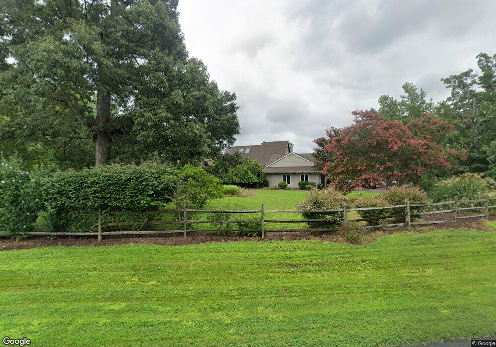
133 Tanners Point Dr Stevensville, MD 21666
Estimated Value: $1,640,000 - $1,697,000
--
Bed
4
Baths
3,151
Sq Ft
$531/Sq Ft
Est. Value
About This Home
This home is located at 133 Tanners Point Dr, Stevensville, MD 21666 and is currently estimated at $1,673,026, approximately $530 per square foot. 133 Tanners Point Dr is a home located in Queen Anne's County with nearby schools including Matapeake Elementary School, Matapeake Middle School, and Kent Island High School.
Ownership History
Date
Name
Owned For
Owner Type
Purchase Details
Closed on
Sep 2, 1997
Sold by
Greene Richard L
Bought by
Bateman Robert J and Bateman Carol I
Current Estimated Value
Purchase Details
Closed on
Oct 7, 1985
Sold by
Kettler Brothers, Inc
Bought by
Greene Richard L and Greene Linda J
Create a Home Valuation Report for This Property
The Home Valuation Report is an in-depth analysis detailing your home's value as well as a comparison with similar homes in the area
Home Values in the Area
Average Home Value in this Area
Purchase History
| Date | Buyer | Sale Price | Title Company |
|---|---|---|---|
| Bateman Robert J | $478,035 | -- | |
| Greene Richard L | $148,500 | -- |
Source: Public Records
Mortgage History
| Date | Status | Borrower | Loan Amount |
|---|---|---|---|
| Closed | Bateman Robert J | -- |
Source: Public Records
Tax History Compared to Growth
Tax History
| Year | Tax Paid | Tax Assessment Tax Assessment Total Assessment is a certain percentage of the fair market value that is determined by local assessors to be the total taxable value of land and additions on the property. | Land | Improvement |
|---|---|---|---|---|
| 2025 | $10,295 | $1,153,167 | $0 | $0 |
| 2024 | $9,770 | $1,065,233 | $0 | $0 |
| 2023 | $9,266 | $977,300 | $519,500 | $457,800 |
| 2022 | $9,266 | $977,300 | $519,500 | $457,800 |
| 2021 | $10,352 | $977,300 | $519,500 | $457,800 |
| 2020 | $10,352 | $1,073,100 | $619,500 | $453,600 |
| 2019 | $10,352 | $1,073,100 | $619,500 | $453,600 |
| 2018 | $10,352 | $1,073,100 | $619,500 | $453,600 |
| 2017 | $10,398 | $1,106,600 | $0 | $0 |
| 2016 | -- | $1,093,333 | $0 | $0 |
| 2015 | $4,036 | $1,080,067 | $0 | $0 |
| 2014 | $4,036 | $1,066,800 | $0 | $0 |
Source: Public Records
Map
Nearby Homes
- 102 Golf Ct
- 0 Ackerman Dr
- 214 Pennick Dr
- Lot 8 Ackerman Dr
- 224 Long Point Rd
- 213 Pennick Dr
- 210 Pennick Dr
- 203 Olive Branch Rd
- 208 Long Point Rd
- 123 Long Point Rd
- 200 Mallard Cove Ln
- 312 S Lake Dr
- Lot 1 - E/Kent Point Romancoke
- 9401 Romancoke Rd
- 114 N Lake Dr
- 145 N Lake Dr
- 208 Tower Dr
- 118 N Lake Dr
- 8905 Romancoke Rd
- 201 Beachside Dr
- 134 Tanners Point Dr
- 131 Tanners Point Dr
- 136 Tanners Point Dr
- 135 Tanners Point Dr
- 132 Tanners Point Dr
- 129 Tanners Point Dr
- 137 Tanners Point Dr
- 138 Tanners Point Dr
- 138 Tanners Point Dr Unit 851419
- 109 Terrapin Ln
- 130 Tanners Point Dr
- 111 Terrapin Ln
- 113 Terrapin Ln
- 106 Windward Ct
- 127 Tanners Point Dr
- 714 Penny Dr
- 115 Terrapin Ln
- 712 Penny Dr
- 128 Tanners Point Dr
- 107 Windward Ct