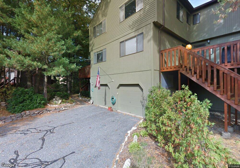
133 Trailside Way Ashland, MA 01721
Estimated Value: $483,376 - $512,000
2
Beds
3
Baths
1,363
Sq Ft
$367/Sq Ft
Est. Value
About This Home
This home is located at 133 Trailside Way, Ashland, MA 01721 and is currently estimated at $500,344, approximately $367 per square foot. 133 Trailside Way is a home located in Middlesex County with nearby schools including William Pittaway Elementary School, Henry E. Warren Elementary School, and David Mindess Elementary School.
Ownership History
Date
Name
Owned For
Owner Type
Purchase Details
Closed on
Aug 16, 2019
Sold by
Smith Pamela J
Bought by
Pamlea J Smith 2019 Ret
Current Estimated Value
Purchase Details
Closed on
Feb 1, 1999
Sold by
Parker John M
Bought by
Smith Pamela J
Home Financials for this Owner
Home Financials are based on the most recent Mortgage that was taken out on this home.
Original Mortgage
$20,000
Interest Rate
6.67%
Mortgage Type
Purchase Money Mortgage
Create a Home Valuation Report for This Property
The Home Valuation Report is an in-depth analysis detailing your home's value as well as a comparison with similar homes in the area
Home Values in the Area
Average Home Value in this Area
Purchase History
| Date | Buyer | Sale Price | Title Company |
|---|---|---|---|
| Pamlea J Smith 2019 Ret | -- | -- | |
| Smith Pamela J | $156,750 | -- |
Source: Public Records
Mortgage History
| Date | Status | Borrower | Loan Amount |
|---|---|---|---|
| Previous Owner | Smith Pamela J | $20,000 | |
| Previous Owner | Smith Pamela J | $115,500 | |
| Closed | Smith Pamela J | $100,000 |
Source: Public Records
Tax History
| Year | Tax Paid | Tax Assessment Tax Assessment Total Assessment is a certain percentage of the fair market value that is determined by local assessors to be the total taxable value of land and additions on the property. | Land | Improvement |
|---|---|---|---|---|
| 2025 | $5,395 | $422,500 | $0 | $422,500 |
| 2024 | $5,017 | $378,900 | $0 | $378,900 |
| 2023 | $4,793 | $348,100 | $0 | $348,100 |
| 2022 | $4,997 | $314,700 | $0 | $314,700 |
| 2021 | $4,693 | $294,580 | $0 | $294,580 |
| 2020 | $4,415 | $273,200 | $0 | $273,200 |
| 2019 | $3,967 | $243,700 | $0 | $243,700 |
| 2018 | $3,780 | $227,600 | $0 | $227,600 |
| 2017 | $3,758 | $225,000 | $0 | $225,000 |
| 2016 | $3,687 | $216,900 | $0 | $216,900 |
| 2015 | $3,753 | $216,918 | $0 | $216,918 |
| 2014 | $3,725 | $214,200 | $0 | $214,200 |
Source: Public Records
Map
Nearby Homes
- 241 Trailside Way
- 306 Trailside Way
- 26 Meeting House Path Unit 26
- 74 Meeting House Path
- 363 Eliot St
- 9 Mountain Gate Rd
- 147 Turner Rd Unit 80
- 207 Eliot St
- 2 Adams Rd Unit 2
- 2 Arrowhead Cir Unit 2
- 1 Adams Ln Unit 1
- 62 Ashland St
- 9 Adams Ln Unit 9
- 102 Captain Eames Cir
- 45 Half Crown Cir
- 59 Brooksmont Dr Unit 59
- 140 Algonquin Trail
- 37 James Rd
- 3 Danforth Dr
- 1 Danforth Dr
- 133 Trailside Way Unit 5-A
- 117 Trailside Way
- 117 Trailside Way Unit 117
- 115 Trailside Way
- 75 Trailside Way
- 111 Trailside Way
- 111 Trailside Way Unit D-6
- 155 Trailside Way
- 161 Trailside Way
- 71 Trailside Way Unit 71
- 157 Trailside Way
- 119 Trailside Way
- 157 Trailside Way Unit 157
- 119 Trailside Way Unit B
- 87 Trailside Way
- 37 Trailside Way
- 35 Trailside Way
- 71 Trailside Way
- 73 Trailside Way
- 71 Trailside Way Unit 35-D
Your Personal Tour Guide
Ask me questions while you tour the home.