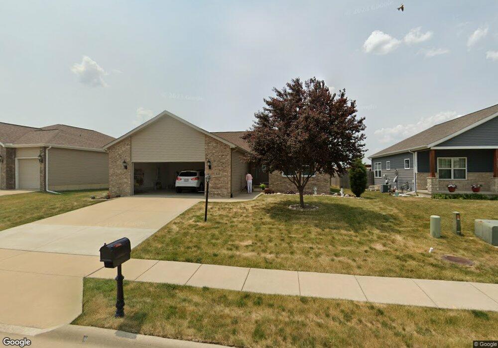
133 Tuscany Ct Morton, IL 61550
Estimated Value: $303,000 - $335,000
3
Beds
2
Baths
1,669
Sq Ft
$191/Sq Ft
Est. Value
About This Home
This home is located at 133 Tuscany Ct, Morton, IL 61550 and is currently estimated at $318,868, approximately $191 per square foot. 133 Tuscany Ct is a home with nearby schools including Morton High School, Bethel Lutheran School, and Blessed Sacrament School.
Ownership History
Date
Name
Owned For
Owner Type
Purchase Details
Closed on
Sep 1, 2011
Sold by
Dean Custom Builders Inc
Bought by
Gettys Dale Edward and Gettys Stella Mae
Current Estimated Value
Purchase Details
Closed on
Apr 8, 2011
Sold by
Tuscany Villas Development Llc
Bought by
Dean Custom Builders Inc
Home Financials for this Owner
Home Financials are based on the most recent Mortgage that was taken out on this home.
Original Mortgage
$178,000
Interest Rate
4.92%
Mortgage Type
Construction
Create a Home Valuation Report for This Property
The Home Valuation Report is an in-depth analysis detailing your home's value as well as a comparison with similar homes in the area
Home Values in the Area
Average Home Value in this Area
Purchase History
| Date | Buyer | Sale Price | Title Company |
|---|---|---|---|
| Gettys Dale Edward | $209,000 | None Available | |
| Dean Custom Builders Inc | $35,000 | None Available |
Source: Public Records
Mortgage History
| Date | Status | Borrower | Loan Amount |
|---|---|---|---|
| Previous Owner | Dean Custom Builders Inc | $178,000 |
Source: Public Records
Tax History Compared to Growth
Tax History
| Year | Tax Paid | Tax Assessment Tax Assessment Total Assessment is a certain percentage of the fair market value that is determined by local assessors to be the total taxable value of land and additions on the property. | Land | Improvement |
|---|---|---|---|---|
| 2024 | $4,335 | $90,270 | $14,170 | $76,100 |
| 2023 | $4,335 | $84,100 | $13,200 | $70,900 |
| 2022 | $4,565 | $77,230 | $12,120 | $65,110 |
| 2021 | $4,566 | $74,260 | $11,650 | $62,610 |
| 2020 | $4,471 | $73,520 | $11,530 | $61,990 |
| 2019 | $4,459 | $73,520 | $11,530 | $61,990 |
| 2018 | $4,377 | $73,520 | $11,530 | $61,990 |
| 2017 | $4,264 | $72,800 | $11,420 | $61,380 |
| 2016 | $4,224 | $72,800 | $11,420 | $61,380 |
| 2015 | $4,234 | $0 | $0 | $0 |
| 2013 | $4,191 | $70,110 | $11,000 | $59,110 |
Source: Public Records
Map
Nearby Homes
- 2100 S 2nd Ave Unit 2100
- 2116 S 2nd Ave
- 50 Brooke Cir Unit 50
- 1220 S Main St
- 749 S Columbus Ave
- 600 S Columbus Ave
- 210 E Crestwood St
- 315 E Birchwood St
- 504 S Glen Ave
- 1156 Brentwood Rd
- 324 S Kansas Ave
- 329 S Nelson Ave
- 507 E Adams St
- 120 N Indiana Ave
- 118 S Liberty Ave
- 115 S Liberty Ave
- 328 N 3rd Ave
- 1209 Whippoorwill Dr
- 452 N Bauman Ave
- 101 N Oregon Ave