Estimated Value: $283,000 - $350,000
--
Bed
--
Bath
--
Sq Ft
5,227
Sq Ft Lot
About This Home
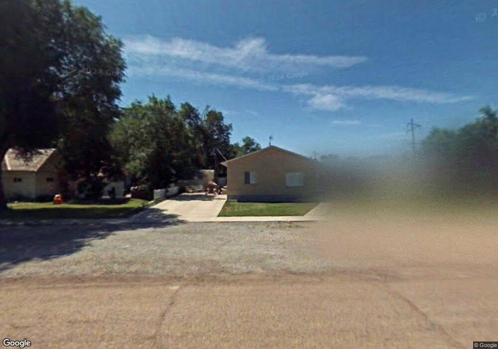
This home is located at 133 W 100 S, Delta, UT 84624 and is currently estimated at $308,839. 133 W 100 S is a home with nearby schools including Cba Center and White River Academy.
Ownership History
Date
Name
Owned For
Owner Type
Purchase Details
Closed on
Mar 21, 2023
Sold by
Jones Russell Clarence
Bought by
Deborah Jones Family Trust
Current Estimated Value
Purchase Details
Closed on
Oct 12, 2021
Sold by
Henderson Jones Merle
Bought by
Merle Jones 2018 Special Family Trust
Purchase Details
Closed on
Jul 13, 2018
Sold by
Jones Merle H
Bought by
Jones Merle Henderson and Jones Family Trust
Create a Home Valuation Report for This Property
The Home Valuation Report is an in-depth analysis detailing your home's value as well as a comparison with similar homes in the area
Home Values in the Area
Average Home Value in this Area
Purchase History
| Date | Buyer | Sale Price | Title Company |
|---|---|---|---|
| Deborah Jones Family Trust | -- | -- | |
| Merle Jones 2018 Special Family Trust | -- | -- | |
| Merle Jones 2018 Special Famil | -- | -- | |
| Jones Merle Henderson | -- | None Available | |
| Jones Merle H | -- | None Available |
Source: Public Records
Tax History Compared to Growth
Tax History
| Year | Tax Paid | Tax Assessment Tax Assessment Total Assessment is a certain percentage of the fair market value that is determined by local assessors to be the total taxable value of land and additions on the property. | Land | Improvement |
|---|---|---|---|---|
| 2025 | $1,434 | $153,282 | $12,137 | $141,145 |
| 2024 | $1,434 | $126,627 | $12,068 | $114,559 |
| 2023 | $1,582 | $126,627 | $12,068 | $114,559 |
| 2022 | $1,212 | $91,122 | $12,616 | $78,506 |
| 2021 | $1,026 | $73,627 | $9,540 | $64,087 |
| 2020 | $955 | $68,086 | $8,672 | $59,414 |
| 2019 | $871 | $62,173 | $8,030 | $54,143 |
| 2018 | $802 | $57,703 | $8,030 | $49,673 |
| 2017 | $829 | $57,469 | $7,796 | $49,673 |
| 2016 | $803 | $57,469 | $7,796 | $49,673 |
| 2015 | $802 | $57,469 | $7,796 | $49,673 |
| 2014 | -- | $51,914 | $7,796 | $44,118 |
| 2013 | -- | $51,914 | $7,796 | $44,118 |
Source: Public Records
Map
Nearby Homes
- 163 W 100 S
- 294 S 300 W
- 328 S Center St
- 32 E 300 S
- 38 E 300 S
- 242 S 400 W
- 435 W 100 S
- 185 N 200 W
- 331 W 200 N
- 0 E Highway 6 Unit LotWP001 16586023
- 44 E 300 S
- 325 N 100 W
- 321 E 200 S
- 451 W 300 N
- 445 Topaz Blvd Unit 10
- 461 Topaz Blvd Unit 6
- 7900 E 250 Rd N
- 625 E Birch Dr
- 665 Bristlecone Ln
- 263 Silver Maple Dr