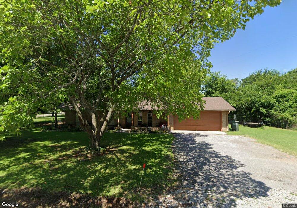
133 Walnut Hill St Ardmore, OK 73401
Estimated Value: $177,946 - $212,000
3
Beds
2
Baths
1,088
Sq Ft
$182/Sq Ft
Est. Value
About This Home
This home is located at 133 Walnut Hill St, Ardmore, OK 73401 and is currently estimated at $197,737, approximately $181 per square foot. 133 Walnut Hill St is a home located in Carter County with nearby schools including Lone Grove Primary School, Lone Grove Intermediate School, and Lone Grove Middle School.
Ownership History
Date
Name
Owned For
Owner Type
Purchase Details
Closed on
Feb 25, 2022
Sold by
Dale Baker Thomas
Bought by
Baker Thomas Dale and Bailey Kimberly Dawn
Current Estimated Value
Purchase Details
Closed on
May 20, 2020
Sold by
Rozzell Billy W and Rozzell Katherene A
Bought by
Baker Thomas D
Home Financials for this Owner
Home Financials are based on the most recent Mortgage that was taken out on this home.
Original Mortgage
$121,250
Interest Rate
3.3%
Mortgage Type
New Conventional
Purchase Details
Closed on
Jul 14, 1998
Sold by
Stewart Albert Lynn Etu
Bought by
Rozzell Billy W and Rozzell Kath
Create a Home Valuation Report for This Property
The Home Valuation Report is an in-depth analysis detailing your home's value as well as a comparison with similar homes in the area
Home Values in the Area
Average Home Value in this Area
Purchase History
| Date | Buyer | Sale Price | Title Company |
|---|---|---|---|
| Baker Thomas Dale | $13,333 | New Title Company Name | |
| Baker Thomas Dale | $13,333 | New Title Company Name | |
| Baker Thomas Dale | $13,333 | New Title Company Name | |
| Baker Thomas D | $125,000 | None Available | |
| Rozzell Billy W | $62,000 | -- |
Source: Public Records
Mortgage History
| Date | Status | Borrower | Loan Amount |
|---|---|---|---|
| Previous Owner | Baker Thomas D | $121,250 |
Source: Public Records
Tax History Compared to Growth
Tax History
| Year | Tax Paid | Tax Assessment Tax Assessment Total Assessment is a certain percentage of the fair market value that is determined by local assessors to be the total taxable value of land and additions on the property. | Land | Improvement |
|---|---|---|---|---|
| 2025 | $1,660 | $16,882 | $2,472 | $14,410 |
| 2024 | $1,660 | $16,390 | $2,400 | $13,990 |
| 2023 | $1,610 | $15,913 | $2,400 | $13,513 |
| 2022 | $1,495 | $15,450 | $2,400 | $13,050 |
| 2021 | $1,458 | $15,000 | $2,400 | $12,600 |
| 2020 | $1,070 | $10,335 | $2,169 | $8,166 |
| 2019 | $1,018 | $9,843 | $2,147 | $7,696 |
| 2018 | $979 | $9,374 | $1,848 | $7,526 |
| 2017 | $928 | $8,927 | $1,631 | $7,296 |
| 2016 | $882 | $8,503 | $1,004 | $7,499 |
| 2015 | $932 | $8,098 | $390 | $7,708 |
| 2014 | $869 | $7,860 | $390 | $7,470 |
Source: Public Records
Map
Nearby Homes
- 270 Hickory St
- 40 Whipperwill St
- 0 Durango St
- 0 High Chaparal Dr Unit 2525272
- 0 Kelly Ln
- 940 Durango St
- 7241 Myall Rd
- 7023 Myall Rd SW
- 58 Wisteria St
- 86 Wisteria St
- 114 Laurel St
- 656 Evergreen St
- 298 Evergreen St
- 00 Bob White Rd
- 213 Laurel St
- 0 Evergreen St
- 318 Wisteria St
- 8841 Brock Rd
- 21 Park St
- 1320 Evergreen St
- 133 Walnut
- 290 Ruidosa St
- 0 Walnut Hill St
- 87 Walnut Hill St
- 249 Ruidosa St
- 49 Sierra St
- 199 Walnut Hill St
- 377 Ruidosa St
- 77 Sierra St
- 54 Sierra St
- 237 Ruidosa St
- 53 Walnut Hill St
- 107 Sierra St
- 226 Ruidosa St
- 232 Hickory St
- 277 Hickory St
- 215 Walnut Hill St
- 211 Ruidosa St
- 211 Ruidosa St
- 38 Apache St NW