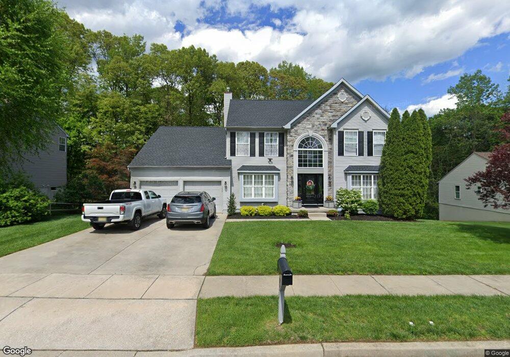
133 Washington Ave Mantua, NJ 08051
Mantua Township NeighborhoodEstimated Value: $273,000 - $635,240
--
Bed
--
Bath
2,739
Sq Ft
$181/Sq Ft
Est. Value
About This Home
This home is located at 133 Washington Ave, Mantua, NJ 08051 and is currently estimated at $495,310, approximately $180 per square foot. 133 Washington Ave is a home located in Gloucester County with nearby schools including Centre City School, J. Mason Tomlin Elementary School, and Clearview Regional Middle School.
Ownership History
Date
Name
Owned For
Owner Type
Purchase Details
Closed on
Dec 20, 2001
Sold by
Headley Homes Inc
Bought by
Mcintyre Edward M and Mcintyre Colleen
Current Estimated Value
Home Financials for this Owner
Home Financials are based on the most recent Mortgage that was taken out on this home.
Original Mortgage
$199,900
Outstanding Balance
$87,205
Interest Rate
8.15%
Estimated Equity
$408,105
Create a Home Valuation Report for This Property
The Home Valuation Report is an in-depth analysis detailing your home's value as well as a comparison with similar homes in the area
Home Values in the Area
Average Home Value in this Area
Purchase History
| Date | Buyer | Sale Price | Title Company |
|---|---|---|---|
| Mcintyre Edward M | $250,592 | -- |
Source: Public Records
Mortgage History
| Date | Status | Borrower | Loan Amount |
|---|---|---|---|
| Open | Mcintyre Edward M | $199,900 |
Source: Public Records
Tax History Compared to Growth
Tax History
| Year | Tax Paid | Tax Assessment Tax Assessment Total Assessment is a certain percentage of the fair market value that is determined by local assessors to be the total taxable value of land and additions on the property. | Land | Improvement |
|---|---|---|---|---|
| 2025 | $12,314 | $478,200 | $96,400 | $381,800 |
| 2024 | $12,185 | $478,200 | $96,400 | $381,800 |
| 2023 | $12,185 | $478,200 | $96,400 | $381,800 |
| 2022 | $10,368 | $296,400 | $80,300 | $216,100 |
| 2021 | $10,445 | $296,400 | $80,300 | $216,100 |
| 2020 | $10,362 | $296,400 | $80,300 | $216,100 |
| 2019 | $10,187 | $296,400 | $80,300 | $216,100 |
| 2018 | $10,042 | $296,400 | $80,300 | $216,100 |
| 2017 | $9,891 | $296,400 | $80,300 | $216,100 |
| 2016 | $9,778 | $296,400 | $80,300 | $216,100 |
| 2015 | $9,538 | $296,400 | $80,300 | $216,100 |
| 2014 | $9,218 | $296,400 | $80,300 | $216,100 |
Source: Public Records
Map
Nearby Homes
- 8 Barry Dr
- 325 Bridgeton Pike
- 119 Monroe Ave
- 12 Brittany St
- 1230 Tristram Cir Unit 1230
- 1415 Tristram Cir Unit 1415
- 1410 Tristram Cir Unit 1410
- 1145 Tristram Cir
- 1356 Tristram Cir Unit 1356
- 1134 Tristram Cir Unit 4
- 1137 Tristram Cir Unit 1137
- 204 W Landing Rd
- 261 Tony Cir
- 485 Harrison Ave
- 1184 Tristram Cir Unit 4
- 122 Turner St
- 530 Galahad Ct
- 112 Norris St
- 118 Pendragon Way Unit 118
- 41 Woodbrook Dr Unit C041
- 129 Washington Ave
- 137 Washington Ave
- 134 Washington Ave
- 130 Washington Ave
- 138 Washington Ave
- 121 Washington Ave
- 141 Washington Ave
- 135 Adams Ave
- 124 Washington Ave
- 139 Adams Ave
- 131 Adams Ave
- 125 Adams Ave
- 119 Washington Ave
- 144 Adams Ave
- 51 Barry Dr
- 132 Adams Ave
- 53 Barry Dr
- 140 Adams Ave
- 175 Carriage Hill Cir
- 136 Adams Ave