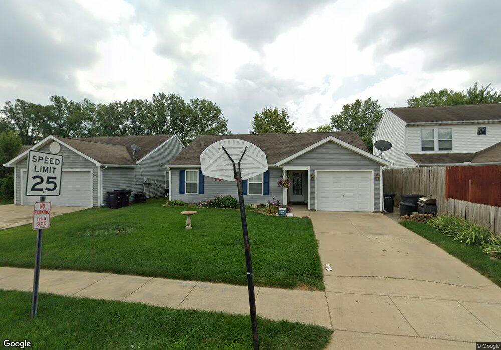
133 Wise Dr Lafayette, IN 47909
Estimated Value: $203,000 - $211,000
--
Bed
--
Bath
992
Sq Ft
$209/Sq Ft
Est. Value
About This Home
This home is located at 133 Wise Dr, Lafayette, IN 47909 and is currently estimated at $207,416, approximately $209 per square foot. 133 Wise Dr is a home located in Tippecanoe County with nearby schools including Wea Ridge Elementary School, Wea Ridge Middle School, and McCutcheon High School.
Ownership History
Date
Name
Owned For
Owner Type
Purchase Details
Closed on
Oct 8, 2007
Sold by
Humanity Of Lafayette Inc
Bought by
Wagner Michelle L
Current Estimated Value
Home Financials for this Owner
Home Financials are based on the most recent Mortgage that was taken out on this home.
Original Mortgage
$58,007
Outstanding Balance
$26,411
Interest Rate
6.5%
Mortgage Type
Unknown
Estimated Equity
$181,005
Purchase Details
Closed on
Apr 7, 2006
Sold by
Beazer Homes Indiana Llp
Bought by
Tippecanoe Land Holding Inc
Purchase Details
Closed on
Dec 31, 2002
Sold by
Crossmann Habitat Llc
Bought by
Crossmann Communities Partnership
Create a Home Valuation Report for This Property
The Home Valuation Report is an in-depth analysis detailing your home's value as well as a comparison with similar homes in the area
Home Values in the Area
Average Home Value in this Area
Purchase History
| Date | Buyer | Sale Price | Title Company |
|---|---|---|---|
| Wagner Michelle L | -- | None Available | |
| Tippecanoe Land Holding Inc | -- | None Available | |
| Crossmann Communities Partnership | -- | -- |
Source: Public Records
Mortgage History
| Date | Status | Borrower | Loan Amount |
|---|---|---|---|
| Open | Wagner Michelle L | $58,007 |
Source: Public Records
Tax History Compared to Growth
Tax History
| Year | Tax Paid | Tax Assessment Tax Assessment Total Assessment is a certain percentage of the fair market value that is determined by local assessors to be the total taxable value of land and additions on the property. | Land | Improvement |
|---|---|---|---|---|
| 2024 | $1,387 | $150,200 | $23,600 | $126,600 |
| 2023 | $961 | $119,400 | $15,000 | $104,400 |
| 2022 | $813 | $103,000 | $15,000 | $88,000 |
| 2021 | $649 | $91,600 | $15,000 | $76,600 |
| 2020 | $506 | $83,300 | $15,000 | $68,300 |
| 2019 | $458 | $80,300 | $15,000 | $65,300 |
| 2018 | $444 | $79,800 | $15,000 | $64,800 |
| 2017 | $429 | $78,300 | $15,000 | $63,300 |
| 2016 | $408 | $77,700 | $15,000 | $62,700 |
| 2014 | $387 | $77,100 | $15,000 | $62,100 |
| 2013 | $395 | $77,100 | $15,000 | $62,100 |
Source: Public Records
Map
Nearby Homes
- 116 Wise Dr
- 312 Hibiscus Dr
- 126 Kensal Ct
- 304 Jersey Ln
- 2820 Limestone Ln
- 3416 Coventry Ln
- 318 Thames Ave
- 2830 Duroc Dr Unit A
- 3638 Round Rock Ct
- 20 Carolyn Ct
- 904 N Southland Dr
- 2514 Eckman Dr
- 324 Persimmon Trail
- 1018 Southport Dr
- 901 Southlea Dr
- 3267 Hendrickson Ln
- 1045 Southlea Dr
- 2561 S 231 Hwy
- 12 Brookhill Ct
- 3428 Ingram Ct