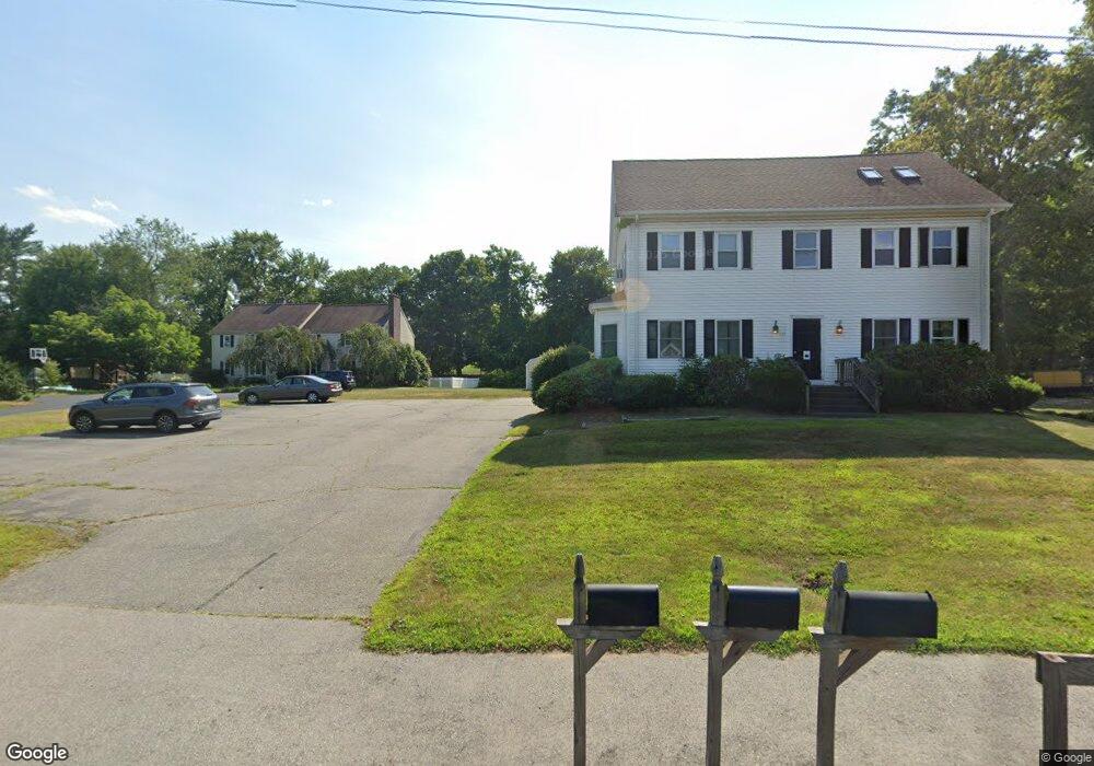
133 Worcester St Unit 2 North Grafton, MA 01536
Estimated Value: $343,000 - $494,000
2
Beds
2
Baths
1,350
Sq Ft
$300/Sq Ft
Est. Value
About This Home
This home is located at 133 Worcester St Unit 2, North Grafton, MA 01536 and is currently estimated at $405,299, approximately $300 per square foot. 133 Worcester St Unit 2 is a home located in Worcester County with nearby schools including Grafton High School, Silver Spruce Montessori School, and Al-Hamra Academy.
Ownership History
Date
Name
Owned For
Owner Type
Purchase Details
Closed on
Dec 1, 1998
Sold by
Kralian Mark A and Kralian Lisa M
Bought by
Eori Theresa A
Current Estimated Value
Home Financials for this Owner
Home Financials are based on the most recent Mortgage that was taken out on this home.
Original Mortgage
$104,000
Outstanding Balance
$23,725
Interest Rate
6.83%
Mortgage Type
Purchase Money Mortgage
Estimated Equity
$381,574
Create a Home Valuation Report for This Property
The Home Valuation Report is an in-depth analysis detailing your home's value as well as a comparison with similar homes in the area
Home Values in the Area
Average Home Value in this Area
Purchase History
| Date | Buyer | Sale Price | Title Company |
|---|---|---|---|
| Eori Theresa A | $112,000 | -- |
Source: Public Records
Mortgage History
| Date | Status | Borrower | Loan Amount |
|---|---|---|---|
| Open | Eori Theresa A | $104,000 |
Source: Public Records
Tax History Compared to Growth
Tax History
| Year | Tax Paid | Tax Assessment Tax Assessment Total Assessment is a certain percentage of the fair market value that is determined by local assessors to be the total taxable value of land and additions on the property. | Land | Improvement |
|---|---|---|---|---|
| 2025 | $4,282 | $307,200 | $0 | $307,200 |
| 2024 | $4,186 | $292,500 | $0 | $292,500 |
| 2023 | $4,008 | $255,100 | $0 | $255,100 |
| 2022 | $3,941 | $233,500 | $0 | $233,500 |
| 2021 | $3,941 | $229,400 | $0 | $229,400 |
| 2020 | $3,564 | $216,000 | $0 | $216,000 |
| 2019 | $3,805 | $228,400 | $0 | $228,400 |
| 2018 | $4,162 | $250,900 | $0 | $250,900 |
| 2017 | $2,629 | $160,300 | $0 | $160,300 |
| 2016 | $2,571 | $153,500 | $0 | $153,500 |
| 2015 | $2,440 | $147,900 | $0 | $147,900 |
| 2014 | $2,257 | $147,900 | $0 | $147,900 |
Source: Public Records
Map
Nearby Homes
- 44 Meadow Ln
- 3 Abby Rd
- 17 Hingham Rd
- 14 Northgate Ct Unit 14
- 11 Hovey Pond Dr Unit 11
- 7 Hovey Pond Dr Unit 7
- 194 Worcester St
- 0 East St
- 1 Doris Dr
- 9 Logan Path
- 22 Beverly Rd
- 156 Brigham Hill Rd
- 4 Winslow Ln Unit 1410
- 55 Carroll Rd
- 11 1/2 Carroll Rd Unit B
- 14 Indian Path
- 76 Samuel Dr
- 4 Abby Rd
- 5 Lincoln Ln Unit 5
- 21 Lordvale Blvd Unit 406
- 133 Worcester St Unit 1
- 133 Worcester St Unit 133A
- 133 Worcester St Unit 2
- 133 Worcester St Unit 1
- 135 Worcester St Unit 3
- 135 Worcester St Unit 2
- 135 Worcester St Unit 1
- 135 Worcester St Unit 2
- 16 Meadow Ln
- 18 Meadow Ln
- 131 Worcester St
- 16 Meadow Lane L-22
- 20 Meadow Ln
- 127 Worcester St
- 12 Meadow Ln
- 130 Worcester St Route 122
- 130 Worcester St
- 17 Meadow Ln
- 22 Meadow Ln
- 126 Worcester St