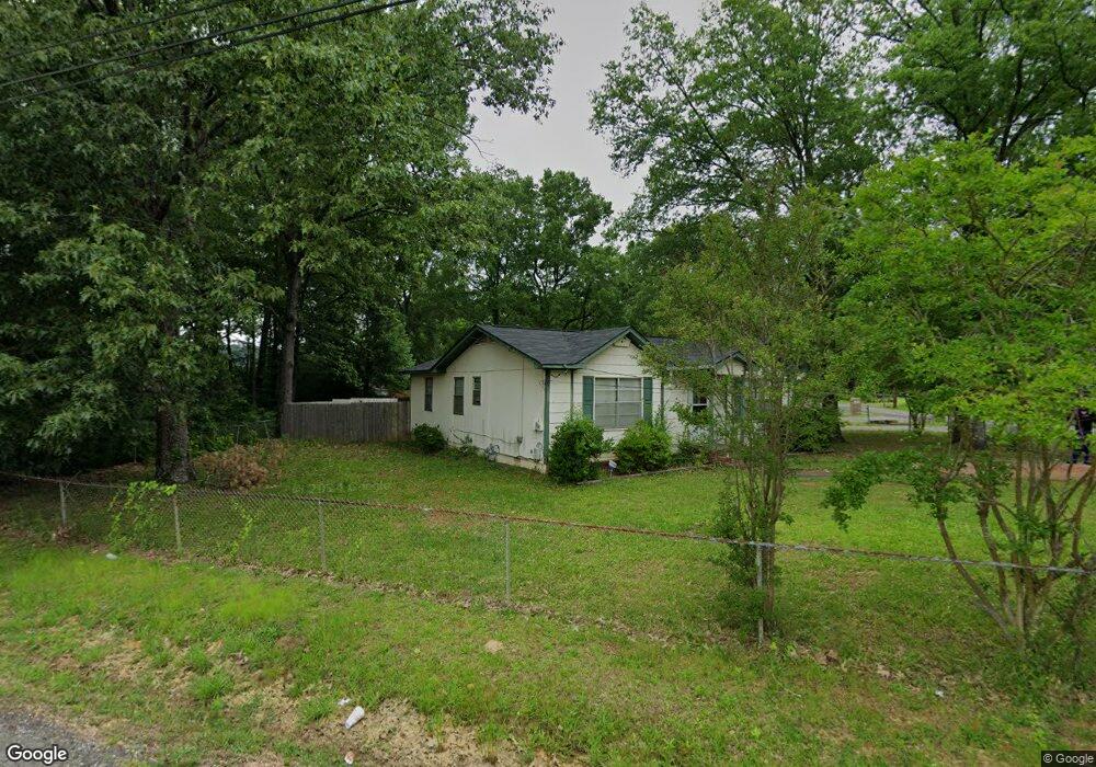
1330 Airport Ln SW Bessemer, AL 35022
Estimated Value: $100,000 - $159,000
3
Beds
2
Baths
1,200
Sq Ft
$104/Sq Ft
Est. Value
About This Home
This home is located at 1330 Airport Ln SW, Bessemer, AL 35022 and is currently estimated at $125,151, approximately $104 per square foot. 1330 Airport Ln SW is a home located in Jefferson County with nearby schools including Bessemer City High School, Bessemer Academy, and New Life Christian School Of Excellence.
Ownership History
Date
Name
Owned For
Owner Type
Purchase Details
Closed on
Jul 25, 2000
Sold by
Reba Smith
Bought by
Jones Curtis M and Mcadory Kristi Y
Current Estimated Value
Home Financials for this Owner
Home Financials are based on the most recent Mortgage that was taken out on this home.
Original Mortgage
$75,898
Interest Rate
8.23%
Mortgage Type
FHA
Create a Home Valuation Report for This Property
The Home Valuation Report is an in-depth analysis detailing your home's value as well as a comparison with similar homes in the area
Home Values in the Area
Average Home Value in this Area
Purchase History
| Date | Buyer | Sale Price | Title Company |
|---|---|---|---|
| Jones Curtis M | $76,900 | Lawyers Title Insurance Corp |
Source: Public Records
Mortgage History
| Date | Status | Borrower | Loan Amount |
|---|---|---|---|
| Previous Owner | Jones Curtis M | $75,898 |
Source: Public Records
Tax History Compared to Growth
Tax History
| Year | Tax Paid | Tax Assessment Tax Assessment Total Assessment is a certain percentage of the fair market value that is determined by local assessors to be the total taxable value of land and additions on the property. | Land | Improvement |
|---|---|---|---|---|
| 2024 | $1,362 | $19,820 | -- | -- |
| 2022 | $1,139 | $8,290 | $3,900 | $4,390 |
| 2021 | $1,066 | $7,760 | $3,900 | $3,860 |
| 2020 | $1,081 | $7,760 | $3,900 | $3,860 |
| 2019 | $1,066 | $15,520 | $0 | $0 |
| 2018 | $1,370 | $19,940 | $0 | $0 |
| 2017 | $1,370 | $19,940 | $0 | $0 |
| 2016 | $1,403 | $20,420 | $0 | $0 |
| 2015 | $1,370 | $19,940 | $0 | $0 |
| 2014 | $1,355 | $21,920 | $0 | $0 |
| 2013 | $1,355 | $21,920 | $0 | $0 |
Source: Public Records
Map
Nearby Homes
- 1343 Anglia Cir Unit 1-6
- 115 Rayfield Dr SW
- 4519 Sassafras Cir Unit 99
- 4523 Sassafras Cir Unit 100
- 4427 Buttercup Ln Unit 113
- 1648 Bradford Ln
- 1120 Potter Ave
- 847 Walnut St
- 212 Quinncrest Ln
- 4291 Candle Brook Ln
- 221 Crestside Cir
- 1676 Bradford Ln
- 4413 Wild Flower Cir
- 840 Delta St
- 4271 Candle Brook Ln
- 702 Southgate Ln
- 708 Southgate Ln
- 1724 4th Ave SW Unit lot 6
- 1301 Shades Ave Unit 7
- 429 Flint Hill Rd Unit 1
- 1328 Airport Ln SW
- 503 Grant St
- 1324 Airport Ln SW
- 502 Grant St
- 1331 Airport Ln SW
- 1322 Airport Ln SW
- 501 Grant St
- 1327 Airport Ln SW
- 1318 Airport Ln SW
- 1429 Airport Ln SW
- 491 Grant St
- 1315 Airport Ln SW
- 1325 4th Ave N
- 1316 Airport Ln SW
- 1307 Airport Ln SW
- 641 Grant St
- 641 - 651 Grant St Unit 2.68 acres
- 1308 Airport Ln SW
- 1311 Airport Ln SW
- 604 Grant St