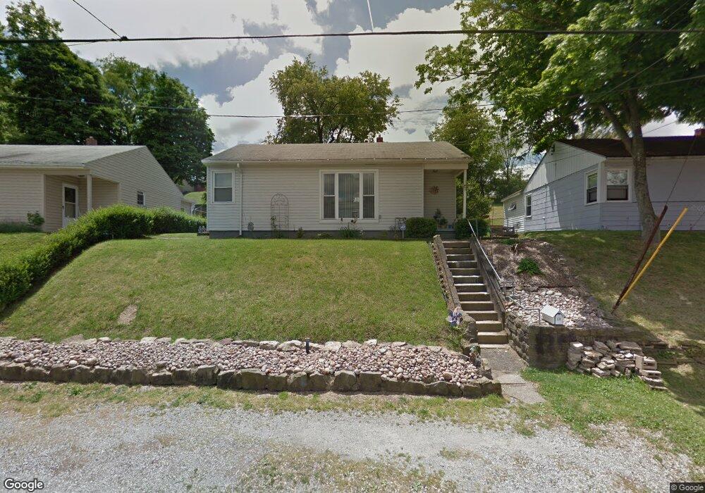
1330 Beverly Rd McKeesport, PA 15133
Estimated Value: $71,000 - $95,000
2
Beds
1
Bath
909
Sq Ft
$90/Sq Ft
Est. Value
About This Home
This home is located at 1330 Beverly Rd, McKeesport, PA 15133 and is currently estimated at $82,201, approximately $90 per square foot. 1330 Beverly Rd is a home located in Allegheny County with nearby schools including South Allegheny Elementary School, South Allegheny High School, and Young Scholars of Greater Allegheny Charter School.
Ownership History
Date
Name
Owned For
Owner Type
Purchase Details
Closed on
Apr 4, 2024
Sold by
Danko John J
Bought by
Rap Family Trust
Current Estimated Value
Purchase Details
Closed on
Aug 21, 2008
Sold by
Groover Charles W
Bought by
Danko John J
Home Financials for this Owner
Home Financials are based on the most recent Mortgage that was taken out on this home.
Original Mortgage
$36,350
Interest Rate
6.69%
Mortgage Type
New Conventional
Purchase Details
Closed on
Aug 19, 2002
Sold by
Fischman David H
Bought by
Groover Charles W and Groover Brandie M
Purchase Details
Closed on
Dec 6, 1995
Sold by
Fischman David H and Fischman Elaine N
Bought by
Fischman David H and Elaine N Fischman Residuary Trust
Purchase Details
Closed on
Nov 14, 1994
Sold by
Fischman Gerald S and Fischman Elaine N
Bought by
Fischman Elaine N
Create a Home Valuation Report for This Property
The Home Valuation Report is an in-depth analysis detailing your home's value as well as a comparison with similar homes in the area
Home Values in the Area
Average Home Value in this Area
Purchase History
| Date | Buyer | Sale Price | Title Company |
|---|---|---|---|
| Rap Family Trust | $30,000 | -- | |
| Danko John J | $38,300 | -- | |
| Groover Charles W | $32,000 | -- | |
| Fischman David H | -- | -- | |
| Fischman Elaine N | -- | -- |
Source: Public Records
Mortgage History
| Date | Status | Borrower | Loan Amount |
|---|---|---|---|
| Previous Owner | Danko John J | $36,350 |
Source: Public Records
Tax History Compared to Growth
Tax History
| Year | Tax Paid | Tax Assessment Tax Assessment Total Assessment is a certain percentage of the fair market value that is determined by local assessors to be the total taxable value of land and additions on the property. | Land | Improvement |
|---|---|---|---|---|
| 2025 | $1,688 | $44,300 | $14,200 | $30,100 |
| 2024 | $1,688 | $44,300 | $14,200 | $30,100 |
| 2023 | $1,623 | $44,300 | $14,200 | $30,100 |
| 2022 | $1,519 | $44,300 | $14,200 | $30,100 |
| 2021 | $1,479 | $44,300 | $14,200 | $30,100 |
| 2020 | $1,446 | $44,300 | $14,200 | $30,100 |
| 2019 | $1,373 | $44,300 | $14,200 | $30,100 |
| 2018 | $210 | $44,300 | $14,200 | $30,100 |
| 2017 | $1,301 | $44,300 | $14,200 | $30,100 |
| 2016 | $210 | $44,300 | $14,200 | $30,100 |
| 2015 | $210 | $44,300 | $14,200 | $30,100 |
| 2014 | $1,301 | $26,300 | $14,200 | $12,100 |
Source: Public Records
Map
Nearby Homes
- 1332 Beverly Rd
- 1310 Beverly Rd
- 1317 New York Ave
- 320 Dersam St
- 335-345 Dersam St
- 1222 Romine Ave
- 1220 Romine Ave
- 1419 Washington Blvd
- 1009 Oakland Ave
- 732 Upston St
- 1000 Washington Blvd
- 706 Upston St
- 706 Upston St Unit 2
- 0 Washington Blvd
- 1120 Portsmouth Dr
- 1817 Gray St
- 505 Manning Ave
- 524 Archer St
- 502 Archer St
- 800 Romine Ave
- 1328 Beverly Rd
- 1326 Beverly Rd
- 1331 Beverly Rd
- 1329 Barkley Rd
- 1331 Barkley Rd
- 1329 Beverly Rd
- 1327 Barkley Rd
- 1336 Beverly Rd
- 1333 Barkley Rd
- 1327 Beverly Rd
- 1324 Beverly Rd
- 1333 Beverly Rd
- 1325 Barkley Rd
- 1335 Barkley Rd
- 1325 Beverly Rd
- 1335 Beverly Rd
- 1323 Barkley Rd
- 1338 Beverly Rd
- 1322 Beverly Rd
- 1337 Barkley Rd