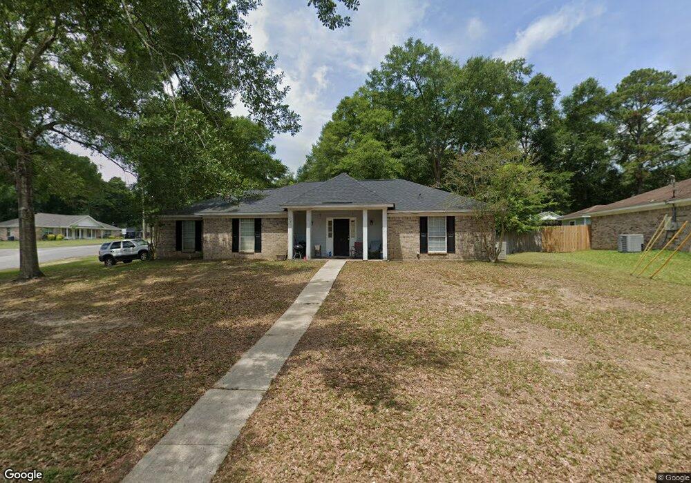
1330 Burnt Tree Dr E Mobile, AL 36695
Baker NeighborhoodEstimated Value: $197,597 - $227,000
3
Beds
2
Baths
1,649
Sq Ft
$128/Sq Ft
Est. Value
About This Home
This home is located at 1330 Burnt Tree Dr E, Mobile, AL 36695 and is currently estimated at $210,899, approximately $127 per square foot. 1330 Burnt Tree Dr E is a home located in Mobile County with nearby schools including Elsie Collier Elementary School, Bernice J Causey Middle School, and Baker High School.
Ownership History
Date
Name
Owned For
Owner Type
Purchase Details
Closed on
Mar 9, 2001
Sold by
Bonner Ernestine M
Bought by
Lutman Patricia
Current Estimated Value
Create a Home Valuation Report for This Property
The Home Valuation Report is an in-depth analysis detailing your home's value as well as a comparison with similar homes in the area
Home Values in the Area
Average Home Value in this Area
Purchase History
| Date | Buyer | Sale Price | Title Company |
|---|---|---|---|
| Lutman Patricia | -- | -- |
Source: Public Records
Tax History
| Year | Tax Paid | Tax Assessment Tax Assessment Total Assessment is a certain percentage of the fair market value that is determined by local assessors to be the total taxable value of land and additions on the property. | Land | Improvement |
|---|---|---|---|---|
| 2025 | -- | $17,370 | $3,000 | $14,370 |
| 2024 | -- | $16,080 | $3,000 | $13,080 |
| 2023 | $0 | $13,860 | $3,300 | $10,560 |
| 2022 | $0 | $12,610 | $3,000 | $9,610 |
| 2021 | $0 | $12,960 | $2,400 | $10,560 |
| 2020 | $0 | $12,960 | $2,400 | $10,560 |
| 2019 | $0 | $12,740 | $0 | $0 |
| 2018 | $0 | $11,920 | $0 | $0 |
| 2017 | $0 | $12,100 | $0 | $0 |
| 2016 | -- | $12,580 | $0 | $0 |
| 2013 | -- | $11,960 | $0 | $0 |
Source: Public Records
Map
Nearby Homes
- 9375 Ashwood Ct
- 9410 Ashwood Ct
- 0 New Neck Rd Unit 387066
- 9391 Smokewood Dr
- 1151 Twelve Oaks Dr
- 9650 Oak Forrest Dr
- 8880 Ohara Dr
- 11905 Airport Blvd
- 11905 Airport Blvd Unit 3
- 860 Trailwood Dr E
- 790 Hale Rd
- 0 Oxbridge Way Unit 7471868
- 0 Oxbridge Way Unit 7 369320
- 0 Oxbridge Way Unit 7471878
- 0 Oxbridge Way Unit 6 369321
- 750 Hale Rd
- 9002 Amelia Dr
- 8710 Londonderry Ct Unit 2
- 8601 Grelot Rd
- 0 Airport Blvd Unit 7368583
- 9290 Seven Hills Curve S
- 1320 Burnt Tree Dr E
- 1329 Burnt Tree Dr E
- 9300 Seven Hills Curve S
- 1310 Burnt Tree Dr E
- 1319 Burnt Tree Dr E
- 9295 Seven Hills Curve S
- 1301 Woodstock Ct
- 9310 Seven Hills Curve S
- 1290 Burnt Tree Dr E
- 1355 Camden Ct
- 1309 Burnt Tree Dr E
- 1330 Baker Ct
- 9305 Seven Hills Curve S
- 9210 Seven Hills Curve S
- 1291 Woodstock Ct
- 1365 Camden Ct
- 9320 Seven Hills Curve S
- 1360 Camden Ct
- 1282 Burnt Tree Dr E