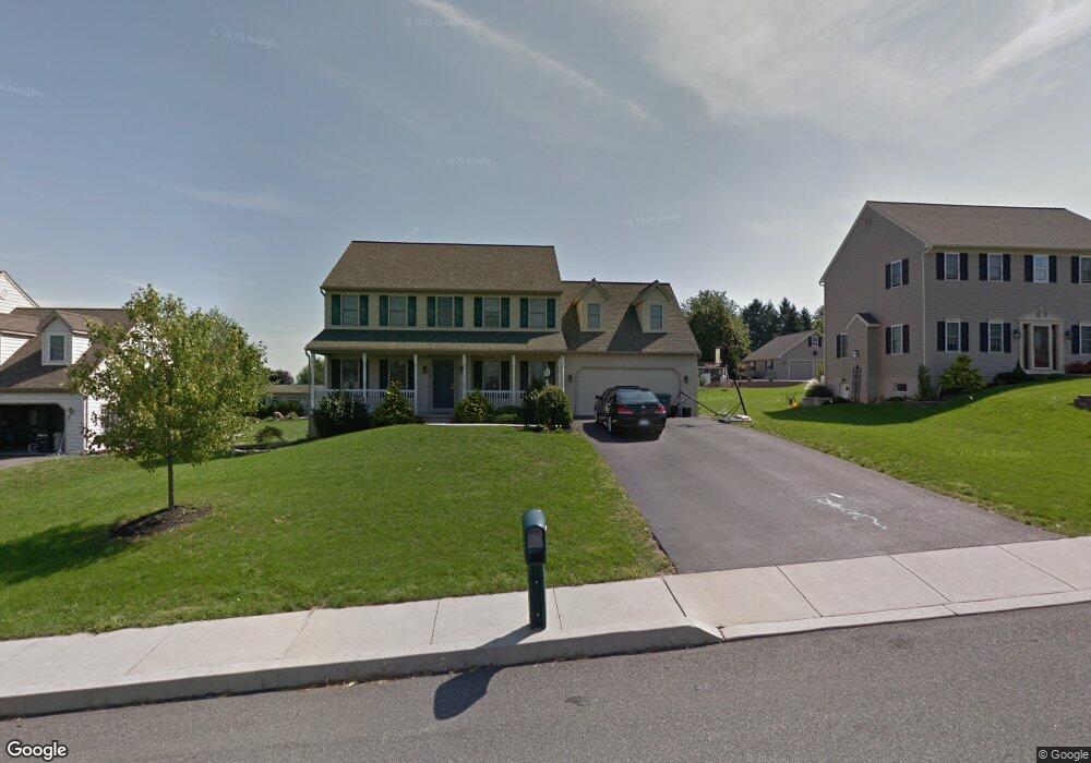
1330 Cedar Ave East Earl, PA 17519
Estimated Value: $487,264 - $543,000
4
Beds
3
Baths
2,241
Sq Ft
$225/Sq Ft
Est. Value
About This Home
This home is located at 1330 Cedar Ave, East Earl, PA 17519 and is currently estimated at $504,566, approximately $225 per square foot. 1330 Cedar Ave is a home located in Lancaster County with nearby schools including Garden Spot Middle School, Garden Spot Senior High School, and Conestoga Parochial School.
Ownership History
Date
Name
Owned For
Owner Type
Purchase Details
Closed on
May 14, 2013
Sold by
Boyer Daniel J and Boyer Vanessa G
Bought by
Boyer Daniel J and King Boyer Vanessa G
Current Estimated Value
Home Financials for this Owner
Home Financials are based on the most recent Mortgage that was taken out on this home.
Original Mortgage
$156,000
Outstanding Balance
$33,931
Interest Rate
3.45%
Mortgage Type
New Conventional
Estimated Equity
$470,635
Create a Home Valuation Report for This Property
The Home Valuation Report is an in-depth analysis detailing your home's value as well as a comparison with similar homes in the area
Home Values in the Area
Average Home Value in this Area
Purchase History
| Date | Buyer | Sale Price | Title Company |
|---|---|---|---|
| Boyer Daniel J | -- | None Available |
Source: Public Records
Mortgage History
| Date | Status | Borrower | Loan Amount |
|---|---|---|---|
| Open | Boyer Daniel J | $156,000 |
Source: Public Records
Tax History Compared to Growth
Tax History
| Year | Tax Paid | Tax Assessment Tax Assessment Total Assessment is a certain percentage of the fair market value that is determined by local assessors to be the total taxable value of land and additions on the property. | Land | Improvement |
|---|---|---|---|---|
| 2025 | $4,796 | $267,800 | $81,300 | $186,500 |
| 2024 | $4,796 | $267,800 | $81,300 | $186,500 |
| 2023 | $4,727 | $267,800 | $81,300 | $186,500 |
| 2022 | $4,676 | $267,800 | $81,300 | $186,500 |
| 2021 | $4,601 | $267,800 | $81,300 | $186,500 |
| 2020 | $4,601 | $267,800 | $81,300 | $186,500 |
| 2019 | $4,552 | $267,800 | $81,300 | $186,500 |
| 2018 | $5,355 | $267,800 | $81,300 | $186,500 |
| 2017 | $4,467 | $214,500 | $37,000 | $177,500 |
| 2016 | $4,467 | $214,500 | $37,000 | $177,500 |
| 2015 | $1,241 | $214,500 | $37,000 | $177,500 |
| 2014 | $3,027 | $214,500 | $37,000 | $177,500 |
Source: Public Records
Map
Nearby Homes
- 1220 Shetland Cir
- 1215 Shetland Cir
- 1276 Martin St
- 1145 Brownstone Ridge
- 529 Ranck Rd Unit 6
- 529 Ranck Rd Unit 10
- 529 Ranck Rd Unit 9
- 529 Ranck Rd Unit 8
- 529 Ranck Rd Unit 5
- 529 Ranck Rd Unit 4
- 529 Ranck Rd Unit 3
- 529 Ranck Rd Unit 2
- 529 Ranck Rd Unit 1
- 13 Amber Cir
- 44 Emily Ln
- 5210 Honeysuckle Ln
- 404 Jared Way
- 300 Jared Way
- 113 Windsock Way
- 504 Jared Way
- 1334 Cedar Ave
- 1326 Cedar Ave
- 1338 Cedar Ave
- 1308 Springville Rd
- 1312 Springville Rd
- 1325 Cedar Ave
- 1304 Poplar St
- 1304 Springville Rd
- 1322 Cedar Ave
- 1342 Cedar Ave
- 1314 Springville Rd
- 1317 Cedar Ave
- 1300 Springville Rd
- 1339 Cedar Ave
- 1300 Poplar St
- 1318 Cedar Ave
- 1320 Springville Rd
- 1301 Poplar St
- 1315 Edgewood Dr
- 1319 Edgewood Dr