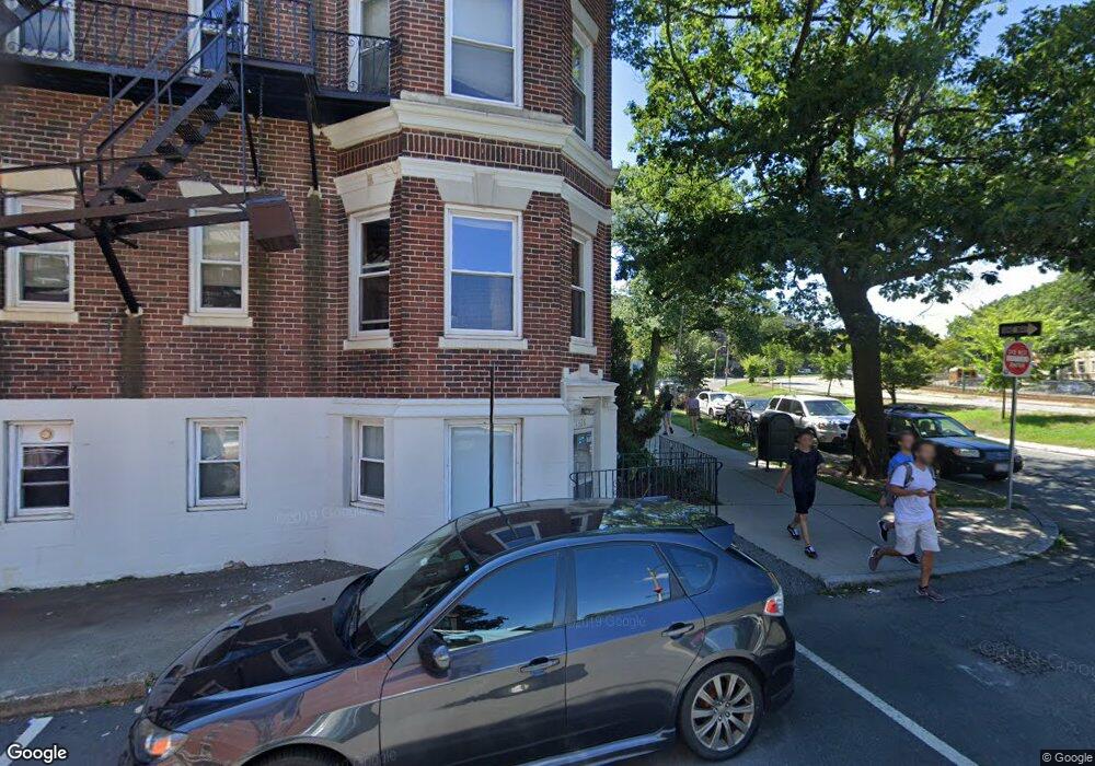
1330 Commonwealth Ave Unit 17 Allston, MA 02134
Commonwealth NeighborhoodEstimated Value: $318,000 - $444,000
--
Bed
1
Bath
--
Sq Ft
305
Sq Ft Lot
About This Home
This home is located at 1330 Commonwealth Ave Unit 17, Allston, MA 02134 and is currently estimated at $378,013. 1330 Commonwealth Ave Unit 17 is a home located in Suffolk County with nearby schools including Match Charter Public School, Boston Green Academy Horace Mann Charter School, and Mesivta High School of Greater Boston.
Ownership History
Date
Name
Owned For
Owner Type
Purchase Details
Closed on
Jan 15, 2019
Sold by
Politman Alexander and Politman Angela
Bought by
133017 Comm Ave Llc
Current Estimated Value
Purchase Details
Closed on
Dec 2, 1993
Sold by
Hinds Walter
Bought by
Politman Alexander and Politman Angela
Purchase Details
Closed on
Sep 24, 1993
Sold by
Us Trust
Bought by
Hinds Walter
Create a Home Valuation Report for This Property
The Home Valuation Report is an in-depth analysis detailing your home's value as well as a comparison with similar homes in the area
Home Values in the Area
Average Home Value in this Area
Purchase History
| Date | Buyer | Sale Price | Title Company |
|---|---|---|---|
| 133017 Comm Ave Llc | -- | None Available | |
| Politman Alexander | $20,000 | -- | |
| Politman Alexander | $20,000 | -- | |
| Hinds Walter | $12,500 | -- |
Source: Public Records
Tax History Compared to Growth
Tax History
| Year | Tax Paid | Tax Assessment Tax Assessment Total Assessment is a certain percentage of the fair market value that is determined by local assessors to be the total taxable value of land and additions on the property. | Land | Improvement |
|---|---|---|---|---|
| 2025 | $3,282 | $283,400 | $0 | $283,400 |
| 2024 | $3,233 | $296,600 | $0 | $296,600 |
| 2023 | $3,185 | $296,600 | $0 | $296,600 |
| 2022 | $3,044 | $279,800 | $0 | $279,800 |
| 2021 | $2,985 | $279,800 | $0 | $279,800 |
| 2020 | $2,221 | $210,300 | $0 | $210,300 |
| 2019 | $2,173 | $206,200 | $0 | $206,200 |
| 2018 | $2,021 | $192,800 | $0 | $192,800 |
| 2017 | $1,890 | $178,500 | $0 | $178,500 |
| 2016 | $1,802 | $163,800 | $0 | $163,800 |
| 2015 | $1,488 | $122,900 | $0 | $122,900 |
| 2014 | $1,405 | $111,700 | $0 | $111,700 |
Source: Public Records
Map
Nearby Homes
- 1304 Commonwealth Ave Unit 5
- 85 Brainerd Rd Unit TH7
- 86 Glenville Ave Unit 2
- 83 Glenville Ave
- 130 Glenville Ave
- 239 Kelton St Unit 41
- 245 Kelton St Unit 21
- 5 Spofford Rd Unit 17
- 159-161 Allston
- 30 Glenville Ave Unit 1
- 14 Radcliffe Rd Unit 1
- 1408 Commonwealth Ave Unit 20
- 5 Fiske Terrace
- 20 Radcliffe Rd Unit 209
- 20 Radcliffe Rd Unit 112
- 198 Allston St Unit 3
- 28 Verndale St
- 53 Quint Ave
- 147 Kelton St Unit 312
- 147 Kelton St Unit 305
- 1330 Commonwealth Ave Unit 8
- 1330 Commonwealth Ave Unit 1
- 1330 Commonwealth Ave Unit 5
- 1330 Commonwealth Ave Unit 6
- 1330 Commonwealth Ave Unit 20
- 1330 Commonwealth Ave Unit 21
- 1330 Commonwealth Ave Unit 23
- 1330 Commonwealth Ave Unit 28
- 1330 Commonwealth Ave Unit 30
- 1330 Commonwealth Ave Unit 27
- 1330 Commonwealth Ave Unit 26
- 1330 Commonwealth Ave Unit 25
- 1330 Commonwealth Ave Unit 24
- 1330 Commonwealth Ave Unit 19
- 1330 Commonwealth Ave Unit 18
- 1330 Commonwealth Ave Unit 16
- 1330 Commonwealth Ave Unit 14
- 1330 Commonwealth Ave Unit 12A
- 1330 Commonwealth Ave Unit 12
- 1330 Commonwealth Ave Unit 11