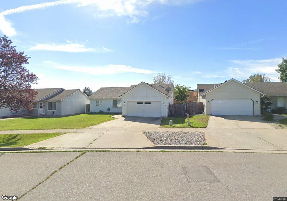
1330 E Stockman Ave Post Falls, ID 83854
Central Post Falls NeighborhoodEstimated Value: $406,000 - $417,000
3
Beds
2
Baths
1,181
Sq Ft
$349/Sq Ft
Est. Value
About This Home
This home is located at 1330 E Stockman Ave, Post Falls, ID 83854 and is currently estimated at $411,642, approximately $348 per square foot. 1330 E Stockman Ave is a home located in Kootenai County with nearby schools including Prairie View Elementary School, Post Falls Middle School, and Post Falls High School.
Ownership History
Date
Name
Owned For
Owner Type
Purchase Details
Closed on
Dec 23, 2008
Sold by
Mackinzie William L and Mackinzie Lynne D
Bought by
Mccallum Mark G
Current Estimated Value
Home Financials for this Owner
Home Financials are based on the most recent Mortgage that was taken out on this home.
Original Mortgage
$134,900
Interest Rate
5.67%
Mortgage Type
New Conventional
Create a Home Valuation Report for This Property
The Home Valuation Report is an in-depth analysis detailing your home's value as well as a comparison with similar homes in the area
Home Values in the Area
Average Home Value in this Area
Purchase History
| Date | Buyer | Sale Price | Title Company |
|---|---|---|---|
| Mccallum Mark G | -- | First American Title Com |
Source: Public Records
Mortgage History
| Date | Status | Borrower | Loan Amount |
|---|---|---|---|
| Closed | Mccallum Mark G | $134,900 |
Source: Public Records
Tax History
| Year | Tax Paid | Tax Assessment Tax Assessment Total Assessment is a certain percentage of the fair market value that is determined by local assessors to be the total taxable value of land and additions on the property. | Land | Improvement |
|---|---|---|---|---|
| 2025 | $1,354 | $370,290 | $165,000 | $205,290 |
| 2024 | $1,343 | $360,820 | $155,250 | $205,570 |
| 2023 | $1,343 | $378,070 | $172,500 | $205,570 |
| 2022 | $1,807 | $413,017 | $172,500 | $240,517 |
| 2021 | $1,475 | $266,480 | $115,000 | $151,480 |
| 2020 | $1,330 | $212,180 | $90,000 | $122,180 |
| 2019 | $1,313 | $199,830 | $85,000 | $114,830 |
| 2018 | $1,270 | $174,720 | $70,000 | $104,720 |
| 2017 | $1,207 | $151,540 | $48,000 | $103,540 |
| 2016 | $1,165 | $138,120 | $40,000 | $98,120 |
| 2015 | $1,089 | $121,860 | $36,000 | $85,860 |
| 2013 | $1,050 | $112,420 | $32,000 | $80,420 |
Source: Public Records
Map
Nearby Homes
- 1245 E Stetson Ave
- 1180 E Mullan Ave
- 634 N Calgary Ct
- 1251 E Polston Ave
- 1163 E Polston Ave
- 1100 N Wild Rose Ln
- 1019 N Nellie Ct
- 1016 E Healy Ave
- 936 E Healy
- 982 E Healy Ave
- 987 E Healy Ave
- 900 N Idaho St Unit 107
- 1552 N McKelvy Ln
- 1535 N Tatum Dr
- 1090 E 4th Ave
- 1031 E Railroad Ave
- 1035 E Railroad Ave
- 1004 E 4th Ave
- 928 E Railroad Ave
- 514 E 13th Ave
- 1300 E Stockman Ave
- 1360 E Stockman Ave
- 875 N Tucson St
- 1390 E Stockman Ave
- 890 N Fulton St
- 880 N Fulton St
- 865 N Tucson St
- 1365 E Stockman Ave
- 1305 E Stockman Ave
- 1335 E Stockman Ave
- NNA Stazenger Ln
- 870 N Fulton St
- 1295 E Stockman Ave
- 855 N Tucson St
- 1395 E Stockman Ave
- 1285 E Stockman Ave
- 860 N Fulton St
- 880 N Tucson St
- 845 N Tucson St
- 890 N Tucson St
Your Personal Tour Guide
Ask me questions while you tour the home.