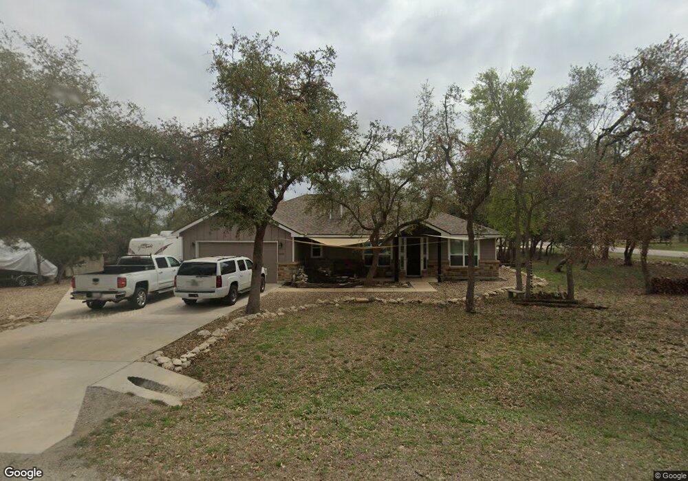
1330 Four Winds Dr Canyon Lake, TX 78133
Estimated Value: $400,604 - $476,000
--
Bed
--
Bath
1,681
Sq Ft
$265/Sq Ft
Est. Value
About This Home
This home is located at 1330 Four Winds Dr, Canyon Lake, TX 78133 and is currently estimated at $446,151, approximately $265 per square foot. 1330 Four Winds Dr is a home with nearby schools including Mt Valley Elementary School, Mt Valley Middle School, and Canyon Lake High School.
Ownership History
Date
Name
Owned For
Owner Type
Purchase Details
Closed on
Jan 19, 2018
Sold by
Hilburn Kathy S and Hilburn Jerry L
Bought by
Evans James T and Hepworth Evans Cindy Mae
Current Estimated Value
Home Financials for this Owner
Home Financials are based on the most recent Mortgage that was taken out on this home.
Original Mortgage
$249,880
Outstanding Balance
$210,869
Interest Rate
3.94%
Mortgage Type
Commercial
Estimated Equity
$235,282
Purchase Details
Closed on
Oct 10, 2017
Sold by
Gonzalez Elvira
Bought by
Hilburn Jerry L and Hilburn Kathy S
Create a Home Valuation Report for This Property
The Home Valuation Report is an in-depth analysis detailing your home's value as well as a comparison with similar homes in the area
Home Values in the Area
Average Home Value in this Area
Purchase History
| Date | Buyer | Sale Price | Title Company |
|---|---|---|---|
| Evans James T | -- | None Available | |
| Hilburn Jerry L | -- | New Braunfels Title Co |
Source: Public Records
Mortgage History
| Date | Status | Borrower | Loan Amount |
|---|---|---|---|
| Open | Evans James T | $249,880 |
Source: Public Records
Tax History Compared to Growth
Tax History
| Year | Tax Paid | Tax Assessment Tax Assessment Total Assessment is a certain percentage of the fair market value that is determined by local assessors to be the total taxable value of land and additions on the property. | Land | Improvement |
|---|---|---|---|---|
| 2025 | $2,979 | $399,919 | -- | -- |
| 2024 | $2,979 | $363,563 | -- | -- |
| 2023 | $2,979 | $330,512 | $0 | $0 |
| 2022 | $3,308 | $300,465 | -- | -- |
| 2021 | $4,892 | $273,150 | $25,690 | $247,460 |
| 2020 | $4,722 | $254,150 | $15,870 | $238,280 |
| 2019 | $5,181 | $271,620 | $15,870 | $255,750 |
| 2018 | $892 | $47,250 | $15,870 | $31,380 |
| 2017 | $265 | $14,170 | $14,170 | $0 |
| 2016 | $221 | $11,790 | $11,790 | $0 |
| 2015 | -- | $11,330 | $11,330 | $0 |
| 2014 | -- | $11,330 | $11,330 | $0 |
Source: Public Records
Map
Nearby Homes
- 1252 Parton Rd
- 1193 Parton Rd
- 1004 Parton Rd
- 1012 Parton Rd
- 1031 Parton and 151 Reeves Rd
- 239 George Strait
- 381 Monarch
- 520 Golden Eagle Loop
- 120 Golden Eagle Loop
- 162 Falcon Ct
- 1560 Roadrunner Ln
- 355 Nighthawk Ct
- 151 Nighthawk Ln
- 1171 Heritage Hill
- 1211 Heritage Hill
- 355 & 375 Nighthawk Ct
- 911 Heritage Hill
- 1440 Fm 3424
- 1316 Lonesome
- 1059 Summit Bluff
- 754 Monarch
- 1350 Four Winds Dr
- 820 Monarch
- 1290 Four Winds Dr
- 754 Monarch
- 735 Monarch
- 1341 Four Winds Dr
- 821 Monarch
- 850 Monarch
- 137 Jennings Ct
- 1370 Four Winds Dr
- 151 Jennings Ct
- 711 Monarch
- 1359 Four Winds Dr
- 1273 Four Winds Dr
- 845 Monarch
- 0000 Jennings Ct
- 0 Jennings Ct
- 0 (LOT 226) Monarch
- 1220 Four Winds Dr