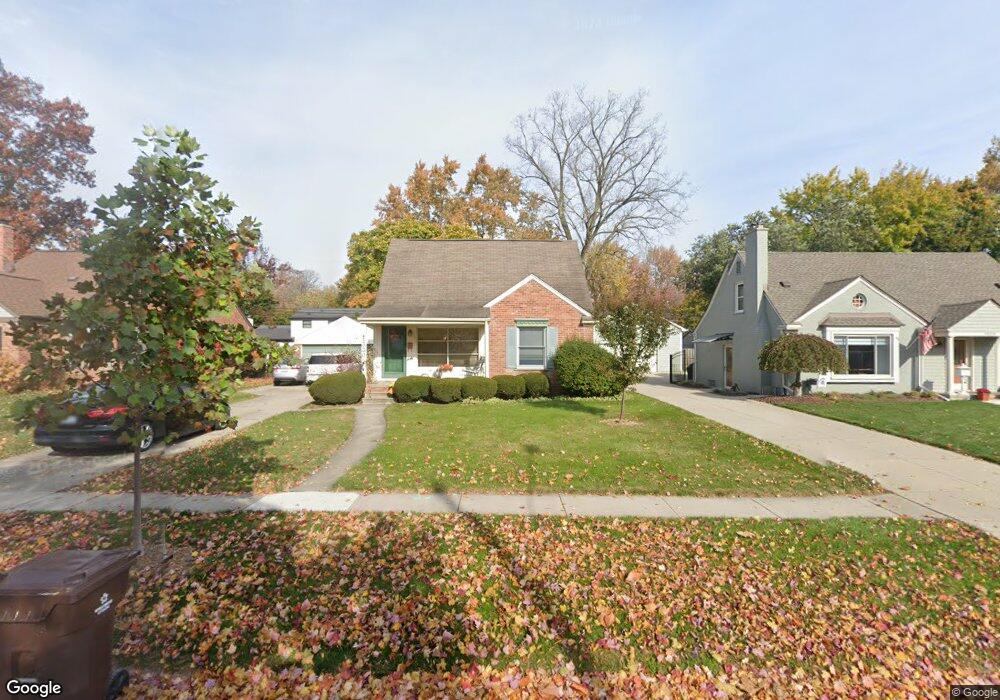
1330 Hartsough St Plymouth, MI 48170
Estimated Value: $413,000 - $454,000
3
Beds
2
Baths
942
Sq Ft
$455/Sq Ft
Est. Value
About This Home
This home is located at 1330 Hartsough St, Plymouth, MI 48170 and is currently estimated at $428,798, approximately $455 per square foot. 1330 Hartsough St is a home located in Wayne County with nearby schools including Canton High School, Smith Elementary School, and West Middle School.
Ownership History
Date
Name
Owned For
Owner Type
Purchase Details
Closed on
Sep 5, 2013
Sold by
Langdon Julie E and Andree Julie E
Bought by
Langdon Julie E and Langdon Kevin M
Current Estimated Value
Home Financials for this Owner
Home Financials are based on the most recent Mortgage that was taken out on this home.
Original Mortgage
$140,000
Interest Rate
4.38%
Mortgage Type
New Conventional
Create a Home Valuation Report for This Property
The Home Valuation Report is an in-depth analysis detailing your home's value as well as a comparison with similar homes in the area
Home Values in the Area
Average Home Value in this Area
Purchase History
| Date | Buyer | Sale Price | Title Company |
|---|---|---|---|
| Langdon Julie E | -- | 1St Security Title Agency In |
Source: Public Records
Mortgage History
| Date | Status | Borrower | Loan Amount |
|---|---|---|---|
| Closed | Langdon Julie E | $140,000 |
Source: Public Records
Tax History Compared to Growth
Tax History
| Year | Tax Paid | Tax Assessment Tax Assessment Total Assessment is a certain percentage of the fair market value that is determined by local assessors to be the total taxable value of land and additions on the property. | Land | Improvement |
|---|---|---|---|---|
| 2025 | $4,804 | $195,400 | $0 | $0 |
| 2024 | $4,804 | $180,200 | $0 | $0 |
| 2023 | $4,679 | $161,900 | $0 | $0 |
| 2022 | $4,960 | $150,500 | $0 | $0 |
| 2021 | $4,806 | $149,100 | $0 | $0 |
| 2020 | $4,793 | $145,100 | $0 | $0 |
| 2019 | $4,220 | $140,900 | $0 | $0 |
| 2018 | $4,099 | $145,600 | $0 | $0 |
| 2017 | $868 | $146,300 | $0 | $0 |
| 2016 | $4,466 | $139,800 | $0 | $0 |
| 2015 | $10,228 | $122,650 | $0 | $0 |
| 2013 | $9,908 | $105,090 | $0 | $0 |
| 2011 | -- | $95,020 | $0 | $0 |
Source: Public Records
Map
Nearby Homes
- 1125 Sutherland St
- 1199 S Sheldon Rd Unit 77
- 1338 S Harvey St
- 844 Ross St
- 638 S Harvey St
- 44571 Clare Blvd
- 553 Jener Place
- 9453 Brookline Ave
- 685 Ross St
- 44736 Lynn Dr
- 775 Deer Ct Unit 104
- 10839 Brookwood Dr
- 44750 Erin Dr Unit 40
- 9405 Northern Ave
- 44703 Erin Dr
- 44872 Lynn Dr
- 801 W Ann Arbor Trail Unit 306
- 44877 Erin Dr Unit 2
- 543 Deer St
- 684 Harding St
- 1340 Hartsough St
- 1320 Hartsough St Unit Bldg-Unit
- 1320 Hartsough St
- 1301 Palmer St
- 1310 Hartsough St Unit Bldg-Unit
- 1310 Hartsough St
- 1350 Hartsough St
- 1281 Palmer St
- 1321 Palmer St
- 1261 Palmer St
- 1341 Palmer St
- 1300 Hartsough St
- 1360 Hartsough St
- 1331 Hartsough St
- 1321 Hartsough St
- 1341 Hartsough St
- 1241 Palmer St
- 13109 Woodridge Cir
- 13119 Woodridge Cir
- 13107 Woodridge Cir