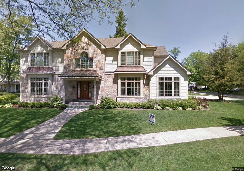
1330 Holly Ln Deerfield, IL 60015
Estimated Value: $1,271,000 - $1,303,899
4
Beds
4
Baths
4,125
Sq Ft
$313/Sq Ft
Est. Value
About This Home
This home is located at 1330 Holly Ln, Deerfield, IL 60015 and is currently estimated at $1,290,300, approximately $312 per square foot. 1330 Holly Ln is a home located in Lake County with nearby schools including Wilmot Elementary School, Charles J Caruso Middle School, and Deerfield High School.
Ownership History
Date
Name
Owned For
Owner Type
Purchase Details
Closed on
Jul 16, 2004
Sold by
Lombardo Alice M
Bought by
Emory David L and Emory Susan L
Current Estimated Value
Home Financials for this Owner
Home Financials are based on the most recent Mortgage that was taken out on this home.
Original Mortgage
$675,000
Interest Rate
6.08%
Mortgage Type
Unknown
Purchase Details
Closed on
Dec 10, 1998
Sold by
First Midwest Trust Company Natl Assn
Bought by
Lombardo Alice M
Home Financials for this Owner
Home Financials are based on the most recent Mortgage that was taken out on this home.
Original Mortgage
$75,000
Interest Rate
6.83%
Create a Home Valuation Report for This Property
The Home Valuation Report is an in-depth analysis detailing your home's value as well as a comparison with similar homes in the area
Home Values in the Area
Average Home Value in this Area
Purchase History
| Date | Buyer | Sale Price | Title Company |
|---|---|---|---|
| Emory David L | $362,500 | -- | |
| Lombardo Alice M | -- | Ticor Title |
Source: Public Records
Mortgage History
| Date | Status | Borrower | Loan Amount |
|---|---|---|---|
| Previous Owner | Emory David L | $675,000 | |
| Previous Owner | Lombardo Alice M | $75,000 |
Source: Public Records
Tax History Compared to Growth
Tax History
| Year | Tax Paid | Tax Assessment Tax Assessment Total Assessment is a certain percentage of the fair market value that is determined by local assessors to be the total taxable value of land and additions on the property. | Land | Improvement |
|---|---|---|---|---|
| 2024 | $29,984 | $340,353 | $53,036 | $287,317 |
| 2023 | $31,349 | $326,634 | $50,898 | $275,736 |
| 2022 | $31,349 | $336,920 | $54,671 | $282,249 |
| 2021 | $29,592 | $324,836 | $52,710 | $272,126 |
| 2020 | $28,459 | $325,520 | $52,821 | $272,699 |
| 2019 | $31,268 | $364,765 | $52,731 | $312,034 |
| 2018 | $28,260 | $347,507 | $55,891 | $291,616 |
| 2017 | $28,349 | $346,399 | $55,713 | $290,686 |
| 2016 | $27,586 | $364,780 | $53,606 | $311,174 |
| 2015 | $29,663 | $342,741 | $50,367 | $292,374 |
| 2014 | $23,507 | $279,877 | $50,727 | $229,150 |
| 2012 | $23,865 | $277,409 | $50,280 | $227,129 |
Source: Public Records
Map
Nearby Homes
- 926 Cedar St
- 931 Holmes Ave
- 934 Wayne Ave
- 816 Appletree Ln
- 1103 Hazel Ave
- 677 Timber Hill Rd
- 745 Price Ln
- 904 Forest Ave
- 1045 Fairoaks Ave
- 1138 Greentree Ave
- 1119 Hampton Ct Unit 1
- 730 Castlewood Ln
- 1131 Linden Ave
- 517 Appletree Ln
- 1038 Brookside Ln
- 1009 Central Ave
- 1410 Berkley Ct
- 1660 Hertel Ln
- 956 Brookside Ln
- 1265 Woodland Dr