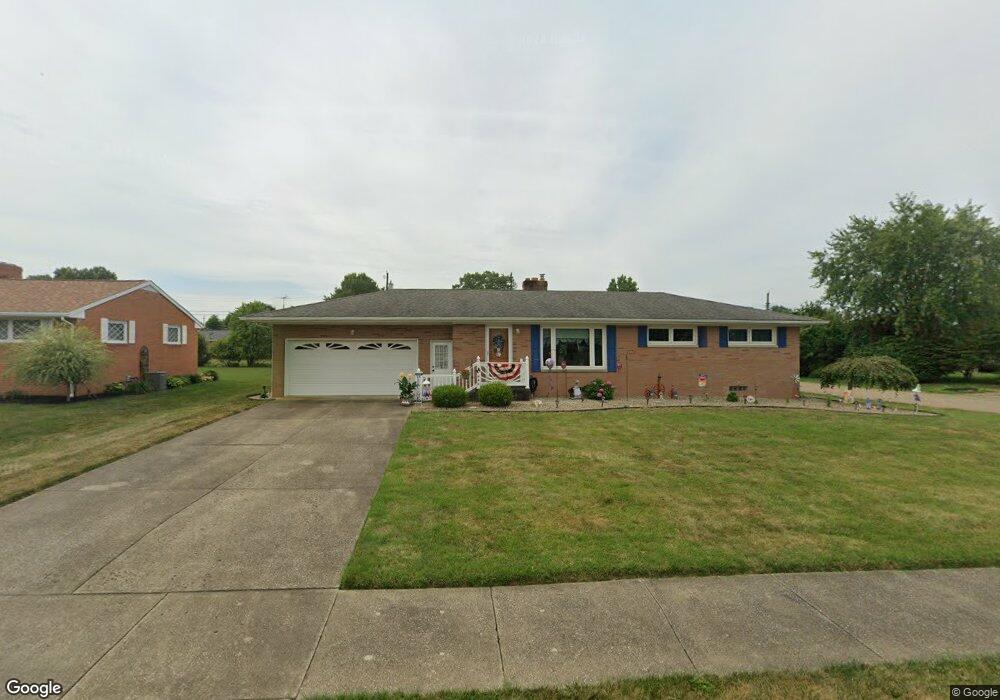
1330 Opal St Louisville, OH 44641
Estimated Value: $196,000 - $230,000
3
Beds
2
Baths
1,196
Sq Ft
$183/Sq Ft
Est. Value
About This Home
This home is located at 1330 Opal St, Louisville, OH 44641 and is currently estimated at $218,753, approximately $182 per square foot. 1330 Opal St is a home located in Stark County with nearby schools including Louisville High School and St. Thomas Aquinas High School & Middle School.
Ownership History
Date
Name
Owned For
Owner Type
Purchase Details
Closed on
Jan 19, 2023
Sold by
Walters Timothy W and Walters Darla J
Bought by
Bonam Francis R
Current Estimated Value
Home Financials for this Owner
Home Financials are based on the most recent Mortgage that was taken out on this home.
Original Mortgage
$161,500
Outstanding Balance
$156,255
Interest Rate
6.33%
Mortgage Type
New Conventional
Estimated Equity
$62,498
Purchase Details
Closed on
Sep 9, 2022
Sold by
Rodak Josette M
Bought by
Walters Timothy W and Walters Darla J
Create a Home Valuation Report for This Property
The Home Valuation Report is an in-depth analysis detailing your home's value as well as a comparison with similar homes in the area
Home Values in the Area
Average Home Value in this Area
Purchase History
| Date | Buyer | Sale Price | Title Company |
|---|---|---|---|
| Bonam Francis R | -- | -- | |
| Walters Timothy W | $150,000 | None Listed On Document |
Source: Public Records
Mortgage History
| Date | Status | Borrower | Loan Amount |
|---|---|---|---|
| Open | Bonam Francis R | $161,500 |
Source: Public Records
Tax History Compared to Growth
Tax History
| Year | Tax Paid | Tax Assessment Tax Assessment Total Assessment is a certain percentage of the fair market value that is determined by local assessors to be the total taxable value of land and additions on the property. | Land | Improvement |
|---|---|---|---|---|
| 2025 | -- | $59,610 | $17,290 | $42,320 |
| 2024 | -- | $59,610 | $17,290 | $42,320 |
| 2023 | $2,590 | $58,840 | $16,310 | $42,530 |
| 2022 | $945 | $52,570 | $16,310 | $36,260 |
| 2021 | $1,894 | $52,570 | $16,310 | $36,260 |
| 2020 | $1,532 | $47,220 | $14,700 | $32,520 |
| 2019 | $1,538 | $47,220 | $14,700 | $32,520 |
| 2018 | $1,532 | $47,220 | $14,700 | $32,520 |
| 2017 | $1,357 | $41,620 | $12,920 | $28,700 |
| 2016 | $1,385 | $41,620 | $12,920 | $28,700 |
| 2015 | $694 | $41,620 | $12,920 | $28,700 |
| 2014 | $1,239 | $35,990 | $11,170 | $24,820 |
| 2013 | $623 | $35,990 | $11,170 | $24,820 |
Source: Public Records
Map
Nearby Homes
- 641 S Nickelplate St
- 1715 High St
- 520 S Silver St
- 1812 E Broad St
- 908 Sand Lot Cir
- 308 Superior St
- 728 E Broad St
- 2110 Edmar St
- 510 S Bauman Ct
- 204 E Broad St
- 107 E Broad St
- 0 Michigan Blvd
- 3390 Meese Rd NE
- 1702 View Pointe Ave
- 2015 E Main St
- 325 Lincoln Ave
- 1639 Horizon Dr
- 8225 Georgetown St
- 1170 Winding Ridge Ave
- 910 Crosswyck Cir