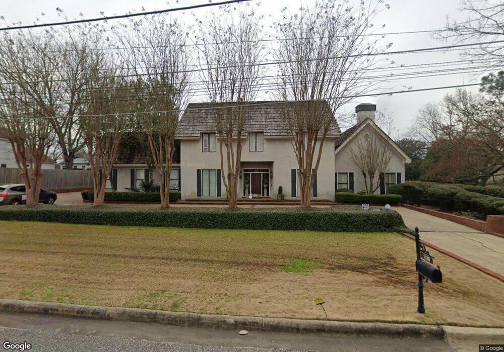
1330 Primrose Ln Montgomery, AL 36111
Estimated Value: $376,000 - $517,423
4
Beds
3
Baths
4,127
Sq Ft
$115/Sq Ft
Est. Value
About This Home
This home is located at 1330 Primrose Ln, Montgomery, AL 36111 and is currently estimated at $476,356, approximately $115 per square foot. 1330 Primrose Ln is a home located in Montgomery County with nearby schools including Dannelly Elementary School, Bellingrath Junior High School, and Lanier Senior High School.
Ownership History
Date
Name
Owned For
Owner Type
Purchase Details
Closed on
Mar 7, 2002
Sold by
Southern Pacific Funding Corp
Bought by
Bannister Christopher P
Current Estimated Value
Home Financials for this Owner
Home Financials are based on the most recent Mortgage that was taken out on this home.
Original Mortgage
$240,000
Outstanding Balance
$98,676
Interest Rate
6.98%
Estimated Equity
$377,680
Purchase Details
Closed on
May 20, 1998
Sold by
Taliaferro Dan William and Taliaferro Sandra Lee
Bought by
Sexton Lowell Landis and Sexton Bettina Mcdonald
Home Financials for this Owner
Home Financials are based on the most recent Mortgage that was taken out on this home.
Original Mortgage
$357,300
Interest Rate
9.3%
Create a Home Valuation Report for This Property
The Home Valuation Report is an in-depth analysis detailing your home's value as well as a comparison with similar homes in the area
Home Values in the Area
Average Home Value in this Area
Purchase History
| Date | Buyer | Sale Price | Title Company |
|---|---|---|---|
| Bannister Christopher P | $300,000 | -- | |
| Sexton Lowell Landis | -- | -- |
Source: Public Records
Mortgage History
| Date | Status | Borrower | Loan Amount |
|---|---|---|---|
| Open | Bannister Christopher P | $240,000 | |
| Previous Owner | Sexton Lowell Landis | $357,300 |
Source: Public Records
Tax History Compared to Growth
Tax History
| Year | Tax Paid | Tax Assessment Tax Assessment Total Assessment is a certain percentage of the fair market value that is determined by local assessors to be the total taxable value of land and additions on the property. | Land | Improvement |
|---|---|---|---|---|
| 2025 | $4,565 | $46,850 | $6,000 | $40,850 |
| 2024 | $4,634 | $47,560 | $6,000 | $41,560 |
| 2023 | $4,634 | $55,400 | $6,000 | $49,400 |
| 2022 | $3,483 | $47,710 | $6,000 | $41,710 |
| 2021 | $3,139 | $86,000 | $12,000 | $74,000 |
| 2020 | $1,542 | $43,360 | $6,000 | $37,360 |
| 2019 | $1,463 | $41,200 | $6,000 | $35,200 |
| 2018 | $1,570 | $43,000 | $6,000 | $37,000 |
| 2017 | $1,469 | $82,760 | $18,000 | $64,760 |
| 2014 | $1,293 | $36,533 | $7,500 | $29,033 |
| 2013 | -- | $33,760 | $7,500 | $26,260 |
Source: Public Records
Map
Nearby Homes
- 3482 Southview Ave
- 3504 Lockwood Ln
- 3415 Lockwood Place
- 3419 Lockwood Place
- 2209 Lockwood Way
- 1252 Augusta Ave
- 3640 Narrow Lane Rd
- 3747 MacLamar Rd
- 3650 Southview Ave
- 3553 Lockwood Ln
- 3345 Dartmouth Cir
- 3612 Lockwood Ln
- 3382 Thomas Ave
- 3635 Lockwood Ct
- 3577 Lockwood Ln
- 3581 Lockwood Ln
- 3705 Lockwood Ln
- 3646 Lockwood Ln
- 3564 Lockwood Ln
- 3644 Lockwood Ln
- 3516 Narrow Lane Rd
- 1336 Primrose Ln
- 3507 Southview Ave
- 1331 Primrose Ln
- 3521 Southview Ave
- 1325 Primrose Ln
- 3530 Narrow Lane Rd
- 1337 Primrose Ln
- 3503 Narrow Lane Rd
- 3531 Southview Ave
- 3485 Southview Ave
- 3545 Southview Ave
- 3469 Southview Ave
- 3456 Narrow Lane Rd
- 1315 Gregory Ave
- 3558 Narrow Lane Rd
- 3457 Southview Ave
- 3583 Southview Ave
- 3444 Narrow Lane Rd
- 3447 Southview Ave