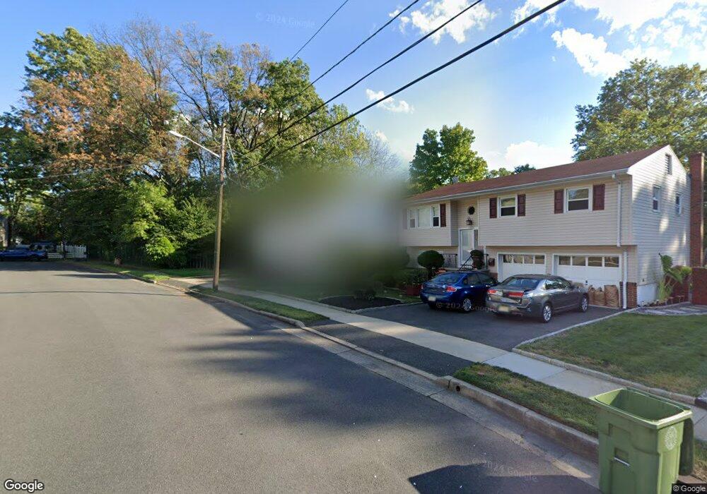
1330 Shaffer Ave Roselle, NJ 07203
Estimated Value: $554,000 - $609,000
Studio
--
Bath
1,688
Sq Ft
$343/Sq Ft
Est. Value
About This Home
This home is located at 1330 Shaffer Ave, Roselle, NJ 07203 and is currently estimated at $579,098, approximately $343 per square foot. 1330 Shaffer Ave is a home located in Union County with nearby schools including Dr Charles C Polk School, Grace Wilday Junior High School, and Leonard V. Moore Middle School.
Ownership History
Date
Name
Owned For
Owner Type
Purchase Details
Closed on
Sep 13, 2022
Sold by
Goldbros2 Llc
Bought by
Doppelt Chaim and Doppelt Bryna
Current Estimated Value
Home Financials for this Owner
Home Financials are based on the most recent Mortgage that was taken out on this home.
Original Mortgage
$389,500
Outstanding Balance
$371,332
Interest Rate
4.99%
Mortgage Type
New Conventional
Estimated Equity
$207,766
Purchase Details
Closed on
Jul 13, 2022
Sold by
1330 Shaffer Llc
Bought by
Eec Goldbros2
Purchase Details
Closed on
May 9, 2022
Sold by
Enza Toscano
Bought by
1330 Shaffer Llc
Purchase Details
Closed on
Jun 15, 2016
Sold by
Toscano Michael Exr
Bought by
Toscano Enza,Michael and Toscano Cipioni,Rosa
Create a Home Valuation Report for This Property
The Home Valuation Report is an in-depth analysis detailing your home's value as well as a comparison with similar homes in the area
Home Values in the Area
Average Home Value in this Area
Purchase History
| Date | Buyer | Sale Price | Title Company |
|---|---|---|---|
| Doppelt Chaim | $535,000 | Madison Title | |
| Eec Goldbros2 | $370,000 | Hauswirth Gregory | |
| Eec Goldbros2 | $370,000 | Hauswirth Gregory | |
| 1330 Shaffer Llc | $200,000 | None Listed On Document | |
| Toscano Enza,Michael | -- | -- |
Source: Public Records
Mortgage History
| Date | Status | Borrower | Loan Amount |
|---|---|---|---|
| Open | Doppelt Chaim | $389,500 |
Source: Public Records
Tax History
| Year | Tax Paid | Tax Assessment Tax Assessment Total Assessment is a certain percentage of the fair market value that is determined by local assessors to be the total taxable value of land and additions on the property. | Land | Improvement |
|---|---|---|---|---|
| 2025 | $11,973 | $137,700 | $72,400 | $65,300 |
| 2024 | $11,673 | $137,700 | $72,400 | $65,300 |
| 2023 | $11,673 | $137,700 | $72,400 | $65,300 |
| 2022 | $11,754 | $137,700 | $72,400 | $65,300 |
| 2021 | $11,684 | $137,700 | $72,400 | $65,300 |
| 2020 | $11,647 | $137,700 | $72,400 | $65,300 |
| 2019 | $11,498 | $137,700 | $72,400 | $65,300 |
| 2018 | $11,435 | $137,700 | $72,400 | $65,300 |
| 2017 | $11,374 | $137,700 | $72,400 | $65,300 |
| 2016 | $11,123 | $137,700 | $72,400 | $65,300 |
| 2015 | $11,122 | $137,700 | $72,400 | $65,300 |
| 2014 | $10,812 | $137,700 | $72,400 | $65,300 |
Source: Public Records
Map
Nearby Homes
- 574 Sherman Ave
- 2105 Wood Ave
- 909 Seymour Ave
- 382 Douglas Rd
- 812 Washington Ave
- 229 Hillcrest Terrace
- 1210 Orchard Terrace
- 215 Victory St
- 724 Walnut St
- 142 Bonna Villa Ave
- 620 Jackson Ave
- 132 Thelma Terrace
- 113 E Curtis St
- 725 N Wood Ave
- 925 Summit St
- 3 Fern St
- 811 Jackson Ave
- 836 Summit St
- 825 Jackson Ave
- 721 E Curtis St
- 465 Brookside Dr
- 461 Brookside Dr
- 469 Brookside Dr
- 1326 Shaffer Ave
- 473 Brookside Dr
- 453 Brookside Dr
- 464 Brookside Dr
- 470 Brookside Dr
- 477 Brookside Dr
- 1322 Shaffer Ave
- 454 Brookside Dr
- 101 Burt Dr
- 100 Burt Dr
- 449 Brookside Dr
- 474 Brookside Dr
- 481 Brookside Dr
- 1327 Shaffer Ave
- 1318 Shaffer Ave
- 478 Brookside Dr
- 105 Burt Dr
Your Personal Tour Guide
Ask me questions while you tour the home.