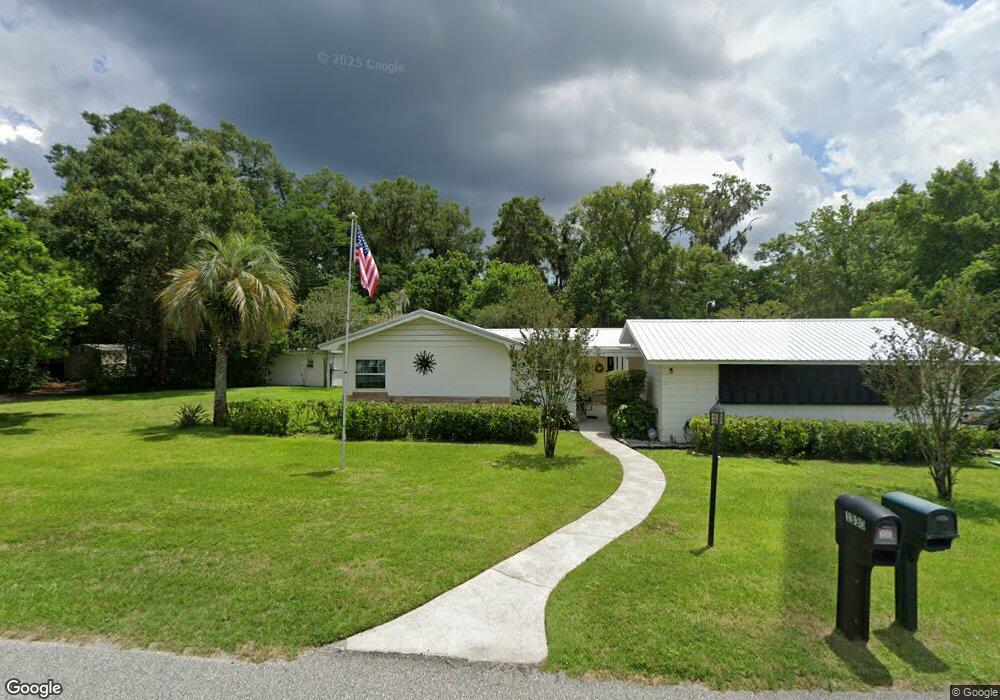
1330 Stevens Ave Deland, FL 32720
West DeLand NeighborhoodEstimated Value: $310,000 - $416,000
5
Beds
3
Baths
2,897
Sq Ft
$132/Sq Ft
Est. Value
About This Home
This home is located at 1330 Stevens Ave, Deland, FL 32720 and is currently estimated at $381,725, approximately $131 per square foot. 1330 Stevens Ave is a home located in Volusia County with nearby schools including Woodward Avenue Elementary School, Deland High School, and Southwestern Middle School.
Ownership History
Date
Name
Owned For
Owner Type
Purchase Details
Closed on
Jun 25, 2014
Sold by
Gomez Carlos H and Gomez Niurka D
Bought by
Gomez Family Revocable Trust
Current Estimated Value
Purchase Details
Closed on
Mar 16, 2006
Sold by
Tuten William H and Tuten D
Bought by
Carr John Paul and Carr Ghislaine B
Purchase Details
Closed on
Jun 6, 2005
Sold by
Gomez Carlos H
Bought by
Gomez Carlos H and Gomez Niurka D
Purchase Details
Closed on
Jul 6, 2000
Sold by
Smith A Chandler and Smith Mary G
Bought by
Gomez Carlos H and Gomez Niurka D
Purchase Details
Closed on
Aug 15, 1972
Bought by
Gomez Family Revoc Trust
Create a Home Valuation Report for This Property
The Home Valuation Report is an in-depth analysis detailing your home's value as well as a comparison with similar homes in the area
Home Values in the Area
Average Home Value in this Area
Purchase History
| Date | Buyer | Sale Price | Title Company |
|---|---|---|---|
| Gomez Family Revocable Trust | -- | None Available | |
| Carr John Paul | -- | Attorney | |
| Gomez Carlos H | -- | -- | |
| Gomez Carlos H | $94,000 | -- | |
| Gomez Family Revoc Trust | $38,000 | -- |
Source: Public Records
Tax History Compared to Growth
Tax History
| Year | Tax Paid | Tax Assessment Tax Assessment Total Assessment is a certain percentage of the fair market value that is determined by local assessors to be the total taxable value of land and additions on the property. | Land | Improvement |
|---|---|---|---|---|
| 2025 | $2,847 | $171,895 | -- | -- |
| 2024 | $2,847 | $167,051 | -- | -- |
| 2023 | $2,847 | $162,186 | $0 | $0 |
| 2022 | $2,668 | $152,225 | $0 | $0 |
| 2021 | $2,740 | $147,791 | $0 | $0 |
| 2020 | $2,695 | $145,750 | $0 | $0 |
| 2019 | $2,760 | $142,473 | $0 | $0 |
| 2018 | $2,727 | $139,816 | $0 | $0 |
| 2017 | $2,689 | $136,940 | $0 | $0 |
| 2016 | $2,557 | $134,123 | $0 | $0 |
| 2015 | $2,600 | $133,191 | $0 | $0 |
| 2014 | $2,576 | $132,134 | $0 | $0 |
Source: Public Records
Map
Nearby Homes
- 1314 Talton Ave
- 1415 Talton Ave
- 541 Rhodes Dr
- 320 S Woodward Ave
- 243 S Hull Ave
- 1141 W Euclid Ave
- 131 S Sheridan Ave
- 1541 W Talton Ave
- 1655 Andover Ridge Dr
- 1659 Andover Ridge Dr
- 1676 Andover Ridge Dr
- 1601 Andover Ridge Dr
- 141 Addle Hill Ct
- 131 Addle Hill Ct
- 780 Helen Ave
- 0 N Spring Garden Ave Unit MFRO6340602
- 0 N Spring Garden Ave Unit 1112700
- 0 N Spring Garden Ave Unit V4920996
- 143 N Woodward Ave
- 1697 Andover Ridge Dr
- 1310 Stevens Ave
- 1400 Stevens Ave
- 1315 Stevens Ave
- 1405 Stevens Ave
- 1309 Stevens Ave
- 1304 Stevens Ave
- 1410 Stevens Ave
- 425 Cass St
- 1415 Stevens Ave
- 1330 Talton Ave
- 414 S Sheridan Ave
- 306 S Sheridan Ave
- 1310 Talton Ave
- 1402 Talton Ave
- 1420 Stevens Ave
- 1306 Talton Ave
- 440 Cass St
- 1406 Talton Ave
- 400 S Sheridan Ave
- 1304 Talton Ave