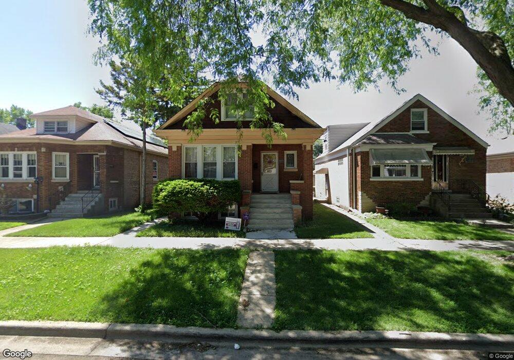
1330 Wenonah Ave Berwyn, IL 60402
Estimated Value: $268,000 - $333,000
3
Beds
1
Bath
921
Sq Ft
$324/Sq Ft
Est. Value
About This Home
This home is located at 1330 Wenonah Ave, Berwyn, IL 60402 and is currently estimated at $298,441, approximately $324 per square foot. 1330 Wenonah Ave is a home located in Cook County with nearby schools including Jefferson Elementary School, Lincoln Middle School, and J Sterling Morton West High School.
Ownership History
Date
Name
Owned For
Owner Type
Purchase Details
Closed on
Feb 2, 2010
Sold by
North Star Trust Company
Bought by
Sidonia Roberto
Current Estimated Value
Home Financials for this Owner
Home Financials are based on the most recent Mortgage that was taken out on this home.
Original Mortgage
$152,192
Interest Rate
4.83%
Mortgage Type
FHA
Create a Home Valuation Report for This Property
The Home Valuation Report is an in-depth analysis detailing your home's value as well as a comparison with similar homes in the area
Home Values in the Area
Average Home Value in this Area
Purchase History
| Date | Buyer | Sale Price | Title Company |
|---|---|---|---|
| Sidonia Roberto | $155,000 | Bt |
Source: Public Records
Mortgage History
| Date | Status | Borrower | Loan Amount |
|---|---|---|---|
| Previous Owner | Sidonia Roberto | $152,192 |
Source: Public Records
Tax History Compared to Growth
Tax History
| Year | Tax Paid | Tax Assessment Tax Assessment Total Assessment is a certain percentage of the fair market value that is determined by local assessors to be the total taxable value of land and additions on the property. | Land | Improvement |
|---|---|---|---|---|
| 2024 | $5,875 | $22,000 | $5,779 | $16,221 |
| 2023 | $3,740 | $22,000 | $5,779 | $16,221 |
| 2022 | $3,740 | $12,754 | $5,009 | $7,745 |
| 2021 | $3,596 | $12,752 | $5,008 | $7,744 |
| 2020 | $3,587 | $12,752 | $5,008 | $7,744 |
| 2019 | $4,203 | $13,619 | $4,494 | $9,125 |
| 2018 | $4,035 | $13,619 | $4,494 | $9,125 |
| 2017 | $3,933 | $13,619 | $4,494 | $9,125 |
| 2016 | $3,742 | $11,345 | $3,724 | $7,621 |
| 2015 | $3,620 | $11,345 | $3,724 | $7,621 |
| 2014 | $3,541 | $11,345 | $3,724 | $7,621 |
| 2013 | $3,941 | $13,616 | $3,724 | $9,892 |
Source: Public Records
Map
Nearby Homes
- 1329 Wisconsin Ave
- 1324 Clinton Ave
- 1216 Wenonah Ave
- 7011 Roosevelt Rd
- 1327 Harlem Ave
- 1227 S Harlem Ave Unit 512
- 1227 S Harlem Ave Unit 208
- 1227 S Harlem Ave Unit 307
- 1227 S Harlem Ave Unit 514
- 1227 S Harlem Ave Unit 510
- 1227 S Harlem Ave Unit 415
- 1409 Harlem Ave
- 1341 Kenilworth Ave
- 1531 Wenonah Ave
- 1224 Elgin Ave
- 1336 Grove Ave
- 1223 Elgin Ave Unit G1
- 1547 Clinton Ave
- 1320 Oak Park Ave
- 1618 Wenonah Ave
- 1326 Wenonah Ave
- 1334 Wenonah Ave
- 1336 Wenonah Ave
- 1324 Wenonah Ave
- 1338 Wenonah Ave
- 1320 Wenonah Ave
- 1340 Wenonah Ave
- 1318 Wenonah Ave
- 1331 Wisconsin Ave
- 1342 Wenonah Ave
- 1335 Wisconsin Ave
- 1323 Wisconsin Ave
- 1337 Wisconsin Ave
- 1316 Wenonah Ave
- 1321 Wisconsin Ave
- 1346 Wenonah Ave
- 1339 Wisconsin Ave
- 1331 Wenonah Ave
- 1327 Wenonah Ave
- 1314 Wenonah Ave