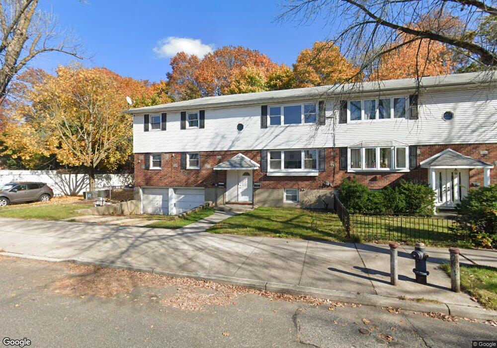
13303 Hawtree St Unit 2 Ozone Park, NY 11417
Ozone Park NeighborhoodEstimated Value: $923,936 - $1,235,000
3
Beds
1
Bath
2,340
Sq Ft
$465/Sq Ft
Est. Value
About This Home
This home is located at 13303 Hawtree St Unit 2, Ozone Park, NY 11417 and is currently estimated at $1,087,984, approximately $464 per square foot. 13303 Hawtree St Unit 2 is a home located in Queens County with nearby schools including P.S. 108 - Capt. Vincent G. Fowler, M.S.137 America's School of Heroes, and John Adams High School.
Ownership History
Date
Name
Owned For
Owner Type
Purchase Details
Closed on
Jan 21, 2004
Sold by
Sprague Eileen A and Sprague Steven J
Bought by
Bissnauth Madhuri and Megnauth Somnauth
Current Estimated Value
Home Financials for this Owner
Home Financials are based on the most recent Mortgage that was taken out on this home.
Original Mortgage
$400,000
Interest Rate
5.65%
Mortgage Type
Purchase Money Mortgage
Create a Home Valuation Report for This Property
The Home Valuation Report is an in-depth analysis detailing your home's value as well as a comparison with similar homes in the area
Home Values in the Area
Average Home Value in this Area
Purchase History
| Date | Buyer | Sale Price | Title Company |
|---|---|---|---|
| Bissnauth Madhuri | $575,000 | -- |
Source: Public Records
Mortgage History
| Date | Status | Borrower | Loan Amount |
|---|---|---|---|
| Previous Owner | Bissnauth Madhuri | $400,000 |
Source: Public Records
Tax History Compared to Growth
Tax History
| Year | Tax Paid | Tax Assessment Tax Assessment Total Assessment is a certain percentage of the fair market value that is determined by local assessors to be the total taxable value of land and additions on the property. | Land | Improvement |
|---|---|---|---|---|
| 2025 | $7,497 | $39,564 | $11,407 | $28,157 |
| 2024 | $7,497 | $37,325 | $12,899 | $24,426 |
| 2023 | $7,427 | $36,979 | $11,904 | $25,075 |
| 2022 | $7,382 | $58,920 | $18,060 | $40,860 |
| 2021 | $7,355 | $51,120 | $18,060 | $33,060 |
| 2020 | $6,979 | $51,180 | $18,060 | $33,120 |
| 2019 | $6,507 | $49,500 | $18,060 | $31,440 |
| 2018 | $6,282 | $30,816 | $15,965 | $14,851 |
| 2017 | $6,282 | $30,816 | $16,683 | $14,133 |
| 2016 | $5,822 | $30,816 | $16,683 | $14,133 |
| 2015 | $3,711 | $27,475 | $17,803 | $9,672 |
| 2014 | $3,711 | $25,920 | $20,100 | $5,820 |
Source: Public Records
Map
Nearby Homes
- 10010 133rd Ave
- 132-01 100th St
- 13318 Centreville St
- 96-06 134th Rd
- 132-11 Centreville St
- 95-18 Linden Blvd
- 9439 134th Ave
- 150-06 Hawtree St
- 9704 Pitkin Ave
- 10317 Plattwood Ave
- 9515 Pitkin Ave
- 9426 Sutter Ave
- 13319 Crossbay Blvd
- 10723 96th St
- 10719 96th St
- 107-16 103rd St
- 10712 Sutter Ave
- 96-15 149th Ave
- 96-36 149th Ave
- 107-62 93rd St
- 13303 Hawtree St
- 13309 Hawtree St
- 133-09 Hawtree St Unit 1
- 97-32 133rd Ave
- 9732 133rd Ave
- 13315 Hawtree St
- 13315 Hawtree St Unit 2
- 13315 Hawtree St
- 13315 Hawtree St Unit 1
- 9730 133rd Ave
- 9735 133rd Ave
- 9731 134th Ave
- 97-31 134th Ave
- 97-31 134th Ave Unit HOUSE
- 9728 133rd Ave
- 13319 Hawtree St
- 9728 133rd Ave
- 13319 Hawtree St
- 9729 134th Ave
- 9729 134th Ave