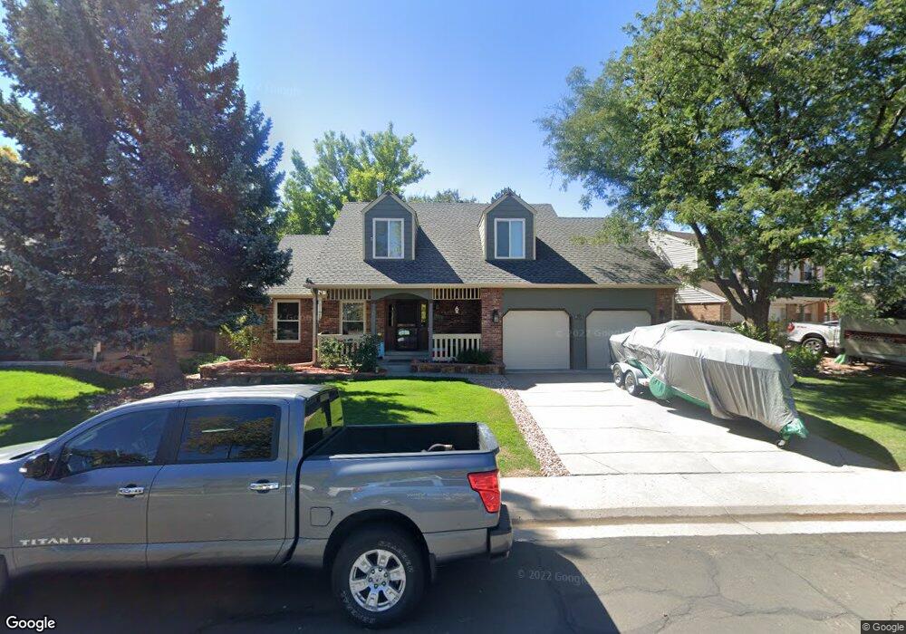
13305 Monroe Way Thornton, CO 80241
Estimated Value: $545,949 - $629,000
3
Beds
4
Baths
1,904
Sq Ft
$309/Sq Ft
Est. Value
About This Home
This home is located at 13305 Monroe Way, Thornton, CO 80241 and is currently estimated at $587,987, approximately $308 per square foot. 13305 Monroe Way is a home located in Adams County with nearby schools including Tarver Elementary School, Century Middle School, and Horizon High School.
Ownership History
Date
Name
Owned For
Owner Type
Purchase Details
Closed on
Apr 30, 2007
Sold by
Weiler Todd M and Matthews Tia R
Bought by
Eads Robert F and Eads Christy L
Current Estimated Value
Home Financials for this Owner
Home Financials are based on the most recent Mortgage that was taken out on this home.
Original Mortgage
$147,000
Outstanding Balance
$89,220
Interest Rate
6.13%
Mortgage Type
Unknown
Estimated Equity
$498,767
Purchase Details
Closed on
Jul 25, 2003
Sold by
Bohlender Jerry L and Bohlender Georgiana
Bought by
Weiler Todd M and Matthews Tia R
Home Financials for this Owner
Home Financials are based on the most recent Mortgage that was taken out on this home.
Original Mortgage
$170,000
Interest Rate
5.15%
Mortgage Type
Unknown
Create a Home Valuation Report for This Property
The Home Valuation Report is an in-depth analysis detailing your home's value as well as a comparison with similar homes in the area
Home Values in the Area
Average Home Value in this Area
Purchase History
| Date | Buyer | Sale Price | Title Company |
|---|---|---|---|
| Eads Robert F | $258,000 | Land Title Guarantee Company | |
| Weiler Todd M | $239,900 | Land Title Guarantee Company |
Source: Public Records
Mortgage History
| Date | Status | Borrower | Loan Amount |
|---|---|---|---|
| Open | Eads Robert F | $147,000 | |
| Previous Owner | Weiler Todd M | $170,000 |
Source: Public Records
Tax History Compared to Growth
Tax History
| Year | Tax Paid | Tax Assessment Tax Assessment Total Assessment is a certain percentage of the fair market value that is determined by local assessors to be the total taxable value of land and additions on the property. | Land | Improvement |
|---|---|---|---|---|
| 2024 | $2,968 | $33,940 | $6,880 | $27,060 |
| 2023 | $2,938 | $39,170 | $6,900 | $32,270 |
| 2022 | $2,312 | $27,940 | $7,090 | $20,850 |
| 2021 | $2,389 | $27,940 | $7,090 | $20,850 |
| 2020 | $2,355 | $28,260 | $7,290 | $20,970 |
| 2019 | $2,360 | $28,260 | $7,290 | $20,970 |
| 2018 | $2,051 | $25,020 | $7,200 | $17,820 |
| 2017 | $2,618 | $25,020 | $7,200 | $17,820 |
| 2016 | $2,207 | $20,540 | $4,140 | $16,400 |
| 2015 | $2,204 | $20,540 | $4,140 | $16,400 |
| 2014 | -- | $19,000 | $3,340 | $15,660 |
Source: Public Records
Map
Nearby Homes
- 13540 Detroit St
- 13080 Harrison Dr
- 13068 Harrison Dr
- 2788 E 132nd Cir
- 3007 E 131st Way
- 2691 E 132nd Ave
- 2746 E 132nd Place
- 12814 Jackson Cir
- 13606 Garfield St Unit E
- 3850 E 128th Way
- 13346 Birch Cir
- 13263 Clermont Cir
- 3022 E 137th Place
- 13022 Bellaire St
- 13638 Garfield St Unit B
- 13638 Garfield St Unit C
- 2883 E 136th Place
- 8346 E 135th Ct
- 13758 Cook St
- 12865 Clermont St
- 13295 Monroe Way
- 3601 E 133rd Cir
- 13287 Monroe Way
- 13323 Monroe Way
- 13220 Garfield Dr
- 13230 Garfield Dr
- 13315 Monroe Way
- 3620 E 133rd Cir
- 13322 Monroe Way
- 13327 Monroe Way
- 13283 Monroe Way
- 3611 E 133rd Cir
- 3198 E 134th Cir
- 13210 Garfield Dr
- 3196 E 134th Cir
- 13345 Monroe Way
- 3630 E 133rd Cir
- 13231 Garfield Dr
- 13275 Monroe Way
- 3602 E 133rd Ct