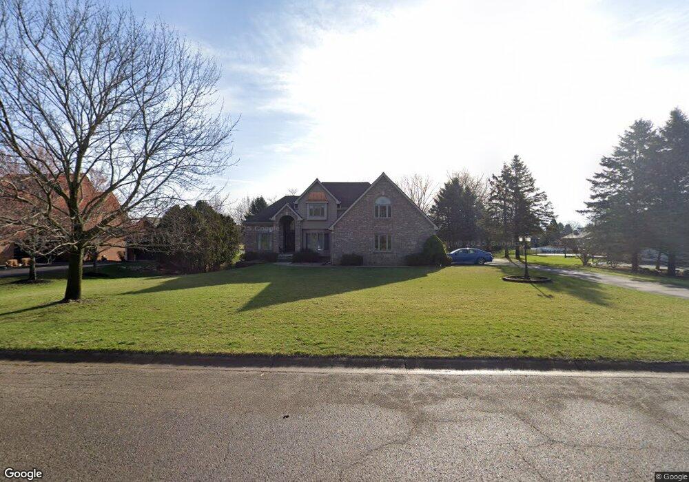
13305 Sumac Rd Unit Bldg-Unit South Lyon, MI 48178
Estimated Value: $586,000 - $673,000
--
Bed
4
Baths
3,089
Sq Ft
$206/Sq Ft
Est. Value
About This Home
This home is located at 13305 Sumac Rd Unit Bldg-Unit, South Lyon, MI 48178 and is currently estimated at $637,300, approximately $206 per square foot. 13305 Sumac Rd Unit Bldg-Unit is a home located in Livingston County with nearby schools including William A. Brummer Elementary School, Centennial Middle School, and South Lyon High School.
Ownership History
Date
Name
Owned For
Owner Type
Purchase Details
Closed on
Aug 27, 2002
Sold by
Sillence David A and Sillence Susan E
Bought by
Casteleyn Kevin M and Casteleyn Kimberly S
Current Estimated Value
Home Financials for this Owner
Home Financials are based on the most recent Mortgage that was taken out on this home.
Original Mortgage
$300,000
Outstanding Balance
$128,243
Interest Rate
6.56%
Estimated Equity
$509,057
Create a Home Valuation Report for This Property
The Home Valuation Report is an in-depth analysis detailing your home's value as well as a comparison with similar homes in the area
Home Values in the Area
Average Home Value in this Area
Purchase History
| Date | Buyer | Sale Price | Title Company |
|---|---|---|---|
| Casteleyn Kevin M | $387,000 | Eit Title |
Source: Public Records
Mortgage History
| Date | Status | Borrower | Loan Amount |
|---|---|---|---|
| Open | Casteleyn Kevin M | $300,000 |
Source: Public Records
Tax History Compared to Growth
Tax History
| Year | Tax Paid | Tax Assessment Tax Assessment Total Assessment is a certain percentage of the fair market value that is determined by local assessors to be the total taxable value of land and additions on the property. | Land | Improvement |
|---|---|---|---|---|
| 2025 | $8,224 | $325,600 | $0 | $0 |
| 2024 | $5,540 | $293,800 | $0 | $0 |
| 2023 | $5,284 | $285,300 | $0 | $0 |
| 2022 | $6,716 | $255,300 | $0 | $0 |
| 2021 | $6,716 | $239,800 | $0 | $0 |
| 2020 | $6,682 | $228,000 | $0 | $0 |
| 2019 | $5,369 | $255,300 | $0 | $0 |
| 2018 | $5,300 | $216,400 | $0 | $0 |
| 2017 | $5,379 | $215,800 | $0 | $0 |
| 2016 | $5,457 | $197,100 | $0 | $0 |
| 2014 | $4,956 | $175,600 | $0 | $0 |
| 2012 | $4,956 | $177,000 | $0 | $0 |
Source: Public Records
Map
Nearby Homes
- 9851 Atwood Dr
- 9859 Aylebury Dr
- 13428 Sequoia Ln
- 13708 Monarch Dr
- 13500 12 Mile Rd
- 26003 N Dixboro Rd
- Bradford Plan at Charleston Park
- Bradford with Second Floor Plan at Charleston Park
- Bartelle Plan at Charleston Park
- Upton Plan at Charleston Park
- Westford Plan at Charleston Park
- Addison Plan at Charleston Park
- Madison Plan at Charleston Park
- Nantucket Plan at Charleston Park
- Preston Plan at Charleston Park
- Rockport II Plan at Charleston Park
- Remington Plan at Charleston Park
- 124 Shannon Partin Ct
- 174 Singh Blvd
- 12459 Janes Landing Unit 41
- 13305 Sumac Rd
- 13311 Sumac Rd
- 13299 Sumac Rd
- 13345 Sumac Rd
- 13293 Sumac Rd
- 13410 Daleview Ct
- 13300 Sumac Rd
- 13274 Sumac Rd
- 13373 Sumac Rd
- 13428 Daleview Ct
- 13306 Sumac Rd
- 13287 Sumac Rd
- 13314 Sumac Rd Unit Bldg-Unit
- 13314 Sumac Rd
- 13392 Daleview Ct
- 13446 Daleview Ct
- 13326 Sumac Rd
- 13288 Sumac Rd
- 13348 Sumac Rd
- 13281 Sumac Rd