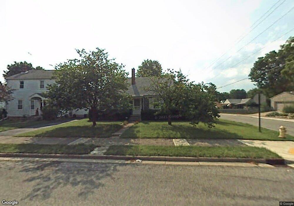
1331 N Lowry Ave Springfield, OH 45504
Estimated Value: $153,851 - $162,000
3
Beds
1
Bath
1,075
Sq Ft
$147/Sq Ft
Est. Value
About This Home
This home is located at 1331 N Lowry Ave, Springfield, OH 45504 and is currently estimated at $158,213, approximately $147 per square foot. 1331 N Lowry Ave is a home located in Clark County with nearby schools including Snowhill Elementary School, Roosevelt Middle School, and Springfield High School.
Ownership History
Date
Name
Owned For
Owner Type
Purchase Details
Closed on
Aug 23, 2005
Sold by
Knowlton Michael C
Bought by
Worman Lionel M
Current Estimated Value
Home Financials for this Owner
Home Financials are based on the most recent Mortgage that was taken out on this home.
Original Mortgage
$83,000
Outstanding Balance
$43,993
Interest Rate
5.8%
Mortgage Type
Fannie Mae Freddie Mac
Estimated Equity
$114,220
Purchase Details
Closed on
Apr 16, 1987
Create a Home Valuation Report for This Property
The Home Valuation Report is an in-depth analysis detailing your home's value as well as a comparison with similar homes in the area
Home Values in the Area
Average Home Value in this Area
Purchase History
| Date | Buyer | Sale Price | Title Company |
|---|---|---|---|
| Worman Lionel M | $83,000 | -- | |
| -- | $43,700 | -- |
Source: Public Records
Mortgage History
| Date | Status | Borrower | Loan Amount |
|---|---|---|---|
| Open | Worman Lionel M | $83,000 |
Source: Public Records
Tax History Compared to Growth
Tax History
| Year | Tax Paid | Tax Assessment Tax Assessment Total Assessment is a certain percentage of the fair market value that is determined by local assessors to be the total taxable value of land and additions on the property. | Land | Improvement |
|---|---|---|---|---|
| 2024 | $1,441 | $29,900 | $7,650 | $22,250 |
| 2023 | $1,441 | $29,900 | $7,650 | $22,250 |
| 2022 | $1,476 | $29,900 | $7,650 | $22,250 |
| 2021 | $1,101 | $20,590 | $6,120 | $14,470 |
| 2020 | $1,103 | $20,590 | $6,120 | $14,470 |
| 2019 | $1,106 | $20,590 | $6,120 | $14,470 |
| 2018 | $1,387 | $24,690 | $5,830 | $18,860 |
| 2017 | $1,386 | $20,812 | $5,828 | $14,984 |
| 2016 | $1,388 | $20,812 | $5,828 | $14,984 |
| 2015 | $1,122 | $20,812 | $5,828 | $14,984 |
| 2014 | $1,117 | $20,812 | $5,828 | $14,984 |
| 2013 | $1,106 | $20,812 | $5,828 | $14,984 |
Source: Public Records
Map
Nearby Homes
- 0 Glendale Dr
- 214 Sunnyside Place
- 125 Hawthorne Rd
- 0 E McCreight Ave
- 716 W 2nd St
- 24 Bill Edwards Dr
- 232 Ardmore Rd
- 1023 Garfield Ave
- 911 N Fountain Ave
- 830 W 2nd St
- 126-128 E Cecil St
- 126 E Cecil St Unit 128
- 134 E Cecil St Unit 136
- 136 E Cecil St
- 120 E Ward St
- 1007 N Limestone St
- 1801 Stratford Place
- 124 Englewood Rd
- 1329 Lamar Dr
- 1512 Amherst Rd
- 1327 N Lowry Ave
- 1325 N Lowry Ave
- 303 Second St
- 321 W 2nd St
- 1321 N Lowry Ave
- 320 W 2nd St
- 1409 N Lowry Ave Unit 1411
- 1315 N Lowry Ave
- 1326 N Plum St
- 1330 N Lowry Ave
- 1336 N Plum St Unit 1338
- 1328 N Lowry Ave
- 1400 N Plum St
- 1324 N Plum St
- 1324 N Lowry Ave
- 1404 N Lowry Ave
- 1307 N Lowry Ave
- 1417 N Lowry Ave Unit 1419
- 1408 N Plum St
- 1320 N Lowry Ave