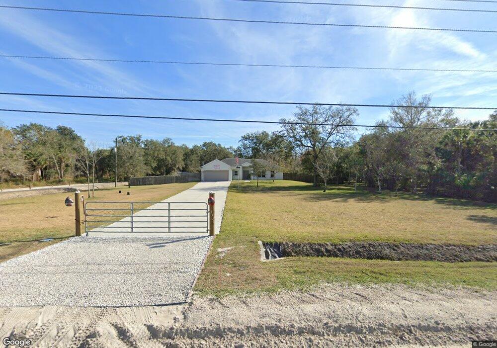
1331 Satellite Blvd Cocoa, FL 32926
Canaveral Groves NeighborhoodEstimated Value: $247,000 - $386,000
3
Beds
2
Baths
1,548
Sq Ft
$212/Sq Ft
Est. Value
About This Home
This home is located at 1331 Satellite Blvd, Cocoa, FL 32926 and is currently estimated at $327,555, approximately $211 per square foot. 1331 Satellite Blvd is a home located in Brevard County with nearby schools including Cocoa High School and Fairglen Elementary School.
Ownership History
Date
Name
Owned For
Owner Type
Purchase Details
Closed on
May 8, 2009
Sold by
Hayhurst Paul W and Hayhurst Julie A
Bought by
Owen Donald L
Current Estimated Value
Home Financials for this Owner
Home Financials are based on the most recent Mortgage that was taken out on this home.
Original Mortgage
$141,334
Outstanding Balance
$92,170
Interest Rate
4.79%
Estimated Equity
$235,385
Purchase Details
Closed on
May 7, 2003
Sold by
Walton Derwood R and Walton Sandra T
Bought by
Hayhurst Paul W and Hayhurst Julie A
Create a Home Valuation Report for This Property
The Home Valuation Report is an in-depth analysis detailing your home's value as well as a comparison with similar homes in the area
Home Values in the Area
Average Home Value in this Area
Purchase History
| Date | Buyer | Sale Price | Title Company |
|---|---|---|---|
| Owen Donald L | $32,000 | Security First Title Partner | |
| Hayhurst Paul W | $5,300 | Fidelity National Title Insu |
Source: Public Records
Mortgage History
| Date | Status | Borrower | Loan Amount |
|---|---|---|---|
| Open | Owen Donald L | $141,334 |
Source: Public Records
Tax History Compared to Growth
Tax History
| Year | Tax Paid | Tax Assessment Tax Assessment Total Assessment is a certain percentage of the fair market value that is determined by local assessors to be the total taxable value of land and additions on the property. | Land | Improvement |
|---|---|---|---|---|
| 2025 | $1,511 | $111,840 | -- | -- |
| 2024 | $1,474 | $108,690 | -- | -- |
| 2023 | $1,474 | $105,530 | $0 | $0 |
| 2022 | $1,374 | $102,460 | $0 | $0 |
| 2021 | $1,374 | $99,480 | $0 | $0 |
| 2020 | $1,312 | $98,110 | $0 | $0 |
| 2019 | $1,249 | $95,910 | $0 | $0 |
| 2018 | $1,241 | $94,130 | $0 | $0 |
| 2017 | $1,235 | $92,200 | $0 | $0 |
| 2016 | $1,237 | $90,310 | $13,000 | $77,310 |
| 2015 | $1,243 | $89,690 | $13,000 | $76,690 |
| 2014 | $1,242 | $88,980 | $13,000 | $75,980 |
Source: Public Records
Map
Nearby Homes
- 000 Satellite Blvd
- 6688 Terri Lee Ave
- 1315 Moonlight Dr
- 0000 Airboat Ave
- 6764 Outback Rd
- 0 Albert Ln
- 0 Airboat Ave
- 00 Olkowski Ave
- 0 Olkowski Ave Unit 1061805
- 24-35-29-01-11-4 Rattlesnake Way
- 0 W Highway 520 Unit 1034167
- 0 Burning Tree Ave Unit 1042503
- 0 Satellite Blvd Unit 1054670
- 0 Satellite Blvd Unit 1058307
- 0 Satellite Blvd Unit A4476061
- 0 Satellite Blvd Unit 1060705
- 0 Dyson Ave
- * Not Assigned
- 0 Doug Williams Ave Unit 1047169
- 0 Doug Williams Ave Unit 1054683
- 1301 Satellite Blvd
- 0 Soggy Bottom Ave Unit 811680
- 0 Soggy Bottom Ave Unit MFRS5134504
- 6897 Soggy Bottom Ave
- 0 Soggy Bottom Ave Unit 456156
- 0 Soggy Bottom Ave Unit 456154
- 6667 Soggy Bottom Ave
- 6757 Soggy Bottom Ave
- 0 Soggy Bottom Ave Unit 345876
- 6727 Soggy Bottom Ave
- 0 Soggy Bottom Ave Unit 415899
- 7 Soggy Bottom Ave
- Blk 8 Soggy Bottom Ave
- 0 Soggy Bottom Ave Unit 963283
- 0 Soggy Bottom Ave Unit R4702281
- 6846 Soggy Bottom Ave
- 0 Soggy Bottom Ave Unit 856313
- 0 Soggy Bottom Ave Unit 856310
- 0 Soggy Bottom Ave Unit 852634
- 0 Soggy Bottom Ave Unit 823986