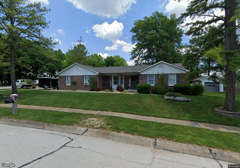
1331 Summit Dr Fenton, MO 63026
Estimated Value: $357,000 - $419,000
2
Beds
2
Baths
1,652
Sq Ft
$232/Sq Ft
Est. Value
About This Home
This home is located at 1331 Summit Dr, Fenton, MO 63026 and is currently estimated at $383,597, approximately $232 per square foot. 1331 Summit Dr is a home located in St. Louis County with nearby schools including Bowles Elementary School, Rockwood South Middle School, and Rockwood Summit Senior High School.
Ownership History
Date
Name
Owned For
Owner Type
Purchase Details
Closed on
Aug 29, 2003
Sold by
Beyer Brian J and Beyer Thomas G
Bought by
Payne Gary M and Payne Regina R
Current Estimated Value
Home Financials for this Owner
Home Financials are based on the most recent Mortgage that was taken out on this home.
Original Mortgage
$145,000
Interest Rate
6.25%
Mortgage Type
Purchase Money Mortgage
Create a Home Valuation Report for This Property
The Home Valuation Report is an in-depth analysis detailing your home's value as well as a comparison with similar homes in the area
Home Values in the Area
Average Home Value in this Area
Purchase History
| Date | Buyer | Sale Price | Title Company |
|---|---|---|---|
| Payne Gary M | $215,000 | -- |
Source: Public Records
Mortgage History
| Date | Status | Borrower | Loan Amount |
|---|---|---|---|
| Previous Owner | Payne Gary M | $145,000 |
Source: Public Records
Tax History Compared to Growth
Tax History
| Year | Tax Paid | Tax Assessment Tax Assessment Total Assessment is a certain percentage of the fair market value that is determined by local assessors to be the total taxable value of land and additions on the property. | Land | Improvement |
|---|---|---|---|---|
| 2025 | $4,511 | $68,700 | $28,270 | $40,430 |
| 2024 | $4,511 | $60,530 | $15,900 | $44,630 |
| 2023 | $4,511 | $60,530 | $15,900 | $44,630 |
| 2022 | $4,292 | $53,710 | $15,900 | $37,810 |
| 2021 | $4,259 | $53,710 | $15,900 | $37,810 |
| 2020 | $4,272 | $51,800 | $13,970 | $37,830 |
| 2019 | $4,285 | $51,800 | $13,970 | $37,830 |
| 2018 | $4,242 | $49,210 | $12,240 | $36,970 |
| 2017 | $4,208 | $49,210 | $12,240 | $36,970 |
| 2016 | $3,879 | $45,780 | $12,240 | $33,540 |
| 2015 | $3,799 | $45,780 | $12,240 | $33,540 |
| 2014 | $3,640 | $42,760 | $9,790 | $32,970 |
Source: Public Records
Map
Nearby Homes
- The Westhampton Plan at Bowles Crossing
- The Rockport Plan at Bowles Crossing
- The Richmond Plan at Bowles Crossing
- The Liberty Plan at Bowles Crossing
- The Brookfield Plan at Bowles Crossing
- The Arlington Plan at Bowles Crossing
- 260 Trueman Heritage Pkwy
- 818 Mary Lee Ct
- 811 Mary Lee Ct
- The Westhampton Plan at Hawkins Point
- The Rockport Plan at Hawkins Point
- The Brookfield Plan at Hawkins Point
- The Liberty Plan at Hawkins Point
- The Arlington Plan at Hawkins Point
- 1009 Remington Oaks Ct
- 1248 Green Knoll Dr
- 800 Mary Lee Ct
- 1095 Hawkins Rd
- The Westhampton Plan at Oak Ridge Place
- 6 Hickory Hollow Ln
- 24 Mount Carmel Ct
- 1327 Summit Dr
- 30 Mount Carmel Ct
- 1323 Summit Dr
- 23 Mount Carmel Ct
- 42 Mount Carmel Ct
- 46 Mount Carmel Ct
- 1344 Summit Dr
- 1319 Summit Dr
- 1324 Summit Dr
- 29 Mount Carmel Ct
- 35 Mount Carmel Ct
- 1343 Summit Dr
- 11 Misty Lou Ct
- 1315 Summit Dr
- 39 Mount Carmel Ct
- 50 Mount Carmel Ct
- 1001 Highland Dr
- 7 Misty Lou Ct
- 15 Misty Lou Ct