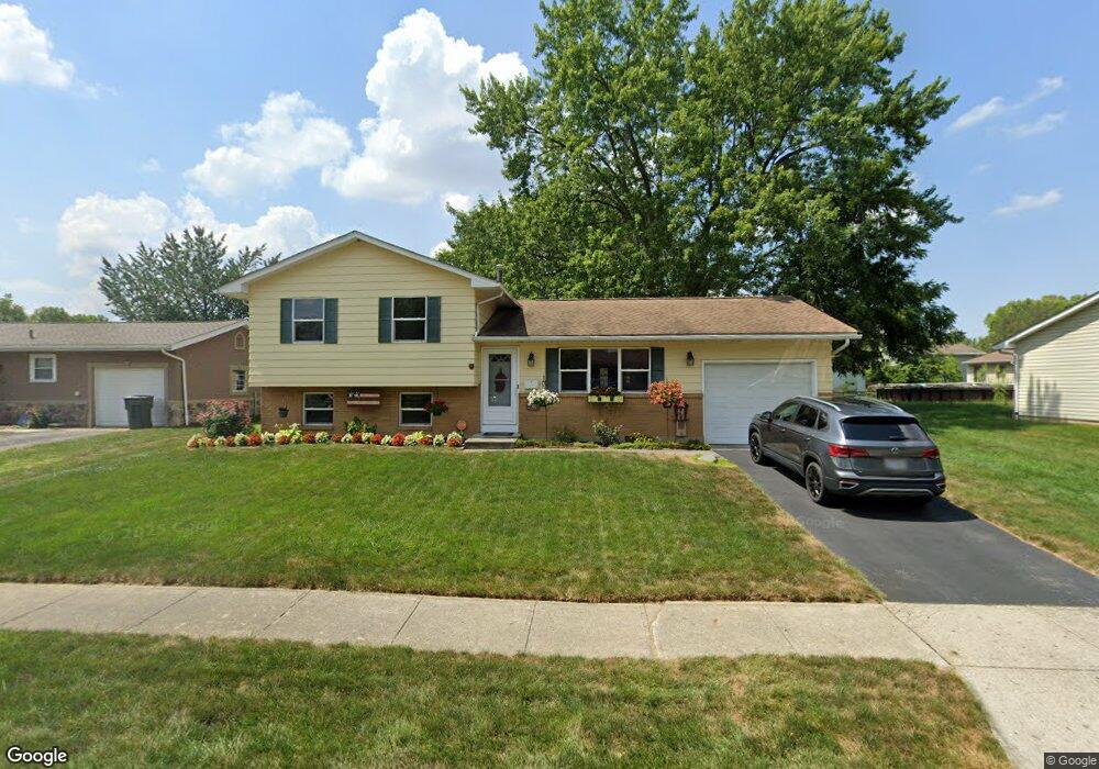
1331 Westshire Rd Columbus, OH 43204
Brookshire NeighborhoodEstimated Value: $212,389 - $246,000
3
Beds
2
Baths
1,028
Sq Ft
$225/Sq Ft
Est. Value
About This Home
This home is located at 1331 Westshire Rd, Columbus, OH 43204 and is currently estimated at $231,597, approximately $225 per square foot. 1331 Westshire Rd is a home located in Franklin County with nearby schools including James A Harmon Elementary School, Franklin Woods Intermediate School, and Finland Middle School.
Ownership History
Date
Name
Owned For
Owner Type
Purchase Details
Closed on
Jun 12, 2020
Sold by
Breckenridge Terry L and Breckenridge Nancy E
Bought by
Breckenridge Terry L and Breckenridge Nancy E
Current Estimated Value
Purchase Details
Closed on
Mar 22, 1976
Bought by
Breckenridge Terry L
Create a Home Valuation Report for This Property
The Home Valuation Report is an in-depth analysis detailing your home's value as well as a comparison with similar homes in the area
Home Values in the Area
Average Home Value in this Area
Purchase History
| Date | Buyer | Sale Price | Title Company |
|---|---|---|---|
| Breckenridge Terry L | -- | None Available | |
| Breckenridge Terry L | -- | -- |
Source: Public Records
Tax History Compared to Growth
Tax History
| Year | Tax Paid | Tax Assessment Tax Assessment Total Assessment is a certain percentage of the fair market value that is determined by local assessors to be the total taxable value of land and additions on the property. | Land | Improvement |
|---|---|---|---|---|
| 2024 | $1,940 | $63,010 | $16,000 | $47,010 |
| 2023 | $2,019 | $65,530 | $16,000 | $49,530 |
| 2022 | $2,451 | $42,010 | $11,450 | $30,560 |
| 2021 | $1,656 | $42,010 | $11,450 | $30,560 |
| 2020 | $1,646 | $42,010 | $11,450 | $30,560 |
| 2019 | $1,553 | $36,440 | $9,940 | $26,500 |
| 2018 | $1,408 | $36,440 | $9,940 | $26,500 |
| 2017 | $1,539 | $36,440 | $9,940 | $26,500 |
| 2016 | $1,271 | $29,750 | $5,950 | $23,800 |
| 2015 | $1,271 | $29,750 | $5,950 | $23,800 |
| 2014 | $1,272 | $29,750 | $5,950 | $23,800 |
| 2013 | $730 | $33,040 | $6,615 | $26,425 |
Source: Public Records
Map
Nearby Homes
- 2987 Daisy Ln
- 1465 Tall Meadows Dr
- 1248 Gresham Rd
- 1181 Onslow Dr
- 1520 Fall Brook Rd
- 2929 Briggs Rd
- 2856 Chesfield Dr
- 1226 Pinnacle Dr
- 1037 Chestershire Rd
- 3488 Rocky Rd
- 3326 Bluhm Ct
- 1657 Ripplebrook Rd
- 1027 S Brinker Ave
- 3029 Rosedale Ave
- 3360 Briggs Rd
- 3623 High Creek Dr
- 898 Binns Blvd
- 2800 Alkire Rd
- 894 Binns Blvd
- 890 S Roys Ave
- 1341 Westshire Rd
- 1323 Westshire Rd
- 3133 Telham Dr
- 1330 Vauxhall Place
- 1338 Vauxhall Place
- 1349 Westshire Rd
- 3141 Telham Dr
- 1332 Westshire Rd
- 1340 Westshire Rd
- 1324 Westshire Rd
- 1348 Westshire Rd
- 1359 Westshire Rd
- 1327 Vauxhall Place
- 1356 Westshire Rd
- 1316 Westshire Rd
- 3124 Telham Dr
- 3132 Telham Dr
- 1367 Westshire Rd
- 3116 Telham Dr
- 3159 Telham Dr