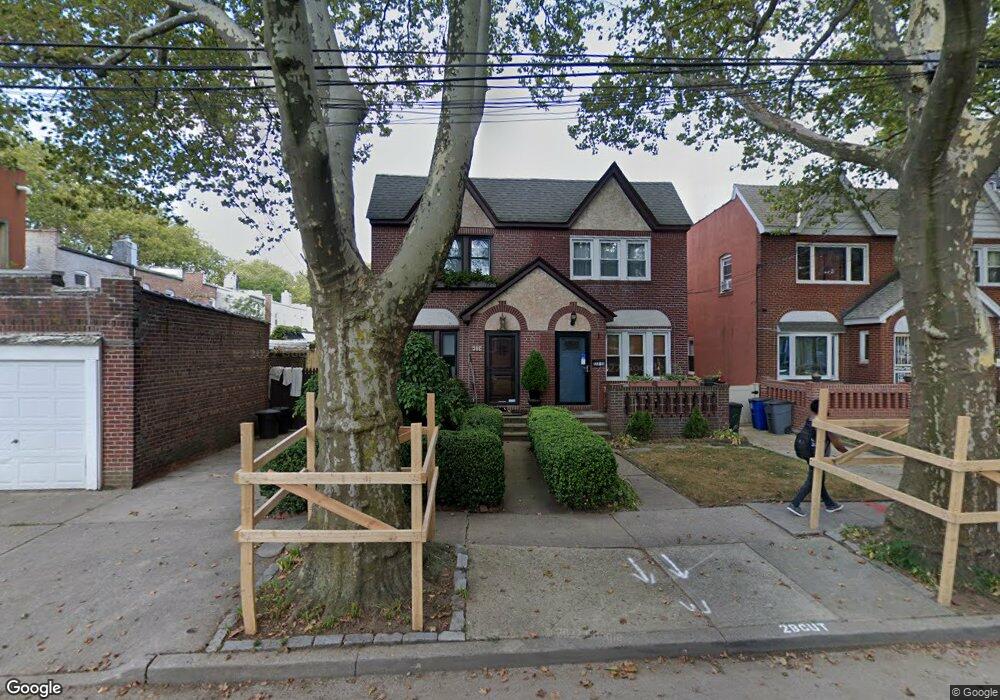
13311 83rd St Ozone Park, NY 11417
Ozone Park NeighborhoodEstimated Value: $642,753 - $840,000
Studio
--
Bath
1,280
Sq Ft
$593/Sq Ft
Est. Value
About This Home
This home is located at 13311 83rd St, Ozone Park, NY 11417 and is currently estimated at $759,438, approximately $593 per square foot. 13311 83rd St is a home located in Queens County with nearby schools including P.S. 63 - Old South, Robert H. Goddard High School, and Our World Neighborhood Charter School 2.
Ownership History
Date
Name
Owned For
Owner Type
Purchase Details
Closed on
Mar 1, 2001
Sold by
Zennache Joan
Bought by
Zennache Louis P
Current Estimated Value
Home Financials for this Owner
Home Financials are based on the most recent Mortgage that was taken out on this home.
Original Mortgage
$115,000
Interest Rate
6.93%
Create a Home Valuation Report for This Property
The Home Valuation Report is an in-depth analysis detailing your home's value as well as a comparison with similar homes in the area
Home Values in the Area
Average Home Value in this Area
Purchase History
| Date | Buyer | Sale Price | Title Company |
|---|---|---|---|
| Zennache Louis P | $150,000 | The Title Guarantee Company | |
| Zennache Louis P | -- | The Title Guarantee Company |
Source: Public Records
Mortgage History
| Date | Status | Borrower | Loan Amount |
|---|---|---|---|
| Closed | Zennache Louis P | $115,000 |
Source: Public Records
Tax History
| Year | Tax Paid | Tax Assessment Tax Assessment Total Assessment is a certain percentage of the fair market value that is determined by local assessors to be the total taxable value of land and additions on the property. | Land | Improvement |
|---|---|---|---|---|
| 2025 | $6,312 | $33,074 | $10,824 | $22,250 |
| 2024 | $6,324 | $32,824 | $10,335 | $22,489 |
| 2023 | $5,938 | $30,966 | $9,213 | $21,753 |
| 2022 | $5,545 | $40,020 | $12,960 | $27,060 |
| 2021 | $5,504 | $35,640 | $12,960 | $22,680 |
| 2020 | $5,538 | $33,060 | $12,960 | $20,100 |
| 2019 | $5,429 | $34,320 | $12,960 | $21,360 |
| 2018 | $4,963 | $25,805 | $11,759 | $14,046 |
| 2017 | $4,663 | $24,345 | $10,623 | $13,722 |
| 2016 | $4,282 | $24,345 | $10,623 | $13,722 |
| 2015 | $2,550 | $22,968 | $12,760 | $10,208 |
| 2014 | $2,550 | $22,795 | $13,885 | $8,910 |
Source: Public Records
Map
Nearby Homes
- 13313 83rd St
- 132-20 82nd St
- 132-12 82nd St
- 84-11 Sutter Ave
- 8514 Sutter Ave
- 8511 Sutter Ave
- 133-42 86th St
- 84-28 108th Ave
- 132-30 80th St
- 84-09 107th Ave
- 13716 88th St
- 84-07 Sutter Ave
- 10713 88th St
- 8837 Pitkin Ave
- 8839 Pitkin Ave
- 105-35 86th St
- 8928 133rd Ave
- 106-35 79th St
- 8851 Pitkin Ave
- 133-155 77th St
- 13315 83rd St
- 133-17 83rd St
- 13317 83rd St
- 8308 133rd Ave
- 8304 133rd Ave
- 8310 133rd Ave
- 8302 133rd Ave
- 83-10 133rd Ave Unit 1R
- 83-10 133rd Ave
- 13319 83rd St
- 8312 133rd Ave
- 83-12 133rd Ave Unit 2
- 83-12 133rd Ave
- 13312 84th St
- 8314 133rd Ave
- 13321 83rd St
- 13316 84th St
- 83-14 133rd Ave
- 8316 133rd Ave
- 8316 133rd Ave
Your Personal Tour Guide
Ask me questions while you tour the home.