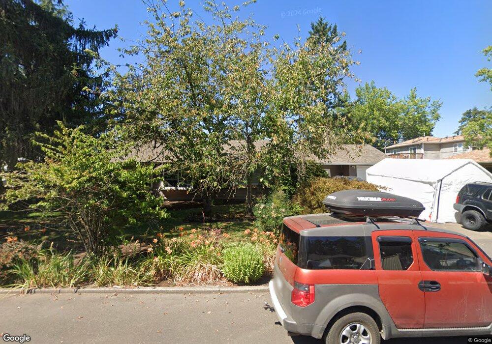
13311 NW Sherry St Portland, OR 97229
Estimated Value: $347,000 - $533,917
3
Beds
2
Baths
1,224
Sq Ft
$394/Sq Ft
Est. Value
About This Home
This home is located at 13311 NW Sherry St, Portland, OR 97229 and is currently estimated at $482,729, approximately $394 per square foot. 13311 NW Sherry St is a home located in Washington County with nearby schools including Terra Linda Elementary School, Sunset High School, and St. Pius X. School.
Ownership History
Date
Name
Owned For
Owner Type
Purchase Details
Closed on
Aug 22, 2002
Sold by
Fisher Tim B
Bought by
Imper Yvonne M
Current Estimated Value
Home Financials for this Owner
Home Financials are based on the most recent Mortgage that was taken out on this home.
Original Mortgage
$174,757
Outstanding Balance
$73,790
Interest Rate
6.52%
Mortgage Type
FHA
Estimated Equity
$408,939
Purchase Details
Closed on
Jul 23, 1998
Sold by
Suwannee Varagoon Joe and Suwannee Piboonvaraggoon
Bought by
Fisher Tim B
Home Financials for this Owner
Home Financials are based on the most recent Mortgage that was taken out on this home.
Original Mortgage
$137,986
Interest Rate
7.01%
Mortgage Type
FHA
Create a Home Valuation Report for This Property
The Home Valuation Report is an in-depth analysis detailing your home's value as well as a comparison with similar homes in the area
Home Values in the Area
Average Home Value in this Area
Purchase History
| Date | Buyer | Sale Price | Title Company |
|---|---|---|---|
| Imper Yvonne M | $177,500 | Chicago Title Insurance Co | |
| Fisher Tim B | $141,500 | Ticor Title Insurance |
Source: Public Records
Mortgage History
| Date | Status | Borrower | Loan Amount |
|---|---|---|---|
| Open | Imper Yvonne M | $174,757 | |
| Previous Owner | Fisher Tim B | $137,986 |
Source: Public Records
Tax History Compared to Growth
Tax History
| Year | Tax Paid | Tax Assessment Tax Assessment Total Assessment is a certain percentage of the fair market value that is determined by local assessors to be the total taxable value of land and additions on the property. | Land | Improvement |
|---|---|---|---|---|
| 2025 | $3,886 | $214,560 | -- | -- |
| 2024 | $3,649 | $208,320 | -- | -- |
| 2023 | $3,649 | $202,260 | $0 | $0 |
| 2022 | $3,531 | $202,260 | $0 | $0 |
| 2021 | $3,404 | $190,660 | $0 | $0 |
| 2020 | $3,301 | $185,110 | $0 | $0 |
| 2019 | $3,193 | $179,720 | $0 | $0 |
| 2018 | $3,089 | $174,490 | $0 | $0 |
| 2017 | $2,978 | $169,410 | $0 | $0 |
| 2016 | $2,872 | $164,480 | $0 | $0 |
| 2015 | $2,761 | $159,690 | $0 | $0 |
| 2014 | $2,705 | $155,040 | $0 | $0 |
Source: Public Records
Map
Nearby Homes
- 12622 NW Barnes Rd Unit 2
- 12622 NW Barnes Rd Unit 6
- 12618 NW Barnes Rd Unit 11
- 12620 NW Barnes Rd Unit 5
- 12634 NW Barnes Rd Unit 8
- 12604 NW Barnes Rd Unit 3
- 425 NW 139th Ave
- 1470 NW 136th Ave
- 245 SW 133rd Ave
- 1545 NW 131st Ave
- 1625 NW 136th Ave
- 13120 SW Rita Dr
- 595 NW Lost Springs Terrace Unit 303
- 615 NW Lost Springs Terrace Unit 102
- 1700 NW Saltzman Rd
- 14386 NW Tripton Ct
- 1632 NW 143rd Ave
- 11845 NW Stone Mountain Ln Unit 403
- 11830 NW Holly Springs Ln Unit 403
- 695 NW Falling Waters Ln Unit 304
- 605 NW Dale Ave
- 13317 NW Sherry St
- 660 NW Joy Ave
- 665 NW Dale Ave
- 13310 NW Sherry St
- 694 NW Joy Ave
- 690 NW Joy Ave
- 13318 NW Sherry St
- 13304 NW Sherry St
- 695 NW Dale Ave
- 13407 NW Sherry St
- 704 NW Joy Ave
- 560 NW Dale Ave
- 13400 NW Sherry St
- 655 NW Joy Ave
- 610 NW Dale Ave
- 580 NW Dale Ave
- 640 NW Dale Ave
- 730 NW Joy Ave
- 670 NW Dale Ave