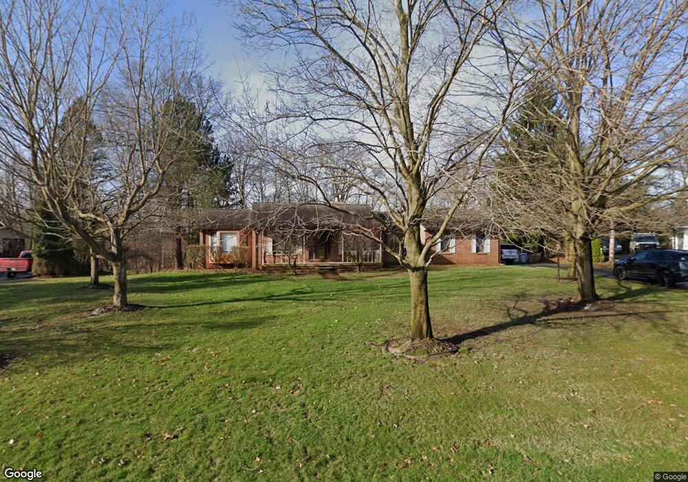
13314 Sumac Rd Unit Bldg-Unit South Lyon, MI 48178
Estimated Value: $454,000 - $530,000
--
Bed
2
Baths
1,786
Sq Ft
$274/Sq Ft
Est. Value
About This Home
This home is located at 13314 Sumac Rd Unit Bldg-Unit, South Lyon, MI 48178 and is currently estimated at $489,402, approximately $274 per square foot. 13314 Sumac Rd Unit Bldg-Unit is a home located in Livingston County with nearby schools including William A. Brummer Elementary School, Centennial Middle School, and South Lyon High School.
Ownership History
Date
Name
Owned For
Owner Type
Purchase Details
Closed on
Jul 16, 2018
Sold by
Hofen Thomas
Bought by
Hisler Jennifer
Current Estimated Value
Purchase Details
Closed on
Jan 25, 2013
Sold by
Burgess Russell T and Burgess Lenore G
Bought by
Hofen Thomas
Home Financials for this Owner
Home Financials are based on the most recent Mortgage that was taken out on this home.
Original Mortgage
$206,000
Interest Rate
3.32%
Purchase Details
Closed on
Jun 24, 1994
Sold by
Tenpenny Wayne
Bought by
Burgess Russell T and Burgess C
Create a Home Valuation Report for This Property
The Home Valuation Report is an in-depth analysis detailing your home's value as well as a comparison with similar homes in the area
Home Values in the Area
Average Home Value in this Area
Purchase History
| Date | Buyer | Sale Price | Title Company |
|---|---|---|---|
| Hisler Jennifer | $317,500 | -- | |
| Hofen Thomas | $257,500 | -- | |
| Burgess Russell T | $200,000 | -- |
Source: Public Records
Mortgage History
| Date | Status | Borrower | Loan Amount |
|---|---|---|---|
| Previous Owner | Hofen Thomas | $206,000 |
Source: Public Records
Tax History Compared to Growth
Tax History
| Year | Tax Paid | Tax Assessment Tax Assessment Total Assessment is a certain percentage of the fair market value that is determined by local assessors to be the total taxable value of land and additions on the property. | Land | Improvement |
|---|---|---|---|---|
| 2025 | $5,447 | $215,400 | $0 | $0 |
| 2024 | $3,669 | $208,400 | $0 | $0 |
| 2023 | $3,500 | $186,000 | $0 | $0 |
| 2022 | $4,448 | $148,200 | $0 | $0 |
| 2021 | $4,448 | $167,400 | $0 | $0 |
| 2020 | $4,426 | $155,000 | $0 | $0 |
| 2019 | $4,469 | $148,200 | $0 | $0 |
| 2018 | $3,770 | $138,800 | $0 | $0 |
| 2017 | $3,829 | $135,600 | $0 | $0 |
| 2016 | $3,885 | $135,800 | $0 | $0 |
| 2014 | $3,571 | $117,900 | $0 | $0 |
| 2012 | $3,571 | $102,100 | $0 | $0 |
Source: Public Records
Map
Nearby Homes
- 9851 Atwood Dr
- 9859 Aylebury Dr
- 13428 Sequoia Ln
- 13708 Monarch Dr
- 13500 12 Mile Rd
- 26003 N Dixboro Rd
- 12459 Janes Landing Unit 41
- 25 Loretta Ln Unit 25
- 48 Loretta Ln Unit 48
- 28 Loretta Ln Unit 28
- 47 Loretta Ln Unit 47
- 64 Loretta Ln Unit 64
- 9931 Loretta Ln
- 124 Shannon Partin Ct
- Bradford Plan at Charleston Park
- Bradford with Second Floor Plan at Charleston Park
- Bartelle Plan at Charleston Park
- Upton Plan at Charleston Park
- Westford Plan at Charleston Park
- Addison Plan at Charleston Park
- 13314 Sumac Rd
- 13326 Sumac Rd
- 13306 Sumac Rd
- 13348 Sumac Rd
- 9665 Peer Rd
- 13311 Sumac Rd
- 13300 Sumac Rd
- 9663 Peer Rd
- 13345 Sumac Rd
- 13305 Sumac Rd Unit Bldg-Unit
- 13305 Sumac Rd
- 13370 Sumac Rd
- 13373 Sumac Rd
- 13274 Sumac Rd
- 9730 Daleview Dr
- 13299 Sumac Rd
- 9730 Daleview Dr
- 9720 Daleview Dr
- 13396 Sumac Rd
- 13293 Sumac Rd