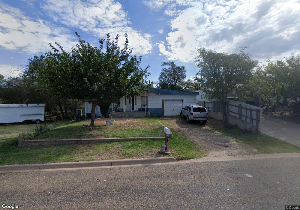
1332 Baker St Borger, TX 79007
Estimated Value: $53,496 - $83,000
--
Bed
--
Bath
1,141
Sq Ft
$58/Sq Ft
Est. Value
About This Home
This home is located at 1332 Baker St, Borger, TX 79007 and is currently estimated at $66,624, approximately $58 per square foot. 1332 Baker St is a home located in Hutchinson County with nearby schools including Paul Belton Elementary School, Crockett Elementary School, and Gateway Elementary School.
Ownership History
Date
Name
Owned For
Owner Type
Purchase Details
Closed on
Jun 8, 2025
Sold by
Laurel Oak Investments Llc
Bought by
Pulido Maria Ocon and Pulido Jesus Ocon
Current Estimated Value
Home Financials for this Owner
Home Financials are based on the most recent Mortgage that was taken out on this home.
Original Mortgage
$34,200
Interest Rate
6.81%
Mortgage Type
Seller Take Back
Purchase Details
Closed on
Feb 13, 2025
Sold by
Hutchinson County Of Sheriffs
Bought by
Laurel Oak Investments Llc
Create a Home Valuation Report for This Property
The Home Valuation Report is an in-depth analysis detailing your home's value as well as a comparison with similar homes in the area
Home Values in the Area
Average Home Value in this Area
Purchase History
| Date | Buyer | Sale Price | Title Company |
|---|---|---|---|
| Pulido Maria Ocon | -- | None Listed On Document | |
| Laurel Oak Investments Llc | $10,579 | None Listed On Document | |
| Laurel Oak Investments Llc | $10,579 | None Listed On Document |
Source: Public Records
Mortgage History
| Date | Status | Borrower | Loan Amount |
|---|---|---|---|
| Previous Owner | Pulido Maria Ocon | $34,200 |
Source: Public Records
Tax History Compared to Growth
Tax History
| Year | Tax Paid | Tax Assessment Tax Assessment Total Assessment is a certain percentage of the fair market value that is determined by local assessors to be the total taxable value of land and additions on the property. | Land | Improvement |
|---|---|---|---|---|
| 2025 | $528 | $20,000 | $1,750 | $18,250 |
| 2024 | $753 | $28,530 | $1,750 | $26,780 |
| 2023 | $740 | $28,530 | $1,750 | $26,780 |
| 2022 | $734 | $25,670 | $1,750 | $23,920 |
| 2021 | $693 | $22,140 | $1,750 | $20,390 |
| 2020 | $703 | $22,140 | $1,750 | $20,390 |
| 2019 | $712 | $22,140 | $1,750 | $20,390 |
| 2018 | $703 | $22,140 | $1,750 | $20,390 |
| 2017 | $628 | $20,910 | $1,750 | $19,160 |
| 2016 | $628 | $20,900 | $1,750 | $19,150 |
| 2015 | -- | $20,900 | $1,750 | $19,150 |
| 2014 | -- | $20,900 | $1,750 | $19,150 |
Source: Public Records
Map
Nearby Homes
- 0 Green St Unit 25-8693
- 1338 Haggard St
- 601 E 10th St
- 717 Alabama St
- 704 Montana St
- 703 Alabama St
- 1200 Lindsey St
- 704 N Harvey St
- 607 Alabama St
- 705 Alabama St
- 626 N Hedgecoke St
- 503 N Main St
- 1311 Boyd St
- 1212 Hazelwood St
- 1224 Hazelwood St
- 601 Coble St
- 516 N McGee St
- 1311 Cooley Dr
- 315 N Hedgecoke St
- 905 Harrington St