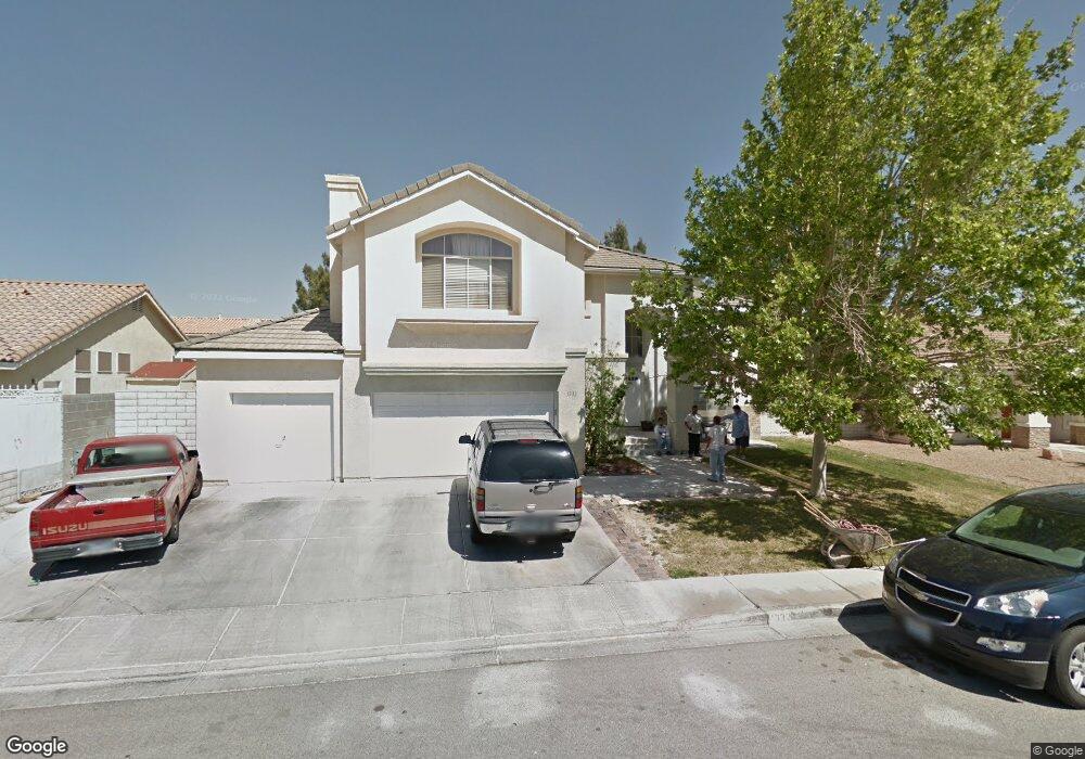
1332 Moorpoint Dr North Las Vegas, NV 89031
Craig Ranch NeighborhoodEstimated Value: $572,315 - $636,000
4
Beds
4
Baths
3,006
Sq Ft
$200/Sq Ft
Est. Value
About This Home
This home is located at 1332 Moorpoint Dr, North Las Vegas, NV 89031 and is currently estimated at $600,329, approximately $199 per square foot. 1332 Moorpoint Dr is a home located in Clark County with nearby schools including Lee Antonello Elementary School, Brian & Teri Cram Middle School, and Legacy High School.
Ownership History
Date
Name
Owned For
Owner Type
Purchase Details
Closed on
Mar 14, 1994
Sold by
Pardee Construction Company Of Nevada
Bought by
Hunsaker Dennis J and Hunsaker Anne H
Current Estimated Value
Home Financials for this Owner
Home Financials are based on the most recent Mortgage that was taken out on this home.
Original Mortgage
$160,150
Interest Rate
7.38%
Create a Home Valuation Report for This Property
The Home Valuation Report is an in-depth analysis detailing your home's value as well as a comparison with similar homes in the area
Home Values in the Area
Average Home Value in this Area
Purchase History
| Date | Buyer | Sale Price | Title Company |
|---|---|---|---|
| Hunsaker Dennis J | $178,000 | National Title Company |
Source: Public Records
Mortgage History
| Date | Status | Borrower | Loan Amount |
|---|---|---|---|
| Closed | Hunsaker Dennis J | $160,150 |
Source: Public Records
Tax History Compared to Growth
Tax History
| Year | Tax Paid | Tax Assessment Tax Assessment Total Assessment is a certain percentage of the fair market value that is determined by local assessors to be the total taxable value of land and additions on the property. | Land | Improvement |
|---|---|---|---|---|
| 2025 | $2,614 | $133,207 | $43,050 | $90,157 |
| 2024 | $2,539 | $133,207 | $43,050 | $90,157 |
| 2023 | $2,539 | $126,726 | $40,600 | $86,126 |
| 2022 | $2,702 | $113,184 | $34,300 | $78,884 |
| 2021 | $2,502 | $107,582 | $32,200 | $75,382 |
| 2020 | $2,321 | $106,011 | $31,150 | $74,861 |
| 2019 | $2,175 | $101,798 | $27,650 | $74,148 |
| 2018 | $2,075 | $92,500 | $21,350 | $71,150 |
| 2017 | $2,856 | $85,150 | $19,250 | $65,900 |
| 2016 | $1,943 | $75,173 | $16,450 | $58,723 |
| 2015 | $1,939 | $59,554 | $12,250 | $47,304 |
| 2014 | $1,878 | $54,331 | $10,500 | $43,831 |
Source: Public Records
Map
Nearby Homes
- 1323 Borderwood Ln
- 1515 Fort Dix Cir
- 1415 Black Hills Way
- 5912 Hollowridge Rd
- 6136 Benchmark Way
- 5871 Prairie Ridge Cir
- 1003 Dover Glen Dr
- 1611 Spotted Pony Dr
- 6126 Leaning Rock Ct
- 6056 Fort Wayne Ct
- 6236 Badgerglen Place
- 6219 Disruptor St Unit 3
- 901 Sage Hollow Cir
- 6241 Golden Rain St
- 825 Cornerstone Place
- 1009 Nawkee Dr
- 920 Grey Hollow Ave
- 5808 Lone Song Rd
- 1705 Night Shadow Ave
- 1642 Heather Ridge Rd
- 1324 Moorpoint Dr
- 1340 Moorpoint Dr
- 1335 Dover Glen Dr
- 1327 Dover Glen Dr
- 1343 Dover Glen Dr
- 1329 Moorpoint Dr
- 1316 Moorpoint Dr
- 1337 Moorpoint Dr
- 1321 Moorpoint Dr
- 1319 Dover Glen Dr
- 6049 Starpoint Rd
- 6041 Starpoint Rd
- 1313 Moorpoint Dr
- 1308 Moorpoint Dr
- 1311 Dover Glen Dr
- 6033 Starpoint Rd
- 6057 Starpoint Rd
- 1336 Dover Glen Dr
- 1320 Crescent Moon Dr
- 1328 Dover Glen Dr