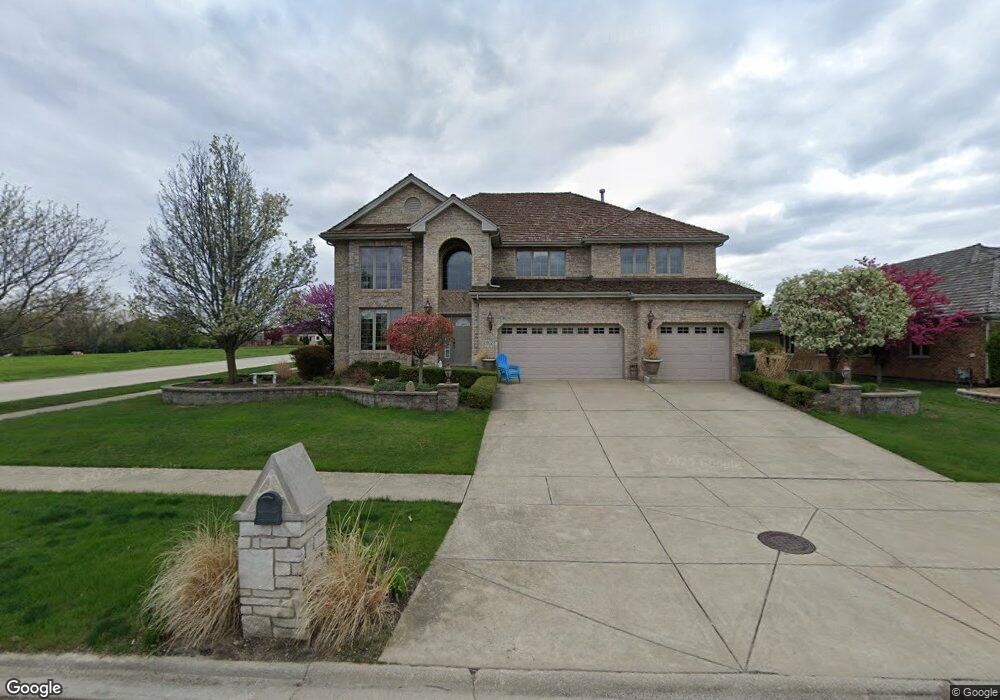
13322 Georgetown Dr Orland Park, IL 60462
Sandburg NeighborhoodEstimated Value: $658,000 - $835,809
4
Beds
3
Baths
3,443
Sq Ft
$224/Sq Ft
Est. Value
About This Home
This home is located at 13322 Georgetown Dr, Orland Park, IL 60462 and is currently estimated at $771,702, approximately $224 per square foot. 13322 Georgetown Dr is a home located in Cook County with nearby schools including Palos West Elementary School, Palos South Middle School, and Carl Sandburg High School.
Ownership History
Date
Name
Owned For
Owner Type
Purchase Details
Closed on
Jun 28, 2006
Sold by
Standard Bank & Trust Co
Bought by
Mele Edward A and Mele Margaret M
Current Estimated Value
Home Financials for this Owner
Home Financials are based on the most recent Mortgage that was taken out on this home.
Original Mortgage
$498,000
Outstanding Balance
$296,955
Interest Rate
6.73%
Mortgage Type
Unknown
Estimated Equity
$474,747
Create a Home Valuation Report for This Property
The Home Valuation Report is an in-depth analysis detailing your home's value as well as a comparison with similar homes in the area
Home Values in the Area
Average Home Value in this Area
Purchase History
| Date | Buyer | Sale Price | Title Company |
|---|---|---|---|
| Mele Edward A | $579,000 | Cti |
Source: Public Records
Mortgage History
| Date | Status | Borrower | Loan Amount |
|---|---|---|---|
| Open | Mele Edward A | $498,000 |
Source: Public Records
Tax History Compared to Growth
Tax History
| Year | Tax Paid | Tax Assessment Tax Assessment Total Assessment is a certain percentage of the fair market value that is determined by local assessors to be the total taxable value of land and additions on the property. | Land | Improvement |
|---|---|---|---|---|
| 2024 | $14,816 | $73,000 | $4,212 | $68,788 |
| 2023 | $11,185 | $73,000 | $4,212 | $68,788 |
| 2022 | $11,185 | $47,689 | $10,044 | $37,645 |
| 2021 | $10,396 | $47,688 | $10,044 | $37,644 |
| 2020 | $10,136 | $47,688 | $10,044 | $37,644 |
| 2019 | $9,571 | $47,220 | $9,072 | $38,148 |
| 2018 | $9,925 | $47,220 | $9,072 | $38,148 |
| 2017 | $10,106 | $49,252 | $9,072 | $40,180 |
| 2016 | $9,477 | $42,275 | $7,776 | $34,499 |
| 2015 | $10,397 | $46,682 | $7,776 | $38,906 |
| 2014 | $10,479 | $46,682 | $7,776 | $38,906 |
| 2013 | $12,572 | $59,059 | $7,776 | $51,283 |
Source: Public Records
Map
Nearby Homes
- Richmond Plan at Brittany Glen
- Hampton Plan at Brittany Glen
- Cape Cod Plan at Brittany Glen
- Barrington Plan at Brittany Glen
- Augusta Plan at Brittany Glen
- 10 Country Manor Ln
- 13344 S Stephen Dr
- 10760 Ridgewood Dr
- 11010 W 131st St
- Fremont Plan at Suffield Woods
- Eden Plan at Suffield Woods
- Briarcliffe Plan at Suffield Woods
- Amberwood Plan at Suffield Woods
- Danbury Plan at Suffield Woods
- Calysta Plan at Suffield Woods
- 10401 Bloomfield Dr
- 10300 Village Circle Dr Unit 1109
- 10300 Village Circle Dr Unit 4407
- 10956 Persimmon Ct
- 11000 W 131st St
- 13312 Georgetown Dr
- 13317 108th Ave
- 13302 Georgetown Dr
- 13311 Georgetown Dr
- 13305 108th Ave
- 10723 Hampton Rd
- 10713 Hampton Rd
- 13310 Hampton Ct
- 13255 108th Ave Unit 1
- 13255 Georgetown Dr
- 10817 W 133rd St
- 13361 108th Ave
- 16 Carriage House Ln
- 10705 Hampton Rd
- 10730 Arlington Ln
- 10649 Hampton Rd
- 13233 108th Ave
- 13240 Georgetown Dr
- 10827 W 133rd St
- 13321 Hampton Ct