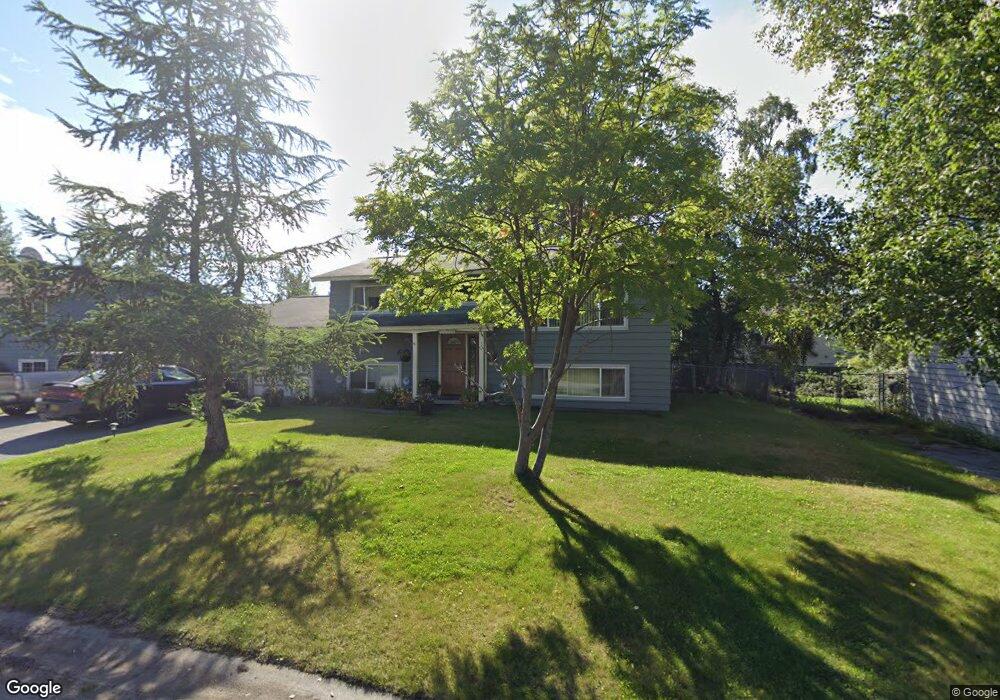
13326 Brant Way Anchorage, AK 99515
Old Seward-Oceanview NeighborhoodEstimated Value: $215,000 - $442,000
4
Beds
2
Baths
912
Sq Ft
$391/Sq Ft
Est. Value
About This Home
This home is located at 13326 Brant Way, Anchorage, AK 99515 and is currently estimated at $356,335, approximately $390 per square foot. 13326 Brant Way is a home located in Anchorage Municipality with nearby schools including Rabbit Creek Elementary School, Goldenview Middle School, and South Anchorage High School.
Ownership History
Date
Name
Owned For
Owner Type
Purchase Details
Closed on
Jun 26, 2003
Sold by
Bullock Brad F and Bullock Debbie R
Bought by
Bullock Christopher M
Current Estimated Value
Home Financials for this Owner
Home Financials are based on the most recent Mortgage that was taken out on this home.
Original Mortgage
$170,000
Outstanding Balance
$71,621
Interest Rate
5.37%
Mortgage Type
Purchase Money Mortgage
Estimated Equity
$284,714
Create a Home Valuation Report for This Property
The Home Valuation Report is an in-depth analysis detailing your home's value as well as a comparison with similar homes in the area
Home Values in the Area
Average Home Value in this Area
Purchase History
| Date | Buyer | Sale Price | Title Company |
|---|---|---|---|
| Bullock Christopher M | -- | -- | |
| Bullock Christopher M | -- | Attorneys Title Guaranty Age |
Source: Public Records
Mortgage History
| Date | Status | Borrower | Loan Amount |
|---|---|---|---|
| Open | Bullock Christopher M | $170,000 | |
| Closed | Bullock Christopher M | $170,000 |
Source: Public Records
Tax History Compared to Growth
Tax History
| Year | Tax Paid | Tax Assessment Tax Assessment Total Assessment is a certain percentage of the fair market value that is determined by local assessors to be the total taxable value of land and additions on the property. | Land | Improvement |
|---|---|---|---|---|
| 2025 | $4,314 | $364,400 | $99,000 | $265,400 |
| 2024 | $4,314 | $342,200 | $99,000 | $243,200 |
| 2023 | $5,245 | $308,000 | $99,000 | $209,000 |
| 2022 | $4,213 | $300,200 | $99,000 | $201,200 |
| 2021 | $5,105 | $283,300 | $99,000 | $184,300 |
| 2020 | $3,837 | $276,000 | $99,000 | $177,000 |
| 2019 | $3,807 | $282,700 | $99,000 | $183,700 |
| 2018 | $3,759 | $279,200 | $99,000 | $180,200 |
| 2017 | $4,111 | $282,500 | $94,500 | $188,000 |
| 2016 | $3,478 | $274,600 | $94,500 | $180,100 |
| 2015 | $3,478 | $264,700 | $94,500 | $170,200 |
| 2014 | $3,478 | $255,300 | $80,200 | $175,100 |
Source: Public Records
Map
Nearby Homes
- 1800 Hamilton Dr
- 13322 Diggins Dr
- 13210 Old Seward Hwy Unit 15
- 13351 Venus Way
- 13105 Stephenson St
- 13103 Brandon St Unit 14
- 2000 Jarvis Ave
- 13901 Jarvi Dr
- 2020 Steeple Dr
- 12653 Bona Kim Loop Unit 7
- 2048 Meander Dr
- 12921 Aro Cir
- 14231 Hancock Dr
- 12496 Silver Fox Ln Unit 6
- 13530 Westwind Dr
- 14121 Sunview Dr
- 2701 Kempton Hills Dr
- 13470 Baywind Cir
- 13481 Baywind Dr
- 1677 Circlewood Dr
- 13316 Brant Way
- 13330 Brant Way
- L1 B2 Brant Way
- 13341 Old Seward Hwy
- 13321 Old Seward Hwy
- 13327 Brant Way
- 13336 Brant Way
- 13310 Brant Way
- 13301 Old Seward Hwy
- 13317 Brant Way
- 13411 Old Seward Hwy
- 13335 Brant Way
- 13340 Brant Way
- 1710 Hamilton Dr
- 13318 Diggins Dr
- 13312 Diggins Dr
- 13341 Brant Way
- 13441 Old Seward Hwy
- 13400 Brant Way
- 13222 Brant Way