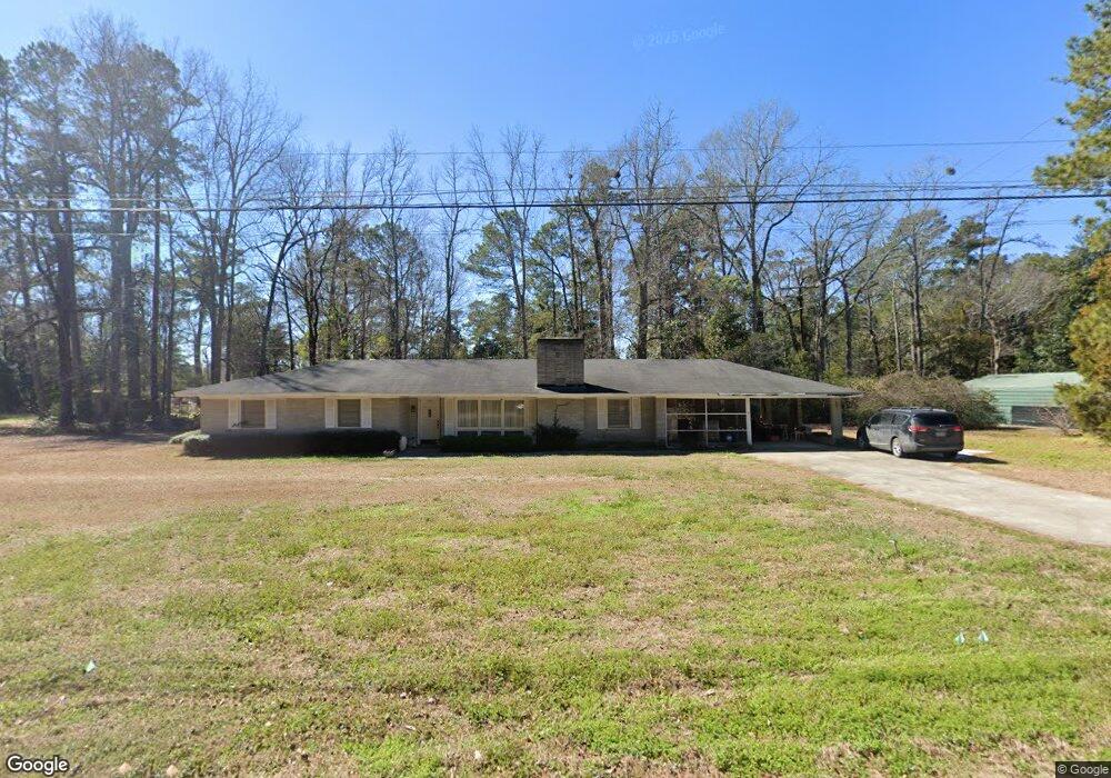
1333 Bennett Cir Holly Hill, SC 29059
Estimated Value: $242,532 - $277,000
3
Beds
2
Baths
1,886
Sq Ft
$137/Sq Ft
Est. Value
About This Home
This home is located at 1333 Bennett Cir, Holly Hill, SC 29059 and is currently estimated at $257,883, approximately $136 per square foot. 1333 Bennett Cir is a home located in Orangeburg County with nearby schools including Holly Hill Elementary School, Holly Hill Elementary, and Holly Hill-Roberts Middle.
Ownership History
Date
Name
Owned For
Owner Type
Purchase Details
Closed on
Nov 15, 2023
Sold by
Rhode Smith Miles
Bought by
Shepherd Andrew L and Shepherd Donna E
Current Estimated Value
Home Financials for this Owner
Home Financials are based on the most recent Mortgage that was taken out on this home.
Original Mortgage
$191,575
Outstanding Balance
$188,227
Interest Rate
7.49%
Mortgage Type
New Conventional
Estimated Equity
$69,656
Create a Home Valuation Report for This Property
The Home Valuation Report is an in-depth analysis detailing your home's value as well as a comparison with similar homes in the area
Home Values in the Area
Average Home Value in this Area
Purchase History
| Date | Buyer | Sale Price | Title Company |
|---|---|---|---|
| Shepherd Andrew L | $197,500 | South Carolina Title |
Source: Public Records
Mortgage History
| Date | Status | Borrower | Loan Amount |
|---|---|---|---|
| Open | Shepherd Andrew L | $191,575 |
Source: Public Records
Tax History Compared to Growth
Tax History
| Year | Tax Paid | Tax Assessment Tax Assessment Total Assessment is a certain percentage of the fair market value that is determined by local assessors to be the total taxable value of land and additions on the property. | Land | Improvement |
|---|---|---|---|---|
| 2024 | $1,443 | $7,900 | $1,188 | $6,712 |
| 2023 | $1,448 | $5,332 | $944 | $4,388 |
| 2022 | $1,422 | $5,332 | $944 | $4,388 |
| 2021 | $1,406 | $5,332 | $944 | $4,388 |
| 2020 | $1,385 | $5,332 | $944 | $4,388 |
| 2019 | $1,390 | $5,332 | $944 | $4,388 |
| 2018 | $1,294 | $4,524 | $944 | $3,580 |
| 2017 | $1,285 | $4,524 | $0 | $0 |
| 2016 | $3,264 | $4,524 | $0 | $0 |
| 2015 | $160 | $4,524 | $0 | $0 |
| 2014 | $160 | $4,524 | $944 | $3,580 |
| 2013 | -- | $4,588 | $944 | $3,644 |
Source: Public Records
Map
Nearby Homes
- 1301 Bennett Cir
- 1000 Holly St
- 264 Walters Rd
- 0 Peake St
- 0 Lindstedt Ln
- 1146 Bennett Cir
- 1108 Gilmore Ave
- 220 Brooks Dr
- BRANDON Plan at Evergreen
- CALI Plan at Evergreen
- HELENA Plan at Evergreen
- DOWNING Plan at Evergreen
- SULLIVAN Plan at Evergreen
- 123 Hopkins St
- 130 Culbertson Ct
- 114 Culbertson Ct
- 414 Brooks Dr
- 128 Culbertson Ct
- 129 Culbertson Cir
- 132 Brooks Dr
- 1333 Bennett Cir
- 1319 Bennett Cir
- 1129 Mccoy St
- 1350 Bennett Cir
- 1249 Bennett Cir
- 1111 Mccoy St
- 1340 Dogwood Ln
- 1132 Mccoy St
- 1312 Bennett Cir
- 1324 Dogwood Ln
- 1101 Mccoy St
- 1400 Bennett Cir
- 1402 Brant Ave
- 1415 Bennett Cir
- 1308 Dogwood Ln
- 1422 Brant Ave
- 1217 Mccoy St
- 1277 Bennett Cir
- 1423 Bennett Cir
- 1401 Brant Ave