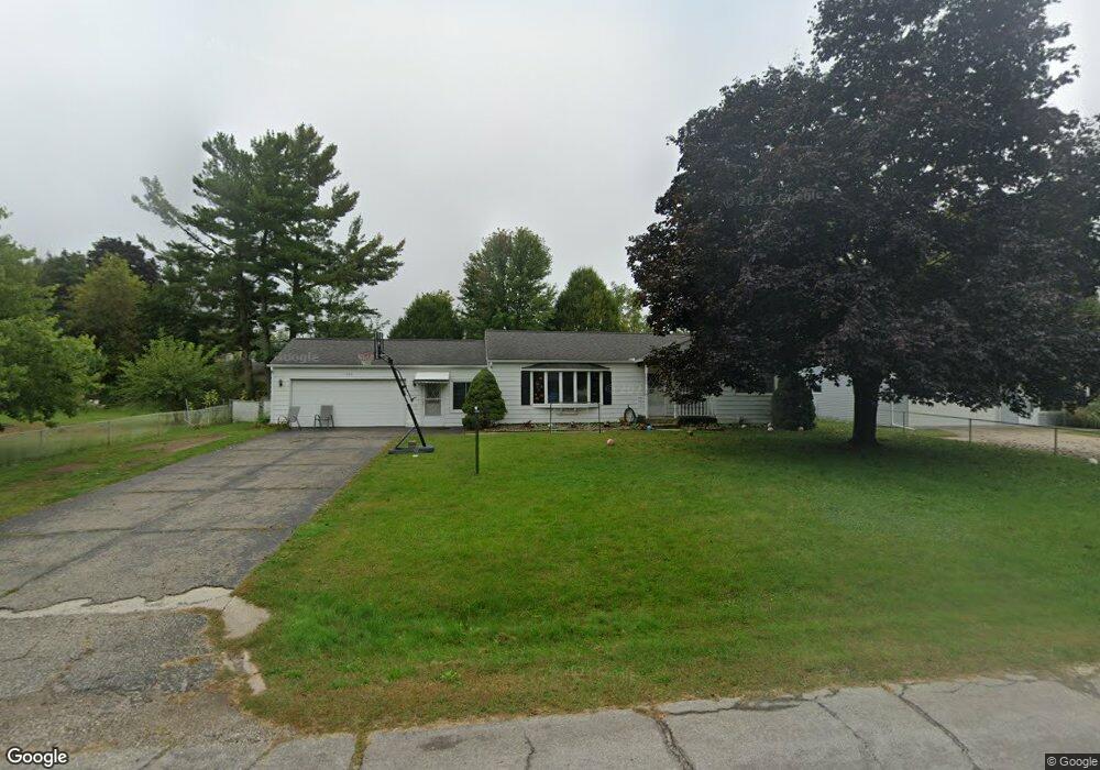
1333 Michael Dr Jackson, MI 49202
Estimated Value: $194,591 - $235,000
3
Beds
1
Bath
1,048
Sq Ft
$205/Sq Ft
Est. Value
About This Home
This home is located at 1333 Michael Dr, Jackson, MI 49202 and is currently estimated at $214,398, approximately $204 per square foot. 1333 Michael Dr is a home located in Jackson County with nearby schools including Northwest Early Elementary School, Northwest Elementary School, and Northwest Middle School.
Ownership History
Date
Name
Owned For
Owner Type
Purchase Details
Closed on
Feb 15, 2012
Sold by
Hancock Efrie M and Robertson Deborah A
Bought by
Robertson Deborah A
Current Estimated Value
Purchase Details
Closed on
Aug 25, 2010
Sold by
Hancock Efrie M and Hancock Beulah R
Bought by
Hancock Efrie M and Hancock Beulah R
Home Financials for this Owner
Home Financials are based on the most recent Mortgage that was taken out on this home.
Original Mortgage
$93,279
Outstanding Balance
$62,263
Interest Rate
4.81%
Mortgage Type
FHA
Estimated Equity
$152,135
Purchase Details
Closed on
Jul 23, 2010
Sold by
Metcalf Thomas J and Metcalf Lori A
Bought by
Hancock Efrie M and Hancock Beulah R
Home Financials for this Owner
Home Financials are based on the most recent Mortgage that was taken out on this home.
Original Mortgage
$93,279
Outstanding Balance
$62,263
Interest Rate
4.81%
Mortgage Type
FHA
Estimated Equity
$152,135
Purchase Details
Closed on
Aug 7, 2001
Sold by
Atkins Thelma R and Atkins Lawrence D
Bought by
Metcalf Thomas J and Metcalf Lori A
Home Financials for this Owner
Home Financials are based on the most recent Mortgage that was taken out on this home.
Original Mortgage
$99,200
Interest Rate
7.15%
Mortgage Type
Purchase Money Mortgage
Purchase Details
Closed on
Jul 21, 1997
Bought by
Atkins Thelma R
Create a Home Valuation Report for This Property
The Home Valuation Report is an in-depth analysis detailing your home's value as well as a comparison with similar homes in the area
Home Values in the Area
Average Home Value in this Area
Purchase History
| Date | Buyer | Sale Price | Title Company |
|---|---|---|---|
| Robertson Deborah A | -- | None Available | |
| Hancock Efrie M | -- | Ltj | |
| Hancock Efrie M | $95,000 | Liberty Title | |
| Metcalf Thomas J | $124,000 | -- | |
| Atkins Thelma R | -- | -- |
Source: Public Records
Mortgage History
| Date | Status | Borrower | Loan Amount |
|---|---|---|---|
| Open | Hancock Efrie M | $93,279 | |
| Previous Owner | Metcalf Thomas J | $99,200 |
Source: Public Records
Tax History
| Year | Tax Paid | Tax Assessment Tax Assessment Total Assessment is a certain percentage of the fair market value that is determined by local assessors to be the total taxable value of land and additions on the property. | Land | Improvement |
|---|---|---|---|---|
| 2025 | $2,580 | $93,050 | $0 | $0 |
| 2024 | $11 | $97,500 | $0 | $0 |
| 2023 | $1,033 | $86,400 | $0 | $0 |
| 2022 | $2,266 | $76,000 | $0 | $0 |
| 2021 | $2,232 | $68,400 | $0 | $0 |
| 2020 | $2,065 | $65,700 | $0 | $0 |
| 2019 | $2,015 | $58,900 | $0 | $0 |
| 2018 | $1,803 | $56,200 | $0 | $0 |
| 2017 | $1,702 | $56,900 | $0 | $0 |
| 2016 | $1,132 | $56,085 | $56,085 | $0 |
| 2015 | $1,629 | $54,597 | $54,597 | $0 |
| 2014 | $1,629 | $51,586 | $0 | $0 |
| 2013 | -- | $51,586 | $51,586 | $0 |
Source: Public Records
Map
Nearby Homes
- 1417 Gerry Dr
- 0 Lansing Ave Unit 26003476
- 3335 Clinton Way
- VL 69 Clinton Way
- 4223 Aspen Way
- VL Morrill Rd
- 3576 Clinton Way
- 3580 Clinton Way
- 0 Burt Ave
- 3556 Clinton Way
- 3560 Clinton Way
- 3564 Clinton Way
- 3568 Clinton Way
- 3572 Clinton Way
- 109 Bradley Dr
- 5123 S Granite St
- 100 Burt Ave
- 5038 Fieldstone St
- 0 Shirley Dr Unit 24064060
- 2013 Cooper St
- 1337 Michael Dr
- 1329 Michael Dr
- 1346 W Parnall Rd
- 1348 W Parnall Rd
- 1338 W Parnall Rd
- 1341 Michael Dr
- 1325 Michael Dr
- 1334 Michael Dr
- 1330 Michael Dr
- 1338 Michael Dr
- 1350 W Parnall Rd
- 1326 Michael Dr
- 1342 Michael Dr
- 1345 Michael Dr
- 1321 Michael Dr
- 1334 W Parnall Rd
- 1333 Joseph St
- 1354 W Parnall Rd
- 1337 Joseph St
- 1329 Joseph St
Your Personal Tour Guide
Ask me questions while you tour the home.