Estimated Value: $547,000 - $721,183
3
Beds
3
Baths
1,528
Sq Ft
$417/Sq Ft
Est. Value
About This Home
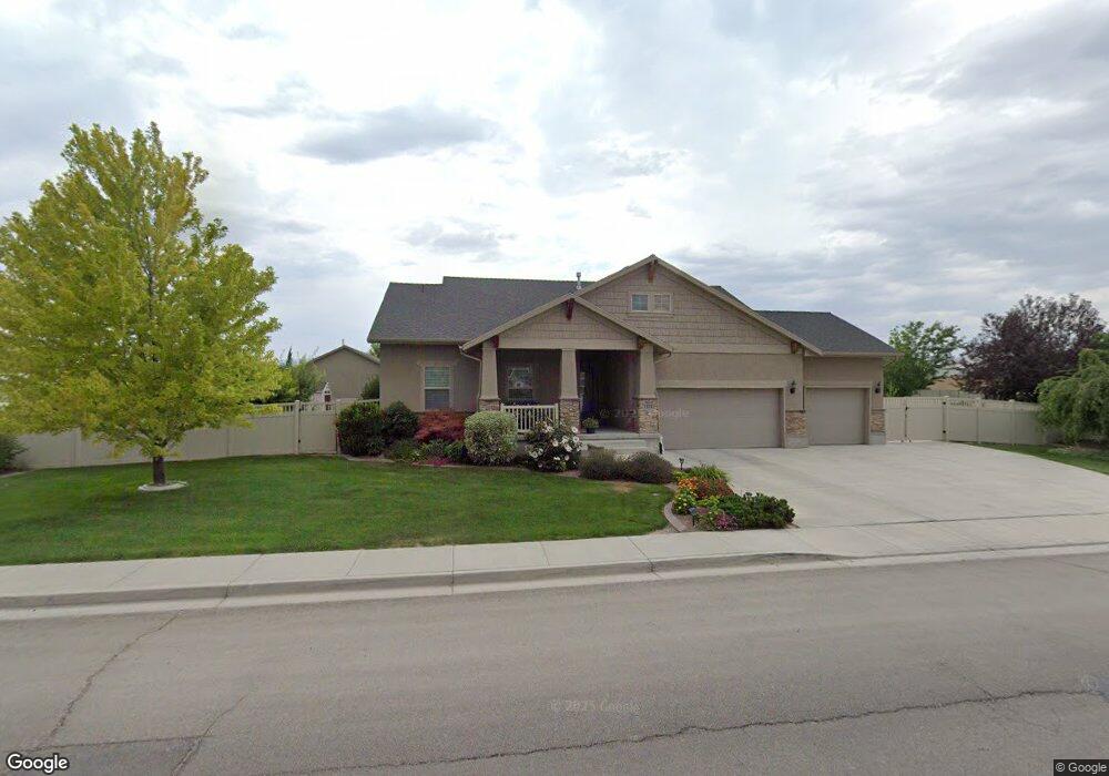
This home is located at 1333 N 1700 W, Lehi, UT 84043 and is currently estimated at $637,796, approximately $417 per square foot. 1333 N 1700 W is a home located in Utah County with nearby schools including North Point Elementary School, Willowcreek Middle School, and Lehi High School.
Ownership History
Date
Name
Owned For
Owner Type
Purchase Details
Closed on
Apr 6, 2010
Sold by
Eyre P Lamar and Eyre Sharron A
Bought by
Eyre Preston L and Eyre Sharron A
Current Estimated Value
Purchase Details
Closed on
Jul 15, 2009
Sold by
Ivory Homes Ltd
Bought by
Eyre P Lamar and Eyre Sharron A
Home Financials for this Owner
Home Financials are based on the most recent Mortgage that was taken out on this home.
Original Mortgage
$70,001
Outstanding Balance
$46,333
Interest Rate
5.59%
Mortgage Type
Purchase Money Mortgage
Estimated Equity
$591,463
Create a Home Valuation Report for This Property
The Home Valuation Report is an in-depth analysis detailing your home's value as well as a comparison with similar homes in the area
Home Values in the Area
Average Home Value in this Area
Purchase History
| Date | Buyer | Sale Price | Title Company |
|---|---|---|---|
| Eyre Preston L | -- | None Available | |
| Eyre P Lamar | -- | Cottonwood Title Insurance | |
| Ivory Homes Ltd | -- | Cottonwood Title Insurance |
Source: Public Records
Mortgage History
| Date | Status | Borrower | Loan Amount |
|---|---|---|---|
| Open | Eyre P Lamar | $70,001 |
Source: Public Records
Tax History Compared to Growth
Tax History
| Year | Tax Paid | Tax Assessment Tax Assessment Total Assessment is a certain percentage of the fair market value that is determined by local assessors to be the total taxable value of land and additions on the property. | Land | Improvement |
|---|---|---|---|---|
| 2025 | $2,847 | $374,275 | $296,700 | $383,800 |
| 2024 | $2,595 | $333,135 | $0 | $0 |
| 2023 | $2,595 | $329,725 | $0 | $0 |
| 2022 | $2,733 | $336,600 | $0 | $0 |
| 2021 | $2,398 | $446,600 | $171,700 | $274,900 |
| 2020 | $2,259 | $415,900 | $159,000 | $256,900 |
| 2019 | $2,040 | $390,300 | $159,000 | $231,300 |
| 2018 | $1,941 | $351,100 | $136,300 | $214,800 |
| 2017 | $1,923 | $184,910 | $0 | $0 |
| 2016 | $1,983 | $176,935 | $0 | $0 |
| 2015 | $1,921 | $162,745 | $0 | $0 |
| 2014 | $1,786 | $150,370 | $0 | $0 |
Source: Public Records
Map
Nearby Homes
- 1659 W Boxwood Dr Unit 109
- 1627 W Boxwood Dr Unit 110
- 1127 N 1500 W
- 1542 N 1900 W
- 1132 Titan Dr
- 1332 W 1500 N
- 1648 N 1900 W
- 1094 W 1425 N
- 1249 W 1800 N
- 1272 W 1800 N
- 1908 N 2230 W
- 1896 N 2230 W
- 1870 N 2230 W
- 1610 N 1125 W
- 1970 N 2090 St W
- 1302 N 2450 W
- 1301 N 900 W Unit 12
- Huntington Plan at Pioneer Meadows
- Silver Lake Plan at Pioneer Meadows
- Summit Plan at Pioneer Meadows