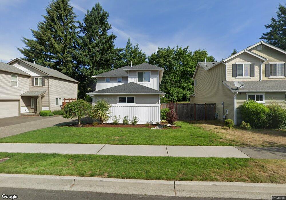
1334 Hudson St Dupont, WA 98327
Estimated Value: $514,003 - $549,000
3
Beds
3
Baths
1,608
Sq Ft
$328/Sq Ft
Est. Value
About This Home
This home is located at 1334 Hudson St, Dupont, WA 98327 and is currently estimated at $527,501, approximately $328 per square foot. 1334 Hudson St is a home located in Pierce County with nearby schools including Chloe Clark Elementary School, Saltars Point Elementary School, and Pioneer Middle School.
Ownership History
Date
Name
Owned For
Owner Type
Purchase Details
Closed on
Sep 22, 2007
Sold by
Johnson Thomas M and Johnson Sarah B
Bought by
Kirst Richard R and Kirst Son
Current Estimated Value
Purchase Details
Closed on
Aug 31, 2004
Sold by
The Quadrant Corp
Bought by
Johnson Thomas M and Johnson Thomas T
Home Financials for this Owner
Home Financials are based on the most recent Mortgage that was taken out on this home.
Original Mortgage
$194,115
Interest Rate
5.92%
Mortgage Type
FHA
Create a Home Valuation Report for This Property
The Home Valuation Report is an in-depth analysis detailing your home's value as well as a comparison with similar homes in the area
Home Values in the Area
Average Home Value in this Area
Purchase History
| Date | Buyer | Sale Price | Title Company |
|---|---|---|---|
| Kirst Richard R | $270,000 | Chicago Title Insurance Co | |
| Johnson Thomas M | $197,161 | Chicago Title | |
| Johnson Thomas M | -- | Chicago Title |
Source: Public Records
Mortgage History
| Date | Status | Borrower | Loan Amount |
|---|---|---|---|
| Previous Owner | Johnson Thomas M | $194,115 |
Source: Public Records
Tax History Compared to Growth
Tax History
| Year | Tax Paid | Tax Assessment Tax Assessment Total Assessment is a certain percentage of the fair market value that is determined by local assessors to be the total taxable value of land and additions on the property. | Land | Improvement |
|---|---|---|---|---|
| 2025 | $3,394 | $466,800 | $216,400 | $250,400 |
| 2024 | $3,394 | $445,500 | $208,500 | $237,000 |
| 2023 | $3,394 | $421,500 | $196,800 | $224,700 |
| 2022 | $3,358 | $428,700 | $196,800 | $231,900 |
| 2021 | $3,156 | $313,300 | $125,000 | $188,300 |
| 2019 | $2,810 | $285,200 | $104,200 | $181,000 |
| 2018 | $3,021 | $274,700 | $104,200 | $170,500 |
| 2017 | $2,725 | $258,700 | $89,000 | $169,700 |
| 2016 | $2,581 | $233,200 | $75,100 | $158,100 |
| 2014 | $1,256 | $229,200 | $75,100 | $154,100 |
| 2013 | $1,256 | $213,200 | $76,800 | $136,400 |
Source: Public Records
Map
Nearby Homes
- 1373 Hudson St Unit 1373
- 1331 Rowan Ct Unit 1331
- 1285 Griggs St
- 1263 Hudson St
- 2699 Erwin Ave Unit 2699
- 2237 Tolmie St
- 2176 Palisade Blvd Unit F-3
- 2147 Hammond Ave Unit B10
- 2176 McDonald Ave
- 1607 Kincaid St Unit E-8
- 1856 Spencer Ct Unit 12F
- 605 Louviers Ave
- 1680 Kennedy Place Unit A4
- 504 Dupont Ave
- 2055 Garry Oaks Ave Unit B
- 1975 Garry Oaks Ave Unit C
- 403 Louviers Ave
- 2420 Simmons St Unit B
- 205 Brandywine Ave
- 3114 Walker Rd
- 1340 Hudson St
- 1328 Hudson St
- 1346 Hudson St
- 1322 Hudson St
- 3120 Rowan Ct
- 1331 Hudson St
- 1325 Hudson St
- 1343 Hudson St
- 1352 Hudson St
- 1316 Hudson St
- 1319 Hudson St
- 1349 Hudson St
- 1355 Hudson St
- 1310 Hudson St
- 1368 Hudson St
- 1361 Hudson St
- 2697 Bronson Ave Unit 2697
- 2685 Bronson Ave Unit B
- 2685 Bronson Ave Unit 2685
- 1336 Griggs St