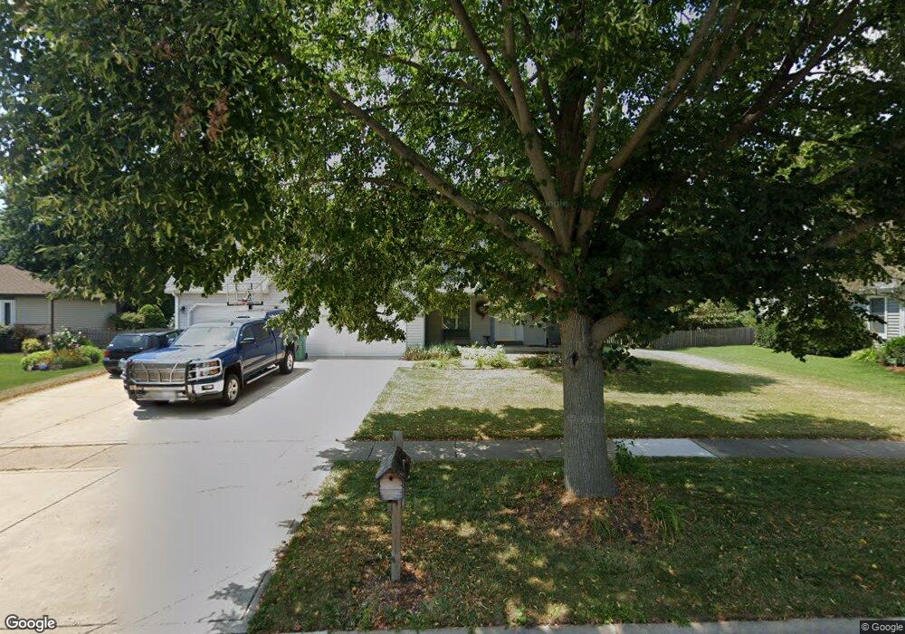
13348 S Columbine Cir Plainfield, IL 60585
North Plainfield NeighborhoodEstimated Value: $342,000 - $475,000
--
Bed
1
Bath
1,930
Sq Ft
$218/Sq Ft
Est. Value
About This Home
This home is located at 13348 S Columbine Cir, Plainfield, IL 60585 and is currently estimated at $421,374, approximately $218 per square foot. 13348 S Columbine Cir is a home located in Will County with nearby schools including Eagle Pointe Elementary School, Heritage Grove Middle School, and Plainfield North High School.
Ownership History
Date
Name
Owned For
Owner Type
Purchase Details
Closed on
Oct 12, 2018
Sold by
Dillon Michael D and Estate Of Christa Dillon
Bought by
Dillon Michael K
Current Estimated Value
Purchase Details
Closed on
Dec 1, 2011
Sold by
Dillon Christa
Bought by
Dillon Michael K and Dillon Christa
Home Financials for this Owner
Home Financials are based on the most recent Mortgage that was taken out on this home.
Original Mortgage
$53,552
Outstanding Balance
$36,580
Interest Rate
3.98%
Mortgage Type
New Conventional
Estimated Equity
$384,794
Purchase Details
Closed on
May 26, 2011
Sold by
Dillon Michael
Bought by
Dillon Christa
Purchase Details
Closed on
Feb 2, 1992
Bought by
Dillon Michael K
Create a Home Valuation Report for This Property
The Home Valuation Report is an in-depth analysis detailing your home's value as well as a comparison with similar homes in the area
Home Values in the Area
Average Home Value in this Area
Purchase History
| Date | Buyer | Sale Price | Title Company |
|---|---|---|---|
| Dillon Michael K | -- | Attorney | |
| Dillon Michael K | -- | Citywide Title Corporation | |
| Dillon Christa | -- | None Available | |
| Dillon Michael K | $39,000 | -- |
Source: Public Records
Mortgage History
| Date | Status | Borrower | Loan Amount |
|---|---|---|---|
| Open | Dillon Michael K | $53,552 |
Source: Public Records
Tax History Compared to Growth
Tax History
| Year | Tax Paid | Tax Assessment Tax Assessment Total Assessment is a certain percentage of the fair market value that is determined by local assessors to be the total taxable value of land and additions on the property. | Land | Improvement |
|---|---|---|---|---|
| 2024 | $8,983 | $123,425 | $30,982 | $92,443 |
| 2023 | $8,983 | $109,032 | $27,369 | $81,663 |
| 2022 | $7,590 | $94,701 | $25,892 | $68,809 |
| 2021 | $7,327 | $90,191 | $24,659 | $65,532 |
| 2020 | $7,328 | $88,762 | $24,268 | $64,494 |
| 2019 | $6,726 | $86,260 | $23,584 | $62,676 |
| 2018 | $6,706 | $84,415 | $23,065 | $61,350 |
| 2017 | $6,668 | $82,236 | $22,470 | $59,766 |
| 2016 | $6,680 | $80,465 | $21,986 | $58,479 |
| 2015 | $6,366 | $77,370 | $21,140 | $56,230 |
| 2014 | $6,366 | $73,355 | $21,140 | $52,215 |
| 2013 | $6,366 | $73,355 | $21,140 | $52,215 |
Source: Public Records
Map
Nearby Homes
- 24331 Norwood Dr
- 13516 Vicarage Dr Unit 2
- 24535 W Beckham Cir
- 24439 W Beckham Cir
- 13028 Bradford Ln Unit 1
- 12901 S Twin Pines Ln
- 12966 S Twin Pines Ln
- 12950 S Twin Pines Ln
- 24112 W Joseph Ave
- 12916 S Mason Ln
- 12854 S Sydney Cir
- 13360 Vicky St
- 12938 S Beckham Dr
- 24650 W Adalyn Ct
- 13018 S Sydney Cir
- 24418 W Alexis Ln Unit 67416
- 24420 W Alexis Ln Unit 55407
- 24422 W Alexis Ln Unit 55406
- 24424 W Alexis Ln Unit 55405
- 24505 W Kroll Dr Unit 67416
- 13358 S Columbine Cir
- 13336 S Columbine Cir
- 13341 Allyn St
- 13349 Allyn St
- 13333 Allyn St
- 13357 Allyn St
- 24253 W Meadow Lily Ct
- 13400 S Columbine Cir
- 24259 W Meadow Lily Ct
- 13353 S Columbine Cir Unit 2
- 13325 Allyn St
- 13343 S Columbine Cir
- 13365 Allyn St
- 13363 S Columbine Cir
- 13408 S Columbine Cir
- 13337 S Columbine Cir
- 13317 Allyn St
- 24263 W Meadow Lily Ct
- 13340 Allyn St
- 13407 Allyn St