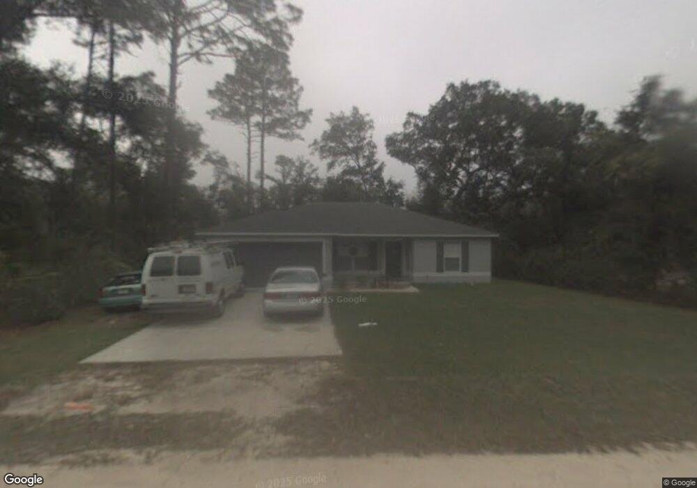
1335 13th St Orange City, FL 32763
Estimated Value: $295,000 - $308,000
3
Beds
2
Baths
1,346
Sq Ft
$224/Sq Ft
Est. Value
About This Home
This home is located at 1335 13th St, Orange City, FL 32763 and is currently estimated at $301,058, approximately $223 per square foot. 1335 13th St is a home located in Volusia County with nearby schools including Orange City Elementary School, River Springs Middle School, and University High School.
Ownership History
Date
Name
Owned For
Owner Type
Purchase Details
Closed on
Mar 31, 2006
Sold by
Abeles Kenneth
Bought by
Lagrosas Noli S and Lagrosas Virginie
Current Estimated Value
Home Financials for this Owner
Home Financials are based on the most recent Mortgage that was taken out on this home.
Original Mortgage
$128,400
Outstanding Balance
$73,489
Interest Rate
6.29%
Mortgage Type
Fannie Mae Freddie Mac
Estimated Equity
$227,569
Purchase Details
Closed on
Mar 17, 2005
Sold by
Ordile Sandra Lee and Ordile Kenneth Edward
Bought by
Abeles Kenneth
Create a Home Valuation Report for This Property
The Home Valuation Report is an in-depth analysis detailing your home's value as well as a comparison with similar homes in the area
Home Values in the Area
Average Home Value in this Area
Purchase History
| Date | Buyer | Sale Price | Title Company |
|---|---|---|---|
| Lagrosas Noli S | $182,900 | Coast Title Of Volusia Inc | |
| Abeles Kenneth | $20,000 | Coast Title Of Volusia Inc |
Source: Public Records
Mortgage History
| Date | Status | Borrower | Loan Amount |
|---|---|---|---|
| Open | Lagrosas Noli S | $128,400 |
Source: Public Records
Tax History Compared to Growth
Tax History
| Year | Tax Paid | Tax Assessment Tax Assessment Total Assessment is a certain percentage of the fair market value that is determined by local assessors to be the total taxable value of land and additions on the property. | Land | Improvement |
|---|---|---|---|---|
| 2025 | $1,143 | $75,317 | -- | -- |
| 2024 | $1,143 | $73,195 | -- | -- |
| 2023 | $1,143 | $71,064 | $0 | $0 |
| 2022 | $1,121 | $68,994 | $0 | $0 |
| 2021 | $1,152 | $66,984 | $0 | $0 |
| 2020 | $1,143 | $66,059 | $0 | $0 |
| 2019 | $1,171 | $64,574 | $0 | $0 |
| 2018 | $1,164 | $63,370 | $0 | $0 |
| 2017 | $1,356 | $62,067 | $0 | $0 |
| 2016 | $1,331 | $60,790 | $0 | $0 |
| 2015 | $1,359 | $60,367 | $0 | $0 |
| 2014 | $1,367 | $59,888 | $0 | $0 |
Source: Public Records
Map
Nearby Homes
- 0 10th St Unit MFRV4941473
- 1275 10th St
- 1261 10th St
- 1425 13th St
- 1450 14th St
- 0 9th St
- 1490 14th St
- 0 12th St Unit MFRO6299359
- 1395 Deland Ave
- 1545 12th St
- 1171 9th St
- 1344 18th St
- 1550 12th St
- 1145 15th St
- 1094 Lolita St
- 0 Schaub Ave Unit MFRO6311639
- 1491 18th St
- 1610 14th St
- 1410 5th St
- 00 7th St