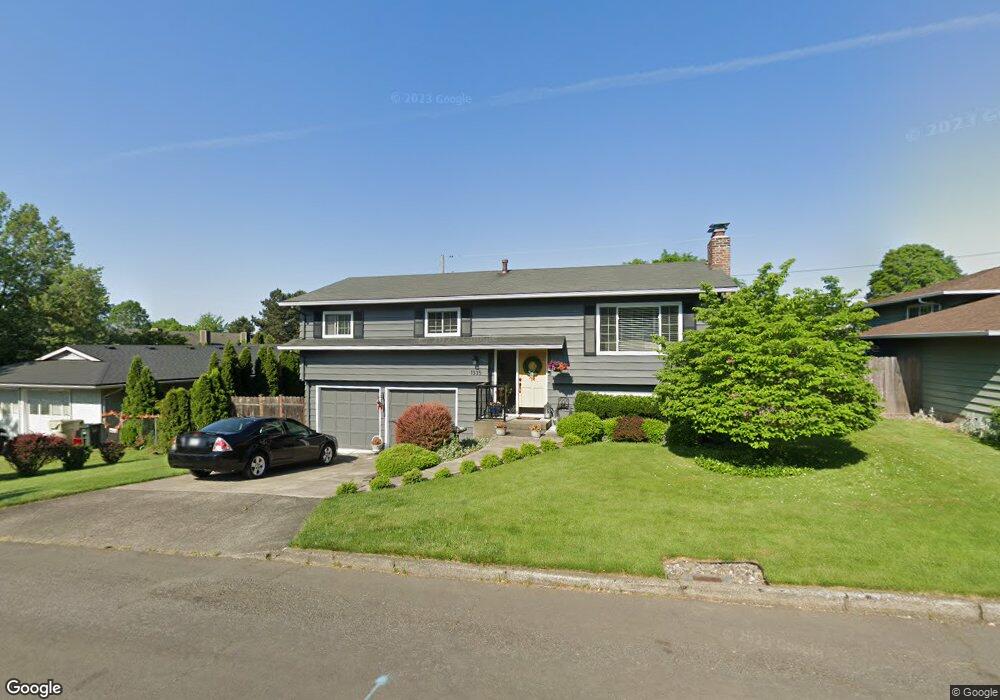
1335 NW 133rd Ave Portland, OR 97229
Estimated Value: $535,000 - $633,000
3
Beds
2
Baths
1,080
Sq Ft
$531/Sq Ft
Est. Value
About This Home
This home is located at 1335 NW 133rd Ave, Portland, OR 97229 and is currently estimated at $573,963, approximately $531 per square foot. 1335 NW 133rd Ave is a home located in Washington County with nearby schools including Terra Linda Elementary School, Sunset High School, and St. Pius X. School.
Ownership History
Date
Name
Owned For
Owner Type
Purchase Details
Closed on
Jan 23, 2025
Sold by
Snyder John and Snyder Marlis
Bought by
Marlis And John Snyder Living Trust and Snyder
Current Estimated Value
Purchase Details
Closed on
Nov 28, 1995
Sold by
White David N and White Anne J
Bought by
Snyder John and Snyder Marlis
Home Financials for this Owner
Home Financials are based on the most recent Mortgage that was taken out on this home.
Original Mortgage
$138,210
Interest Rate
7.42%
Mortgage Type
VA
Create a Home Valuation Report for This Property
The Home Valuation Report is an in-depth analysis detailing your home's value as well as a comparison with similar homes in the area
Home Values in the Area
Average Home Value in this Area
Purchase History
| Date | Buyer | Sale Price | Title Company |
|---|---|---|---|
| Marlis And John Snyder Living Trust | -- | None Listed On Document | |
| Snyder John | $135,500 | Chicago Title |
Source: Public Records
Mortgage History
| Date | Status | Borrower | Loan Amount |
|---|---|---|---|
| Previous Owner | Snyder John | $138,210 |
Source: Public Records
Tax History Compared to Growth
Tax History
| Year | Tax Paid | Tax Assessment Tax Assessment Total Assessment is a certain percentage of the fair market value that is determined by local assessors to be the total taxable value of land and additions on the property. | Land | Improvement |
|---|---|---|---|---|
| 2025 | $4,639 | $256,140 | -- | -- |
| 2024 | $4,356 | $248,680 | -- | -- |
| 2023 | $4,356 | $241,440 | $0 | $0 |
| 2022 | $4,215 | $241,440 | $0 | $0 |
| 2021 | $4,063 | $227,590 | $0 | $0 |
| 2020 | $3,941 | $220,970 | $0 | $0 |
| 2019 | $3,812 | $214,540 | $0 | $0 |
| 2018 | $3,687 | $208,300 | $0 | $0 |
| 2017 | $3,555 | $202,240 | $0 | $0 |
| 2016 | $3,428 | $196,350 | $0 | $0 |
| 2015 | $3,296 | $190,640 | $0 | $0 |
| 2014 | $3,230 | $185,090 | $0 | $0 |
Source: Public Records
Map
Nearby Homes
- 1470 NW 136th Ave
- 1545 NW 131st Ave
- 1625 NW 136th Ave
- 1632 NW 143rd Ave
- 1700 NW Saltzman Rd
- 1914 NW 143rd Ave Unit 28
- 1914 NW 143rd Ave Unit 25
- 12622 NW Barnes Rd Unit 2
- 12622 NW Barnes Rd Unit 6
- 12620 NW Barnes Rd Unit 5
- 1912 NW 143rd Ave Unit 23
- 12618 NW Barnes Rd Unit 11
- 1750 NW 143rd Ave
- 1946 NW 143rd Ave Unit 92
- 1950 NW 143rd Ave Unit 99
- 12634 NW Barnes Rd Unit 8
- 1771 NW 143rd Ave Unit 40
- 1924 NW 143rd Ave Unit 58
- 425 NW 139th Ave
- 13187 NW Burton St
- 1355 NW 133rd Ave
- 13345 NW Westlawn Terrace
- 1320 NW Jenne Ave
- 13385 NW Westlawn Terrace
- 1340 NW Jenne Ave
- 13395 NW Westlawn Terrace
- 1375 NW 133rd Ave
- 1340 NW 133rd Ave
- 1360 NW 133rd Ave
- 13275 NW Westlawn Terrace
- 1360 NW Jenne Ave
- 1380 NW 133rd Ave
- 1395 NW 133rd Ave
- 1380 NW Jenne Ave
- 13237 NW Westlawn Terrace
- 1335 NW Jenne Ave
- 1275 NW Jenne Ave
- 1335 NW Murray Rd
- 1355 NW Murray (Quiet Part) Rd
- 13235 NW Westlawn Terrace