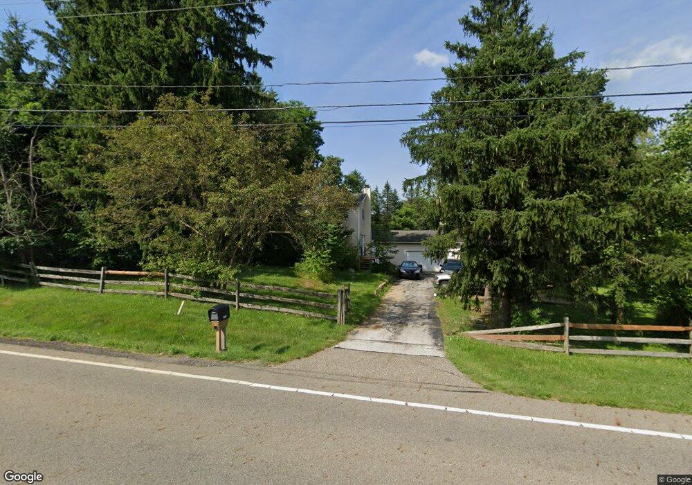
13351 Sperry Rd Chesterland, OH 44026
Estimated Value: $325,000 - $398,000
4
Beds
3
Baths
2,138
Sq Ft
$163/Sq Ft
Est. Value
About This Home
This home is located at 13351 Sperry Rd, Chesterland, OH 44026 and is currently estimated at $347,888, approximately $162 per square foot. 13351 Sperry Rd is a home located in Geauga County with nearby schools including West Geauga High School and St Anselm School.
Ownership History
Date
Name
Owned For
Owner Type
Purchase Details
Closed on
Mar 9, 2001
Sold by
Cicek Robin E and Dome Robin E
Bought by
Dome John G
Current Estimated Value
Home Financials for this Owner
Home Financials are based on the most recent Mortgage that was taken out on this home.
Original Mortgage
$17,500
Outstanding Balance
$6,377
Interest Rate
7.03%
Mortgage Type
Credit Line Revolving
Estimated Equity
$341,511
Purchase Details
Closed on
Apr 3, 1990
Bought by
Gardner Craig D
Create a Home Valuation Report for This Property
The Home Valuation Report is an in-depth analysis detailing your home's value as well as a comparison with similar homes in the area
Home Values in the Area
Average Home Value in this Area
Purchase History
| Date | Buyer | Sale Price | Title Company |
|---|---|---|---|
| Dome John G | -- | U S Title Agency Inc | |
| Gardner Craig D | $75,000 | -- |
Source: Public Records
Mortgage History
| Date | Status | Borrower | Loan Amount |
|---|---|---|---|
| Open | Dome John G | $17,500 |
Source: Public Records
Tax History Compared to Growth
Tax History
| Year | Tax Paid | Tax Assessment Tax Assessment Total Assessment is a certain percentage of the fair market value that is determined by local assessors to be the total taxable value of land and additions on the property. | Land | Improvement |
|---|---|---|---|---|
| 2024 | $3,341 | $77,460 | $12,810 | $64,650 |
| 2023 | $3,341 | $77,460 | $12,810 | $64,650 |
| 2022 | $2,607 | $51,840 | $10,750 | $41,090 |
| 2021 | $2,598 | $51,840 | $10,750 | $41,090 |
| 2020 | $2,701 | $51,840 | $10,750 | $41,090 |
| 2019 | $2,507 | $46,490 | $10,750 | $35,740 |
| 2018 | $2,487 | $46,490 | $10,750 | $35,740 |
| 2017 | $2,507 | $46,490 | $10,750 | $35,740 |
| 2016 | $2,947 | $51,670 | $10,750 | $40,920 |
| 2015 | $2,728 | $51,670 | $10,750 | $40,920 |
| 2014 | $2,728 | $51,670 | $10,750 | $40,920 |
| 2013 | $2,748 | $51,670 | $10,750 | $40,920 |
Source: Public Records
Map
Nearby Homes
- 9502 Winchester Valley
- 13610 Sperry Rd
- 13655 Sperry Rd
- 8949 Ranch Dr
- 8986 Fairmount Rd
- 8735 Cedar Rd
- 9475 Mayfield Rd
- 12790 Heath Rd
- 9448 Mayfield Rd
- 8547 Camelot Dr
- 0 Cedar Rd
- 8701 Mayfield Rd Unit 194
- 10263 Wye Rd
- 13031 Dorothy Dr
- 8 Sperry Rd
- 0 Hickory St
- 14545 Shire Ct
- 13228 Boulder Glen Dr
- 14525 Sperry Rd
- 12084 Heath Rd
- 9325 Fraser Ln
- 13309 Sperry Rd
- 13330 Sperry Rd
- 13398 Sperry Rd
- 13393 Sperry Rd
- 9300 Fraser Ln
- 13310 Sperry Rd
- 13401 Sperry Rd
- 13298 Sperry Rd
- 13410 Sperry Rd
- 9345 Winchester Valley
- 9435 Marsh Hawk Run
- 13419 Sperry Rd
- 9430 Marsh Hawk Run
- 13275 Sperry Rd
- 13432 Sperry Rd
- 9305 Fraser Ln
- 9321 Winchester Valley
- 13280 Sperry Rd
- 13280 Sperry Rd