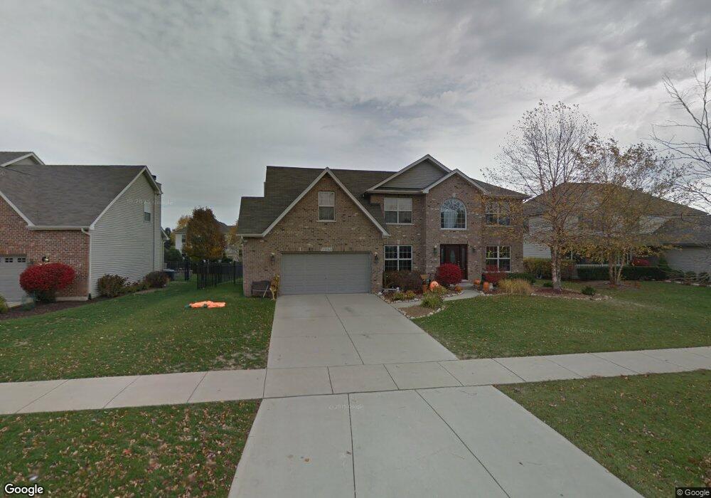
13355 Blackstone Ln Plainfield, IL 60585
North Plainfield NeighborhoodEstimated Value: $514,939 - $594,000
Studio
1
Bath
2,574
Sq Ft
$214/Sq Ft
Est. Value
About This Home
This home is located at 13355 Blackstone Ln, Plainfield, IL 60585 and is currently estimated at $551,735, approximately $214 per square foot. 13355 Blackstone Ln is a home located in Will County with nearby schools including Eagle Pointe Elementary School, Heritage Grove Middle School, and Plainfield North High School.
Ownership History
Date
Name
Owned For
Owner Type
Purchase Details
Closed on
Apr 30, 2003
Sold by
Andreacchi Construction Inc
Bought by
Kaeding Richard D and Kaeding Tiffany L
Current Estimated Value
Home Financials for this Owner
Home Financials are based on the most recent Mortgage that was taken out on this home.
Original Mortgage
$230,000
Outstanding Balance
$101,635
Interest Rate
6.02%
Mortgage Type
Purchase Money Mortgage
Estimated Equity
$450,100
Purchase Details
Closed on
Aug 9, 2000
Sold by
First Midwest Trust Company Natl Assn
Bought by
Andreacchi Construction Inc
Create a Home Valuation Report for This Property
The Home Valuation Report is an in-depth analysis detailing your home's value as well as a comparison with similar homes in the area
Home Values in the Area
Average Home Value in this Area
Purchase History
| Date | Buyer | Sale Price | Title Company |
|---|---|---|---|
| Kaeding Richard D | $288,000 | Greater Illinois Title Compa | |
| Andreacchi Construction Inc | $60,000 | Greater Illinois Title Compa |
Source: Public Records
Mortgage History
| Date | Status | Borrower | Loan Amount |
|---|---|---|---|
| Open | Kaeding Richard D | $230,000 | |
| Closed | Kaeding Richard D | $28,700 |
Source: Public Records
Tax History
| Year | Tax Paid | Tax Assessment Tax Assessment Total Assessment is a certain percentage of the fair market value that is determined by local assessors to be the total taxable value of land and additions on the property. | Land | Improvement |
|---|---|---|---|---|
| 2024 | $10,905 | $157,844 | $36,830 | $121,014 |
| 2023 | $10,905 | $139,438 | $32,535 | $106,903 |
| 2022 | $10,205 | $122,512 | $30,778 | $91,734 |
| 2021 | $8,992 | $116,678 | $29,312 | $87,366 |
| 2020 | $8,985 | $114,830 | $28,848 | $85,982 |
| 2019 | $8,849 | $111,594 | $28,035 | $83,559 |
| 2018 | $8,691 | $107,636 | $27,418 | $80,218 |
| 2017 | $9,397 | $113,443 | $26,710 | $86,733 |
| 2016 | $9,420 | $111,001 | $26,135 | $84,866 |
| 2015 | $9,226 | $106,732 | $25,130 | $81,602 |
| 2014 | $9,226 | $105,536 | $25,130 | $80,406 |
| 2013 | $9,226 | $105,536 | $25,130 | $80,406 |
Source: Public Records
Map
Nearby Homes
- 13066 S Sydney Cir
- 24535 W Beckham Cir
- 12854 S Sydney Cir
- 13018 S Sydney Cir
- 25004 Chelsea Ln
- 24331 Norwood Dr
- 12938 S Beckham Dr
- 12966 S Twin Pines Ln
- 24650 W Adalyn Ct
- 12950 S Twin Pines Ln
- 12901 S Twin Pines Ln
- 12942 S Sydney Cir
- 12946 S Sydney Cir
- 2912 Savana Dr
- 2921 Savana Dr
- 2915 Savana Dr
- 2908 Savana Dr
- 2916 Savana Dr
- 2917 Savana Dr
- 12913 Waterford Ct Unit 1
- 13347 Blackstone Ln
- 13363 Blackstone Ln
- 13316 Millbank Dr
- 13308 Millbank Dr
- 13339 Blackstone Ln Unit 2
- 13405 Blackstone Ln Unit 2
- 13324 Millbank Dr
- 13356 Blackstone Ln
- 13348 Blackstone Ln
- 13300 Millbank Dr Unit 2
- 13364 Blackstone Ln
- 13332 Millbank Dr
- 13340 Blackstone Ln
- 13331 Blackstone Ln
- 13413 Blackstone Ln
- 13406 Blackstone Ln
- 13258 Millbank Dr Unit 2
- 13332 Blackstone Ln
- 13340 Millbank Dr Unit 2
- 13323 Blackstone Ln
Your Personal Tour Guide
Ask me questions while you tour the home.