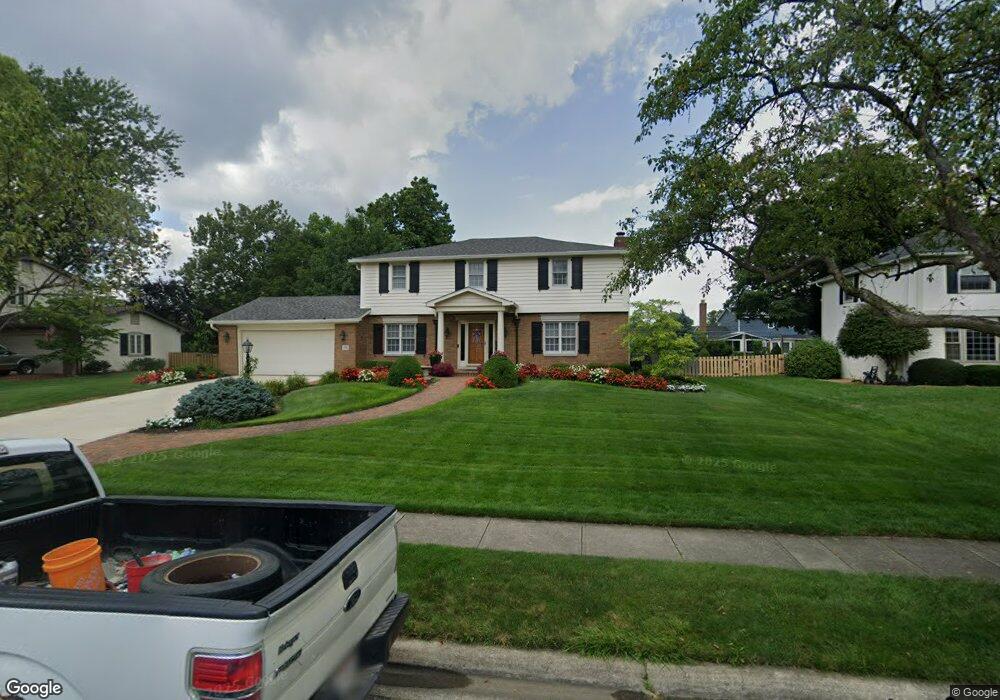
1336 Langston Dr Columbus, OH 43220
Estimated Value: $696,000 - $877,000
4
Beds
3
Baths
2,280
Sq Ft
$338/Sq Ft
Est. Value
About This Home
This home is located at 1336 Langston Dr, Columbus, OH 43220 and is currently estimated at $770,284, approximately $337 per square foot. 1336 Langston Dr is a home located in Franklin County with nearby schools including Greensview Elementary School, Hastings Middle School, and Upper Arlington High School.
Ownership History
Date
Name
Owned For
Owner Type
Purchase Details
Closed on
Feb 13, 2004
Sold by
Mcguire Brian C
Bought by
Mcguire Dawne E
Current Estimated Value
Home Financials for this Owner
Home Financials are based on the most recent Mortgage that was taken out on this home.
Original Mortgage
$210,000
Interest Rate
5.96%
Mortgage Type
New Conventional
Create a Home Valuation Report for This Property
The Home Valuation Report is an in-depth analysis detailing your home's value as well as a comparison with similar homes in the area
Home Values in the Area
Average Home Value in this Area
Purchase History
| Date | Buyer | Sale Price | Title Company |
|---|---|---|---|
| Mcguire Dawne E | -- | Amerititle Agency Inc |
Source: Public Records
Mortgage History
| Date | Status | Borrower | Loan Amount |
|---|---|---|---|
| Closed | Mcguire Dawne E | $210,000 |
Source: Public Records
Tax History
| Year | Tax Paid | Tax Assessment Tax Assessment Total Assessment is a certain percentage of the fair market value that is determined by local assessors to be the total taxable value of land and additions on the property. | Land | Improvement |
|---|---|---|---|---|
| 2025 | $12,865 | $222,220 | $86,030 | $136,190 |
| 2024 | $12,865 | $222,220 | $86,030 | $136,190 |
| 2023 | $12,706 | $222,215 | $86,030 | $136,185 |
| 2022 | $10,913 | $156,180 | $50,230 | $105,950 |
| 2021 | $9,661 | $156,180 | $50,230 | $105,950 |
| 2020 | $9,575 | $156,180 | $50,230 | $105,950 |
| 2019 | $9,196 | $132,620 | $50,230 | $82,390 |
| 2018 | $8,890 | $132,620 | $50,230 | $82,390 |
| 2017 | $9,126 | $132,620 | $50,230 | $82,390 |
| 2016 | $8,644 | $130,730 | $41,270 | $89,460 |
| 2015 | $8,636 | $130,730 | $41,270 | $89,460 |
| 2014 | $8,646 | $130,730 | $41,270 | $89,460 |
| 2013 | $4,129 | $118,860 | $37,520 | $81,340 |
Source: Public Records
Map
Nearby Homes
- 1168 Airendel Ln Unit 1
- 1512 Lafayette Dr Unit B
- 4543 Ducrest Dr
- 1594 Lafayette Dr Unit 1594
- 4818 Winterset Dr Unit 820
- 1126 Merrimar Cir N Unit H
- 1126 Merrimar Cir N Unit M
- 4710 Charecote Ln Unit D
- 1046 Merrimar Cir N Unit B
- 955 Amberly Place
- 1466 Weybridge Rd
- 1030 Galliton Ct Unit H
- 946 Birchmont Rd
- 4944 Buck Thorn Ln
- 1677 Francisco Rd
- 745 Highland Dr
- 1904 Willoway Cir S Unit 1904
- 3701 Reed Rd
- 4545 Benderton Ct
- 1379 La Rochelle Dr Unit 19C
- 1322 Langston Dr
- 1348 Langston Dr
- 1335 Darcann Dr
- 1347 Darcann Dr
- 1323 Darcann Dr
- 1310 Langston Dr
- 1341 Langston Dr
- 1329 Langston Dr
- 1311 Darcann Dr
- 1359 Darcann Dr
- 4250 Chadbourne Dr
- 1298 Langston Dr
- 1372 Langston Dr
- 1299 Darcann Dr
- 1371 Darcann Dr
- 1305 Langston Dr
- 1342 Darcann Dr
- 1342 Carron Dr
- 1330 Carron Dr
- 1354 Darcann Dr
Your Personal Tour Guide
Ask me questions while you tour the home.