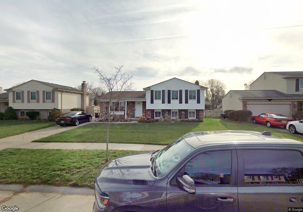
13362 Wessel Ct Unit Bldg-Unit Sterling Heights, MI 48313
Estimated Value: $328,000 - $360,000
4
Beds
2
Baths
1,700
Sq Ft
$205/Sq Ft
Est. Value
About This Home
This home is located at 13362 Wessel Ct Unit Bldg-Unit, Sterling Heights, MI 48313 and is currently estimated at $349,154, approximately $205 per square foot. 13362 Wessel Ct Unit Bldg-Unit is a home located in Macomb County with nearby schools including Havel Elementary School, Bemis Junior High School, and Henry Ford II High School.
Ownership History
Date
Name
Owned For
Owner Type
Purchase Details
Closed on
Jul 8, 2021
Sold by
Denham Martin
Bought by
Denham Martin and Austin Danae
Current Estimated Value
Home Financials for this Owner
Home Financials are based on the most recent Mortgage that was taken out on this home.
Original Mortgage
$227,300
Outstanding Balance
$205,056
Interest Rate
2.9%
Mortgage Type
Stand Alone Refi Refinance Of Original Loan
Estimated Equity
$144,098
Purchase Details
Closed on
Jun 27, 2018
Sold by
Waller Larry L and Waller Ann M
Bought by
Denham Jrd Martin
Home Financials for this Owner
Home Financials are based on the most recent Mortgage that was taken out on this home.
Original Mortgage
$213,069
Interest Rate
4.6%
Mortgage Type
FHA
Create a Home Valuation Report for This Property
The Home Valuation Report is an in-depth analysis detailing your home's value as well as a comparison with similar homes in the area
Home Values in the Area
Average Home Value in this Area
Purchase History
| Date | Buyer | Sale Price | Title Company |
|---|---|---|---|
| Denham Martin | -- | Amrock Inc | |
| Denham Jrd Martin | $220,000 | Leading Edge Title Agency |
Source: Public Records
Mortgage History
| Date | Status | Borrower | Loan Amount |
|---|---|---|---|
| Open | Denham Martin | $227,300 | |
| Closed | Denham Jrd Martin | $213,069 |
Source: Public Records
Tax History Compared to Growth
Tax History
| Year | Tax Paid | Tax Assessment Tax Assessment Total Assessment is a certain percentage of the fair market value that is determined by local assessors to be the total taxable value of land and additions on the property. | Land | Improvement |
|---|---|---|---|---|
| 2025 | $4,065 | $152,700 | $0 | $0 |
| 2024 | $3,717 | $145,200 | $0 | $0 |
| 2023 | $3,509 | $131,400 | $0 | $0 |
| 2022 | $3,658 | $115,900 | $0 | $0 |
| 2021 | $3,583 | $106,300 | $0 | $0 |
| 2020 | $3,196 | $93,600 | $0 | $0 |
| 2019 | $2,028 | $89,900 | $0 | $0 |
| 2018 | $2,270 | $78,700 | $0 | $0 |
| 2017 | $2,169 | $72,600 | $14,300 | $58,300 |
| 2016 | $2,028 | $72,600 | $0 | $0 |
| 2015 | -- | $66,800 | $0 | $0 |
| 2014 | -- | $55,300 | $0 | $0 |
Source: Public Records
Map
Nearby Homes
- 13374 Wessel Ct
- 13431 Melanie Dr
- 41222 Paign Dr
- 13980 Amanda Dr
- 13689 Ridgepoint Dr
- 12646 Bender Dr
- 13936 Grove Park Dr
- 14239 Alpena Dr
- 41309 Memphis Dr
- 42708 Wilmington Dr
- 42153 Mac Rae Dr
- 41744 Mae Wood Dr
- 13722 Diversion Dr
- 42222 Mac Rae Dr
- 42811 Wilmington Dr
- 13299 Jennilynn Ln
- 13104 Carnaby Ct
- 14554 Alma Dr
- 42917 Freeport Dr
- 12840 19 Mile Rd
- 13362 Wessel Ct
- 13350 Wessel Ct
- 13338 Wessel Ct
- 13406 Wessel Ct
- 13407 Melanie Dr
- 13351 Melanie Dr
- 13419 Melanie Dr
- 13339 Melanie Dr
- 13418 Wessel Ct
- 13326 Wessel Ct
- 13361 Wessel Ct
- 13373 Wessel Ct
- 13349 Wessel Ct
- 13327 Melanie Dr
- 13405 Wessel Ct
- 13443 Melanie Dr
- 13337 Wessel Ct
- 13430 Wessel Ct
- 13314 Wessel Ct
- 13417 Wessel Ct