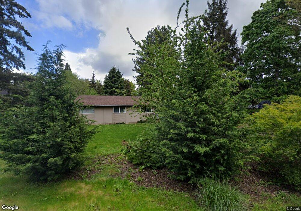
13365 NW Glenridge Dr Portland, OR 97229
Estimated Value: $417,000 - $544,000
4
Beds
2
Baths
1,590
Sq Ft
$313/Sq Ft
Est. Value
About This Home
This home is located at 13365 NW Glenridge Dr, Portland, OR 97229 and is currently estimated at $497,346, approximately $312 per square foot. 13365 NW Glenridge Dr is a home located in Washington County with nearby schools including Terra Linda Elementary School, Sunset High School, and St. Pius X. School.
Ownership History
Date
Name
Owned For
Owner Type
Purchase Details
Closed on
Feb 21, 2003
Sold by
Caudill Mary Cathleen
Bought by
Wood Philip M
Current Estimated Value
Home Financials for this Owner
Home Financials are based on the most recent Mortgage that was taken out on this home.
Original Mortgage
$120,000
Interest Rate
5.93%
Purchase Details
Closed on
Oct 8, 2002
Sold by
Wirfs Brock Allen
Bought by
Caudill Mary Cathleen and Robert Caudill Testamentary Trust
Create a Home Valuation Report for This Property
The Home Valuation Report is an in-depth analysis detailing your home's value as well as a comparison with similar homes in the area
Home Values in the Area
Average Home Value in this Area
Purchase History
| Date | Buyer | Sale Price | Title Company |
|---|---|---|---|
| Wood Philip M | $150,000 | First American | |
| Caudill Mary Cathleen | -- | -- | |
| Caudill Mary Cathleen | -- | -- |
Source: Public Records
Mortgage History
| Date | Status | Borrower | Loan Amount |
|---|---|---|---|
| Previous Owner | Wood Philip M | $120,000 |
Source: Public Records
Tax History Compared to Growth
Tax History
| Year | Tax Paid | Tax Assessment Tax Assessment Total Assessment is a certain percentage of the fair market value that is determined by local assessors to be the total taxable value of land and additions on the property. | Land | Improvement |
|---|---|---|---|---|
| 2025 | $4,242 | $234,220 | -- | -- |
| 2024 | $3,983 | $227,400 | -- | -- |
| 2023 | $3,983 | $220,780 | $0 | $0 |
| 2022 | $3,854 | $220,780 | $0 | $0 |
| 2021 | $3,715 | $208,110 | $0 | $0 |
| 2020 | $3,603 | $202,050 | $0 | $0 |
| 2019 | $3,486 | $196,170 | $0 | $0 |
| 2018 | $3,372 | $190,460 | $0 | $0 |
| 2017 | $3,250 | $184,920 | $0 | $0 |
| 2016 | $3,134 | $179,540 | $0 | $0 |
| 2015 | $3,014 | $174,320 | $0 | $0 |
| 2014 | $2,953 | $169,250 | $0 | $0 |
Source: Public Records
Map
Nearby Homes
- 12618 NW Barnes Rd Unit 11
- 12622 NW Barnes Rd Unit 2
- 12622 NW Barnes Rd Unit 6
- 12620 NW Barnes Rd Unit 5
- 425 NW 139th Ave
- 12634 NW Barnes Rd Unit 8
- 12604 NW Barnes Rd Unit 3
- 245 SW 133rd Ave
- 1470 NW 136th Ave
- 13120 SW Rita Dr
- 14386 NW Tripton Ct
- 1545 NW 131st Ave
- 1625 NW 136th Ave
- 13860 SW Butner Rd
- 595 NW Lost Springs Terrace Unit 303
- 615 NW Lost Springs Terrace Unit 102
- 1632 NW 143rd Ave
- 938 SW Adrian Terrace
- 13720 SW Butner Rd
- 1700 NW Saltzman Rd
- 13385 NW Glenridge Dr
- 13345 NW Glenridge Dr
- 13406 NW Sherry St
- 13414 NW Sherry St
- 13329 NW Glenridge Dr
- 13400 NW Sherry St
- 13325 NW Glenridge Dr
- 13318 NW Sherry St
- 13330 NW Glenridge Dr
- 630 NW Murray Blvd
- 13407 NW Sherry St
- 13409 NW Sherry St
- 13315 NW Glenridge Dr
- 13310 NW Sherry St
- 13317 NW Sherry St
- 13312 NW Glenridge Dr
- 13304 NW Sherry St
- 655 NW Joy Ave
- 13311 NW Sherry St
- 13242 NW Glenridge Dr