Estimated Value: $112,509 - $177,000
2
Beds
2
Baths
1,176
Sq Ft
$117/Sq Ft
Est. Value
About This Home
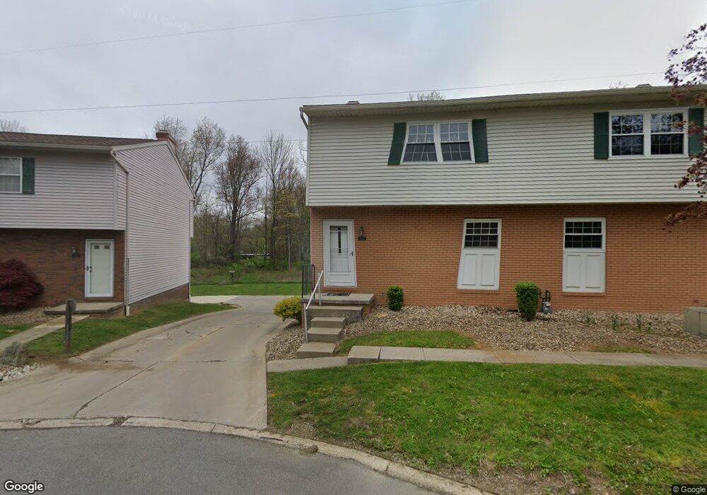
This home is located at 1337 Cedarwood Dr, Kent, OH 44240 and is currently estimated at $137,877, approximately $117 per square foot. 1337 Cedarwood Dr is a home located in Portage County with nearby schools including Brimfield Elementary School, Field Middle School, and Field High School.
Ownership History
Date
Name
Owned For
Owner Type
Purchase Details
Closed on
Jul 21, 2016
Sold by
Rock Bernadine
Bought by
Rock Bernadine
Current Estimated Value
Purchase Details
Closed on
Mar 13, 2011
Sold by
Rock Bernadine
Bought by
Rock Bernadine and Bernadine Rock Revocable Trust
Purchase Details
Closed on
Jul 27, 2000
Sold by
Ray Timothy R
Bought by
Rock Bernadine
Home Financials for this Owner
Home Financials are based on the most recent Mortgage that was taken out on this home.
Original Mortgage
$52,000
Outstanding Balance
$17,328
Interest Rate
8.27%
Mortgage Type
Purchase Money Mortgage
Estimated Equity
$120,549
Purchase Details
Closed on
Mar 2, 1987
Bought by
Ray Nancy L
Create a Home Valuation Report for This Property
The Home Valuation Report is an in-depth analysis detailing your home's value as well as a comparison with similar homes in the area
Home Values in the Area
Average Home Value in this Area
Purchase History
| Date | Buyer | Sale Price | Title Company |
|---|---|---|---|
| Rock Bernadine | -- | None Available | |
| Rock Bernadine | -- | Attorney | |
| Rock Bernadine | $72,000 | Approved Statewide Title Age | |
| Ray Nancy L | $45,000 | -- |
Source: Public Records
Mortgage History
| Date | Status | Borrower | Loan Amount |
|---|---|---|---|
| Open | Rock Bernadine | $52,000 |
Source: Public Records
Tax History
| Year | Tax Paid | Tax Assessment Tax Assessment Total Assessment is a certain percentage of the fair market value that is determined by local assessors to be the total taxable value of land and additions on the property. | Land | Improvement |
|---|---|---|---|---|
| 2025 | $1,301 | $35,810 | $3,500 | $32,310 |
| 2024 | $1,297 | $35,810 | $3,500 | $32,310 |
| 2023 | $972 | $24,510 | $2,630 | $21,880 |
| 2022 | $999 | $24,510 | $2,630 | $21,880 |
| 2021 | $959 | $24,510 | $2,630 | $21,880 |
| 2020 | $773 | $20,410 | $2,630 | $17,780 |
| 2019 | $772 | $20,410 | $2,630 | $17,780 |
| 2018 | $510 | $17,960 | $3,500 | $14,460 |
| 2017 | $510 | $17,960 | $3,500 | $14,460 |
| 2016 | $505 | $17,960 | $3,500 | $14,460 |
| 2015 | $489 | $17,960 | $3,500 | $14,460 |
| 2014 | $710 | $22,050 | $3,500 | $18,550 |
| 2013 | $659 | $22,050 | $3,500 | $18,550 |
Source: Public Records
Map
Nearby Homes
- 4360 Beal Dr
- 4545 State Route 43
- 2477 Waterford Pointe Dr
- 1676 Countryview Dr
- 1680 Countryview Dr
- 5088 Spruce Knoll Run
- 4088 Lynwood Dr
- 0 Meloy Rd Unit 5162435
- 1233 Cedar Ridge Rd
- 5096 Spruce Knoll Run
- 3880 Selnik Rd
- 3890 Grace Dr
- 3929 Lor Ron St
- 2092 Sugar Maple Dr
- 3910 Willow Way
- 1997 Sugar Maple Dr
- 410 Beryl Dr
- 3532 Gary Dr
- 4700 Gooseberry Knoll
- 4620 Briar Hill Dr
- 1335 Cedarwood Dr Unit 42E
- 1333 Cedarwood Dr
- 1333 Cedarwood Dr Unit 43D
- 1331 Cedarwood Dr Unit 44D
- 1329 Cedarwood Dr
- 1329 Cedarwood Dr Unit 45D
- 1327 Cedarwood Dr
- 1327 Cedarwood Dr Unit 46D
- 1303 Cedarwood Dr
- 1323 Cedarwood Dr
- 1326 Cedarwood Dr Unit 57E
- 4484 Sandlewood Dr Unit 40F
- 1324 Cedarwood Dr
- 1321 Cedarwood Dr Unit 48E
- 1322 Cedarwood Dr
- 1322 Cedarwood Dr Unit 59-D
- 1319 Cedarwood Dr
- 4480 Sandlewood Dr
- 1320 Cedarwood Dr Unit 60D
- 1317 Cedarwood Dr
Your Personal Tour Guide
Ask me questions while you tour the home.